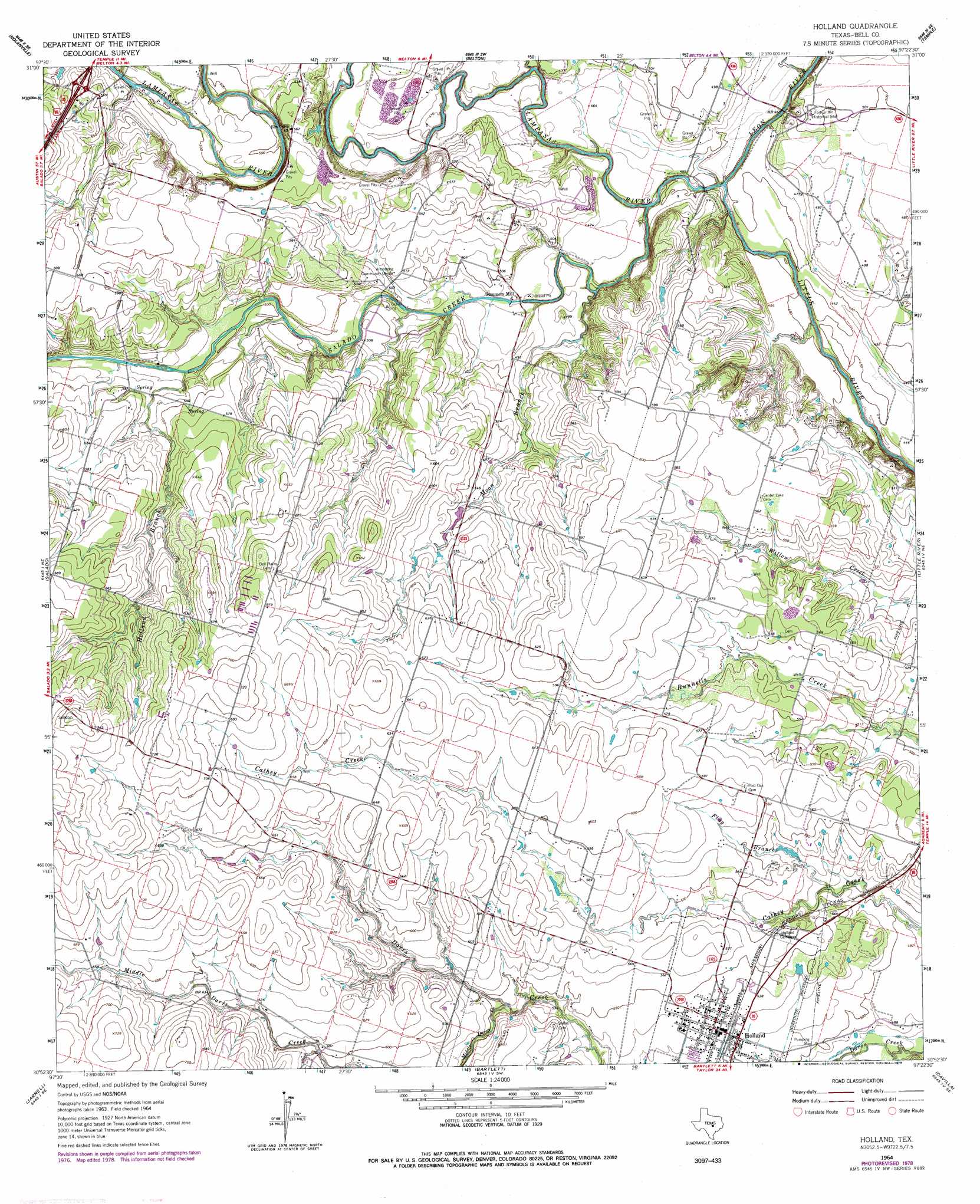
Holland Topo Map Texas
To zoom in, hover over the map of Holland
USGS Topo Quad 30097h4 - 1:24,000 scale
| Topo Map Name: | Holland |
| USGS Topo Quad ID: | 30097h4 |
| Print Size: | ca. 21 1/4" wide x 27" high |
| Southeast Coordinates: | 30.875° N latitude / 97.375° W longitude |
| Map Center Coordinates: | 30.9375° N latitude / 97.4375° W longitude |
| U.S. State: | TX |
| Filename: | o30097h4.jpg |
| Download Map JPG Image: | Holland topo map 1:24,000 scale |
| Map Type: | Topographic |
| Topo Series: | 7.5´ |
| Map Scale: | 1:24,000 |
| Source of Map Images: | United States Geological Survey (USGS) |
| Alternate Map Versions: |
Holland TX 1964, updated 1966 Download PDF Buy paper map Holland TX 1964, updated 1979 Download PDF Buy paper map Holland TX 2010 Download PDF Buy paper map Holland TX 2013 Download PDF Buy paper map Holland TX 2016 Download PDF Buy paper map |
1:24,000 Topo Quads surrounding Holland
Post Oak Mountain |
Bland |
Moffat |
Troy |
Belfalls |
Killeen |
Nolanville |
Belton |
Temple |
Seaton |
Youngsport |
Salado |
Holland |
Little River |
Rogers |
Cobbs Cavern |
Jarrell |
Bartlett |
Davilla |
Sharp |
Georgetown |
Weir |
Granger |
Friendship |
San Gabriel |
> Back to 30097e1 at 1:100,000 scale
> Back to 30096a1 at 1:250,000 scale
> Back to U.S. Topo Maps home
Holland topo map: Gazetteer
Holland: Populated Places
Childers Mill (historical) elevation 145m 475′Holland elevation 160m 524′
Sommers Mill elevation 140m 459′
Holland: Post Offices
Holland Post Office elevation 161m 528′Holland: Streams
Flag Branch elevation 156m 511′Holland Branch elevation 155m 508′
Lampasas River elevation 137m 449′
Leon River elevation 138m 452′
Middle Darrs Creek elevation 165m 541′
Mitchell Branch elevation 142m 465′
Moon Branch elevation 137m 449′
Salado Creek elevation 137m 449′
Holland digital topo map on disk
Buy this Holland topo map showing relief, roads, GPS coordinates and other geographical features, as a high-resolution digital map file on DVD: