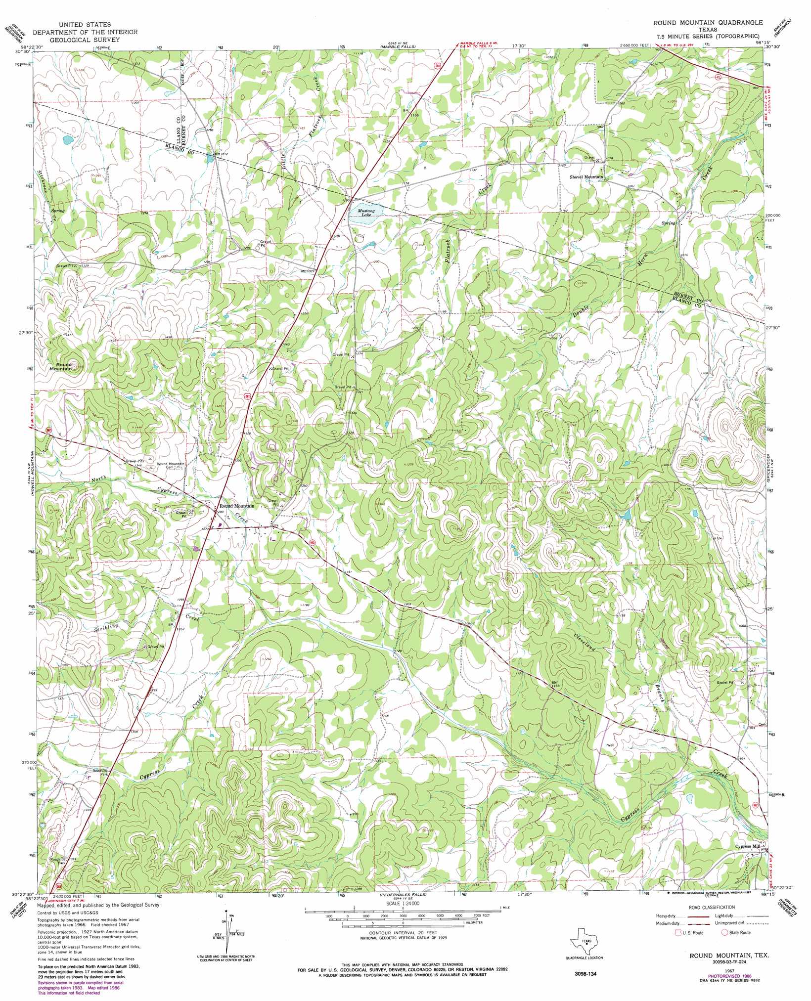
Round Mountain Topo Map Texas
To zoom in, hover over the map of Round Mountain
USGS Topo Quad 30098d3 - 1:24,000 scale
| Topo Map Name: | Round Mountain |
| USGS Topo Quad ID: | 30098d3 |
| Print Size: | ca. 21 1/4" wide x 27" high |
| Southeast Coordinates: | 30.375° N latitude / 98.25° W longitude |
| Map Center Coordinates: | 30.4375° N latitude / 98.3125° W longitude |
| U.S. State: | TX |
| Filename: | o30098d3.jpg |
| Download Map JPG Image: | Round Mountain topo map 1:24,000 scale |
| Map Type: | Topographic |
| Topo Series: | 7.5´ |
| Map Scale: | 1:24,000 |
| Source of Map Images: | United States Geological Survey (USGS) |
| Alternate Map Versions: |
Round Mountain TX 1967, updated 1969 Download PDF Buy paper map Round Mountain TX 1967, updated 1987 Download PDF Buy paper map Round Mountain TX 2010 Download PDF Buy paper map Round Mountain TX 2012 Download PDF Buy paper map Round Mountain TX 2016 Download PDF Buy paper map |
1:24,000 Topo Quads surrounding Round Mountain
Cap Mountain |
Kingsland |
Longhorn Cavern |
Mormon Mill |
Bertram |
Click |
Dunman Mountain |
Marble Falls |
Smithwick |
Travis Peak |
Blowout |
Howell Mountain |
Round Mountain |
Spicewood |
Pace Bend |
Rocky Creek |
Johnson City |
Pedernales Falls |
Hammetts Crossing |
Shingle Hills |
Hye |
Monument Hill |
Yeager Creek |
Henly |
Dripping Springs |
> Back to 30098a1 at 1:100,000 scale
> Back to 30098a1 at 1:250,000 scale
> Back to U.S. Topo Maps home
Round Mountain topo map: Gazetteer
Round Mountain: Airports
Herbert Ranch Airport elevation 340m 1115′Round Mountain: Lakes
Mustang Lake elevation 358m 1174′Round Mountain: Populated Places
Cypress Mill elevation 300m 984′Round Mountain elevation 390m 1279′
Shovel Mountain elevation 330m 1082′
Round Mountain: Springs
Ebeling Springs elevation 325m 1066′Round Mountain: Streams
Cleveland Branch elevation 306m 1003′North Cypress Creek elevation 357m 1171′
Stribling Creek elevation 360m 1181′
Round Mountain: Summits
Round Mountain elevation 480m 1574′Round Mountain digital topo map on disk
Buy this Round Mountain topo map showing relief, roads, GPS coordinates and other geographical features, as a high-resolution digital map file on DVD: