Crabapple Topo Map Texas
To zoom in, hover over the map of Crabapple
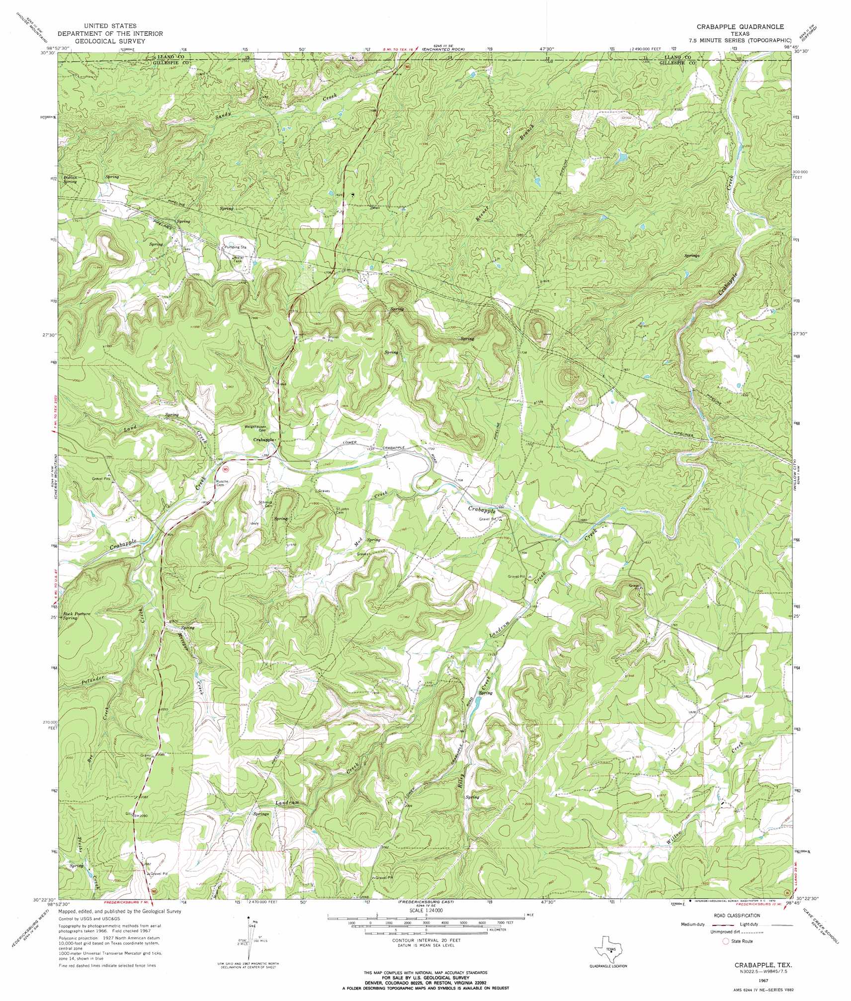
USGS Topo Quad 30098d7 - 1:24,000 scale
| Topo Map Name: | Crabapple |
| USGS Topo Quad ID: | 30098d7 |
| Print Size: | ca. 21 1/4" wide x 27" high |
| Southeast Coordinates: | 30.375° N latitude / 98.75° W longitude |
| Map Center Coordinates: | 30.4375° N latitude / 98.8125° W longitude |
| U.S. State: | TX |
| Filename: | o30098d7.jpg |
| Download Map JPG Image: | Crabapple topo map 1:24,000 scale |
| Map Type: | Topographic |
| Topo Series: | 7.5´ |
| Map Scale: | 1:24,000 |
| Source of Map Images: | United States Geological Survey (USGS) |
| Alternate Map Versions: |
Crabapple TX 1967, updated 1969 Download PDF Buy paper map Crabapple TX 1967, updated 1970 Download PDF Buy paper map Crabapple TX 2010 Download PDF Buy paper map Crabapple TX 2012 Download PDF Buy paper map Crabapple TX 2016 Download PDF Buy paper map |
1:24,000 Topo Quads surrounding Crabapple
Art |
Castell |
Scotts Crossing |
Llano South |
Cap Mountain |
Loyal Valley |
House Mountain |
Enchanted Rock |
Oxford |
Click |
Cherry Spring |
Cherry Mountain |
Crabapple |
Willow City |
Blowout |
Roundhead |
Fredericksburg West |
Fredericksburg East |
Cave Creek School |
Rocky Creek |
Morris Ranch |
Oak Crest Park |
Cain City |
Stonewall |
Hye |
> Back to 30098a1 at 1:100,000 scale
> Back to 30098a1 at 1:250,000 scale
> Back to U.S. Topo Maps home
Crabapple topo map: Gazetteer
Crabapple: Dams
Petersen Site 1 Dam elevation 550m 1804′Crabapple: Populated Places
Crabapple elevation 541m 1774′Crabapple: Reservoirs
Petersen Site 1 Lake elevation 550m 1804′Crabapple: Springs
Indian Spring elevation 514m 1686′Rock Pasture Spring elevation 583m 1912′
Crabapple: Streams
Bee Creek elevation 568m 1863′Land Creek elevation 536m 1758′
Landrum Creek elevation 506m 1660′
Metzger Creek elevation 555m 1820′
Mud Creek elevation 518m 1699′
Polander Creek elevation 548m 1797′
Riley Creek elevation 519m 1702′
Crabapple: Trails
Loop Trail elevation 443m 1453′Crabapple digital topo map on disk
Buy this Crabapple topo map showing relief, roads, GPS coordinates and other geographical features, as a high-resolution digital map file on DVD: