Cherry Mountain Topo Map Texas
To zoom in, hover over the map of Cherry Mountain
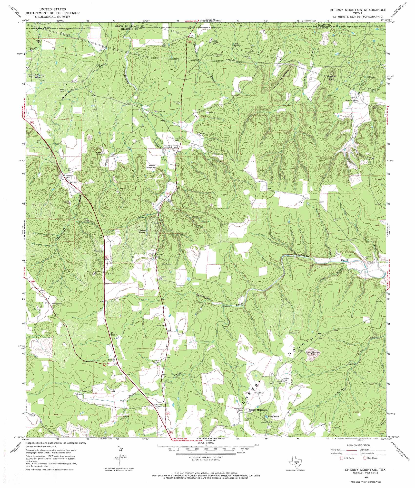
USGS Topo Quad 30098d8 - 1:24,000 scale
| Topo Map Name: | Cherry Mountain |
| USGS Topo Quad ID: | 30098d8 |
| Print Size: | ca. 21 1/4" wide x 27" high |
| Southeast Coordinates: | 30.375° N latitude / 98.875° W longitude |
| Map Center Coordinates: | 30.4375° N latitude / 98.9375° W longitude |
| U.S. State: | TX |
| Filename: | o30098d8.jpg |
| Download Map JPG Image: | Cherry Mountain topo map 1:24,000 scale |
| Map Type: | Topographic |
| Topo Series: | 7.5´ |
| Map Scale: | 1:24,000 |
| Source of Map Images: | United States Geological Survey (USGS) |
| Alternate Map Versions: |
Cherry Mountain TX 1967, updated 1969 Download PDF Buy paper map Cherry Mountain TX 2010 Download PDF Buy paper map Cherry Mountain TX 2012 Download PDF Buy paper map Cherry Mountain TX 2016 Download PDF Buy paper map |
1:24,000 Topo Quads surrounding Cherry Mountain
Mason |
Art |
Castell |
Scotts Crossing |
Llano South |
Panther Creek |
Loyal Valley |
House Mountain |
Enchanted Rock |
Oxford |
Doss |
Cherry Spring |
Cherry Mountain |
Crabapple |
Willow City |
Harper East |
Roundhead |
Fredericksburg West |
Fredericksburg East |
Cave Creek School |
Nott Branch |
Morris Ranch |
Oak Crest Park |
Cain City |
Stonewall |
> Back to 30098a1 at 1:100,000 scale
> Back to 30098a1 at 1:250,000 scale
> Back to U.S. Topo Maps home
Cherry Mountain topo map: Gazetteer
Cherry Mountain: Airports
Tschirhart Ranch Airport elevation 630m 2066′Cherry Mountain: Lakes
Holly Pond elevation 665m 2181′Cherry Mountain: Mines
Cherry Mountain Mine elevation 643m 2109′Cherry Mountain: Populated Places
Cherry Mountain elevation 649m 2129′Hilltop elevation 658m 2158′
Cherry Mountain: Springs
Cherry Spring elevation 596m 1955′Cold Spring elevation 530m 1738′
Cherry Mountain: Streams
Little Creek elevation 520m 1706′Long Branch elevation 557m 1827′
Pecan Spring Creek elevation 554m 1817′
Rocky Creek elevation 596m 1955′
Walnut Spring Creek elevation 566m 1856′
Cherry Mountain: Summits
Cedar Mountain elevation 608m 1994′Cherry Mountain elevation 660m 2165′
Sagebiel Hills elevation 594m 1948′
Cherry Mountain digital topo map on disk
Buy this Cherry Mountain topo map showing relief, roads, GPS coordinates and other geographical features, as a high-resolution digital map file on DVD: