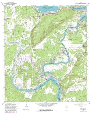
Kingsland Topo Map Texas
To zoom in, hover over the map of Kingsland
USGS Topo Quad 30098f4 - 1:24,000 scale
| Topo Map Name: | Kingsland |
| USGS Topo Quad ID: | 30098f4 |
| Print Size: | ca. 21 1/4" wide x 27" high |
| Southeast Coordinates: | 30.625° N latitude / 98.375° W longitude |
| Map Center Coordinates: | 30.6875° N latitude / 98.4375° W longitude |
| U.S. State: | TX |
| Filename: | o30098f4.jpg |
| Download Map JPG Image: | Kingsland topo map 1:24,000 scale |
| Map Type: | Topographic |
| Topo Series: | 7.5´ |
| Map Scale: | 1:24,000 |
| Source of Map Images: | United States Geological Survey (USGS) |
| Alternate Map Versions: |
Kingsland TX 1967, updated 1970 Download PDF Buy paper map Kingsland TX 1967, updated 1982 Download PDF Buy paper map Kingsland TX 1967, updated 1982 Download PDF Buy paper map Kingsland TX 2010 Download PDF Buy paper map Kingsland TX 2012 Download PDF Buy paper map Kingsland TX 2016 Download PDF Buy paper map |
1:24,000 Topo Quads surrounding Kingsland
> Back to 30098e1 at 1:100,000 scale
> Back to 30098a1 at 1:250,000 scale
> Back to U.S. Topo Maps home
Kingsland topo map: Gazetteer
Kingsland: Airports
Camp Longhorn Airport elevation 280m 918′Kingsland Estates Airport elevation 272m 892′
Shirley Williams Airport elevation 265m 869′
Kingsland: Basins
Hoovers Valley elevation 275m 902′Kingsland: Bridges
State Highway 29 Bridge elevation 271m 889′Kingsland: Dams
Roy Inks Dam elevation 259m 849′Kingsland: Populated Places
Buchanan Dam elevation 318m 1043′Kingsland elevation 255m 836′
Lakeside Heights elevation 268m 879′
Kingsland: Post Offices
Buchanan Dam Post Office elevation 318m 1043′Kingsland Post Office elevation 260m 853′
Kingsland: Reservoirs
Inks Lake elevation 259m 849′Kingsland Lake elevation 262m 859′
Kingsland: Springs
Boil Spring elevation 279m 915′Williams Spring elevation 303m 994′
Kingsland: Streams
Clear Creek elevation 271m 889′Dry Creek elevation 253m 830′
French John Creek elevation 266m 872′
Honey Creek elevation 253m 830′
Llano River elevation 252m 826′
Mill Creek elevation 252m 826′
Moss Creek elevation 252m 826′
Pennington Creek elevation 264m 866′
Peters Creek elevation 252m 826′
Sandy Creek elevation 268m 879′
Tantrough Creek elevation 262m 859′
Williams Creek elevation 252m 826′
Kingsland: Summits
Backbone Mountain elevation 360m 1181′Bald Knob elevation 404m 1325′
Long Mountain elevation 410m 1345′
Kingsland digital topo map on disk
Buy this Kingsland topo map showing relief, roads, GPS coordinates and other geographical features, as a high-resolution digital map file on DVD:


