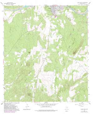
Llano South Topo Map Texas
To zoom in, hover over the map of Llano South
USGS Topo Quad 30098f6 - 1:24,000 scale
| Topo Map Name: | Llano South |
| USGS Topo Quad ID: | 30098f6 |
| Print Size: | ca. 21 1/4" wide x 27" high |
| Southeast Coordinates: | 30.625° N latitude / 98.625° W longitude |
| Map Center Coordinates: | 30.6875° N latitude / 98.6875° W longitude |
| U.S. State: | TX |
| Filename: | o30098f6.jpg |
| Download Map JPG Image: | Llano South topo map 1:24,000 scale |
| Map Type: | Topographic |
| Topo Series: | 7.5´ |
| Map Scale: | 1:24,000 |
| Source of Map Images: | United States Geological Survey (USGS) |
| Alternate Map Versions: |
Llano South TX 1960, updated 1962 Download PDF Buy paper map Llano South TX 1960, updated 1974 Download PDF Buy paper map Llano South TX 1960, updated 1982 Download PDF Buy paper map Llano South TX 2010 Download PDF Buy paper map Llano South TX 2012 Download PDF Buy paper map Llano South TX 2016 Download PDF Buy paper map |
1:24,000 Topo Quads surrounding Llano South
> Back to 30098e1 at 1:100,000 scale
> Back to 30098a1 at 1:250,000 scale
> Back to U.S. Topo Maps home
Llano South topo map: Gazetteer
Llano South: Parks
Llano City Park elevation 313m 1026′Llano South: Streams
Bailey Branch elevation 318m 1043′Byrnes Creek elevation 294m 964′
Hickory Mountain Branch elevation 331m 1085′
Johnson Creek elevation 309m 1013′
Marchison Creek elevation 309m 1013′
Mule Mountain Branch elevation 333m 1092′
Oatman Creek elevation 294m 964′
Pyramid Creek elevation 440m 1443′
Salt Branch elevation 437m 1433′
Llano South: Summits
Bachelor Peak elevation 386m 1266′Hickory Mountain elevation 483m 1584′
Pyramid Rock elevation 531m 1742′
Sharp Mountain elevation 472m 1548′
Yearling Head Mountain elevation 514m 1686′
Llano South: Valleys
Bald Mountain Hollow elevation 332m 1089′Elm Hollow elevation 372m 1220′
Llano South digital topo map on disk
Buy this Llano South topo map showing relief, roads, GPS coordinates and other geographical features, as a high-resolution digital map file on DVD:


