Lake Victor Topo Map Texas
To zoom in, hover over the map of Lake Victor
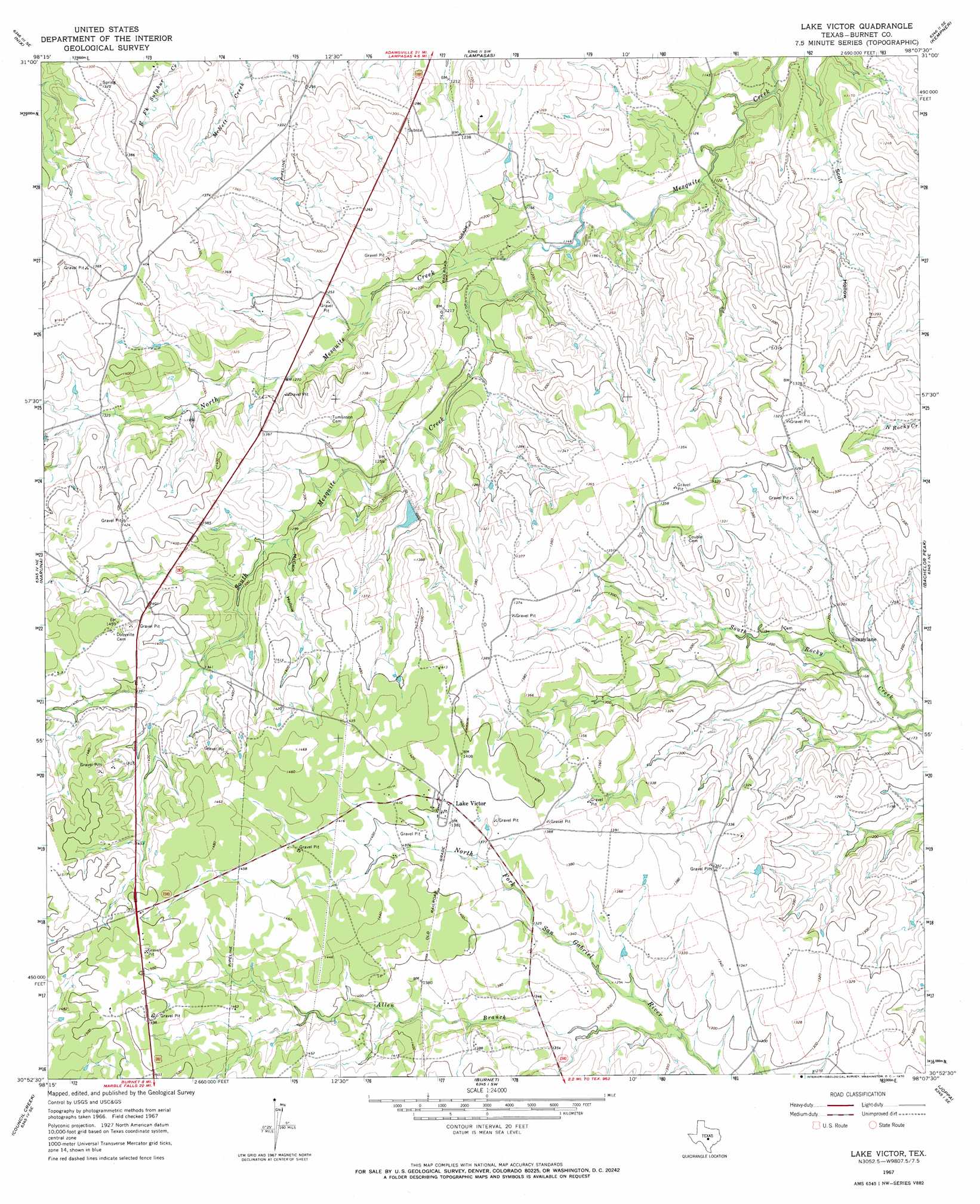
USGS Topo Quad 30098h2 - 1:24,000 scale
| Topo Map Name: | Lake Victor |
| USGS Topo Quad ID: | 30098h2 |
| Print Size: | ca. 21 1/4" wide x 27" high |
| Southeast Coordinates: | 30.875° N latitude / 98.125° W longitude |
| Map Center Coordinates: | 30.9375° N latitude / 98.1875° W longitude |
| U.S. State: | TX |
| Filename: | o30098h2.jpg |
| Download Map JPG Image: | Lake Victor topo map 1:24,000 scale |
| Map Type: | Topographic |
| Topo Series: | 7.5´ |
| Map Scale: | 1:24,000 |
| Source of Map Images: | United States Geological Survey (USGS) |
| Alternate Map Versions: |
Lake Victor TX 1967, updated 1969 Download PDF Buy paper map Lake Victor TX 2010 Download PDF Buy paper map Lake Victor TX 2012 Download PDF Buy paper map Lake Victor TX 2016 Download PDF Buy paper map |
1:24,000 Topo Quads surrounding Lake Victor
Lometa |
Ogles |
Flat Top Peak |
Rumley |
Twin Mountains |
Gorman Falls |
Nix |
Lampasas |
Kempner |
Copperas Cove |
Tow |
Naruna |
Lake Victor |
Bachelor Peak |
Briggs |
Lake Buchanan |
Council Creek |
Burnet |
Joppa |
Mahomet |
Kingsland |
Longhorn Cavern |
Mormon Mill |
Bertram |
Liberty Hill |
> Back to 30098e1 at 1:100,000 scale
> Back to 30098a1 at 1:250,000 scale
> Back to U.S. Topo Maps home
Lake Victor topo map: Gazetteer
Lake Victor: Airports
Deer Pasture Airport elevation 433m 1420′Lake Victor: Populated Places
Lake Victor elevation 425m 1394′Sunnylane elevation 359m 1177′
Sunnylane elevation 364m 1194′
Lake Victor: Streams
Allen Branch elevation 384m 1259′North Mesquite Creek elevation 350m 1148′
South Mesquite Creek elevation 350m 1148′
Lake Victor: Valleys
McCain Hollow elevation 392m 1286′Scott Hollow elevation 333m 1092′
Lake Victor digital topo map on disk
Buy this Lake Victor topo map showing relief, roads, GPS coordinates and other geographical features, as a high-resolution digital map file on DVD: