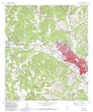
Kerrville Topo Map Texas
To zoom in, hover over the map of Kerrville
USGS Topo Quad 30099a2 - 1:24,000 scale
| Topo Map Name: | Kerrville |
| USGS Topo Quad ID: | 30099a2 |
| Print Size: | ca. 21 1/4" wide x 27" high |
| Southeast Coordinates: | 30° N latitude / 99.125° W longitude |
| Map Center Coordinates: | 30.0625° N latitude / 99.1875° W longitude |
| U.S. State: | TX |
| Filename: | o30099a2.jpg |
| Download Map JPG Image: | Kerrville topo map 1:24,000 scale |
| Map Type: | Topographic |
| Topo Series: | 7.5´ |
| Map Scale: | 1:24,000 |
| Source of Map Images: | United States Geological Survey (USGS) |
| Alternate Map Versions: |
Kerrville TX 1964, updated 1967 Download PDF Buy paper map Kerrville TX 1964, updated 1982 Download PDF Buy paper map Kerrville TX 1964, updated 1982 Download PDF Buy paper map Kerrville TX 2010 Download PDF Buy paper map Kerrville TX 2012 Download PDF Buy paper map Kerrville TX 2016 Download PDF Buy paper map |
1:24,000 Topo Quads surrounding Kerrville
> Back to 30099a1 at 1:100,000 scale
> Back to 30098a1 at 1:250,000 scale
> Back to U.S. Topo Maps home
Kerrville topo map: Gazetteer
Kerrville: Dams
Camp Meeting Creek Dam elevation 491m 1610′Kerrville Ponding Dam elevation 491m 1610′
South Dam elevation 575m 1886′
Town Creek Dam Number 4 elevation 533m 1748′
Kerrville: Parks
Carver Park elevation 513m 1683′Carver Park elevation 498m 1633′
Kerrville State Park elevation 533m 1748′
Lions Park elevation 514m 1686′
Louise Hays Park elevation 487m 1597′
Richard Park elevation 499m 1637′
Schultz Park elevation 536m 1758′
Kerrville: Populated Places
Ingram elevation 528m 1732′Kerrville elevation 499m 1637′
Mount Wesley elevation 584m 1916′
Kerrville: Reservoirs
Camp Meeting Creek Reservoir elevation 491m 1610′Kerrville Ponding Lake elevation 491m 1610′
Lake Old Ingram elevation 510m 1673′
South Lake elevation 575m 1886′
Town Creek Reservoir Number 4 elevation 533m 1748′
Kerrville: Springs
Colbarth Springs elevation 568m 1863′Goat Springs elevation 576m 1889′
Kerrville: Streams
Bear Creek elevation 497m 1630′Brushy Branch elevation 518m 1699′
East Town Creek elevation 512m 1679′
Goat Creek elevation 497m 1630′
Indian Creek elevation 510m 1673′
Johnson Creek elevation 509m 1669′
Nichols Creek elevation 503m 1650′
Quinlan Creek elevation 481m 1578′
Town Creek elevation 488m 1601′
West Goat Creek elevation 542m 1778′
Kerrville: Valleys
Cow Head Hollow elevation 530m 1738′George Hollow elevation 542m 1778′
Kerrville digital topo map on disk
Buy this Kerrville topo map showing relief, roads, GPS coordinates and other geographical features, as a high-resolution digital map file on DVD:


