Hunt Topo Map Texas
To zoom in, hover over the map of Hunt
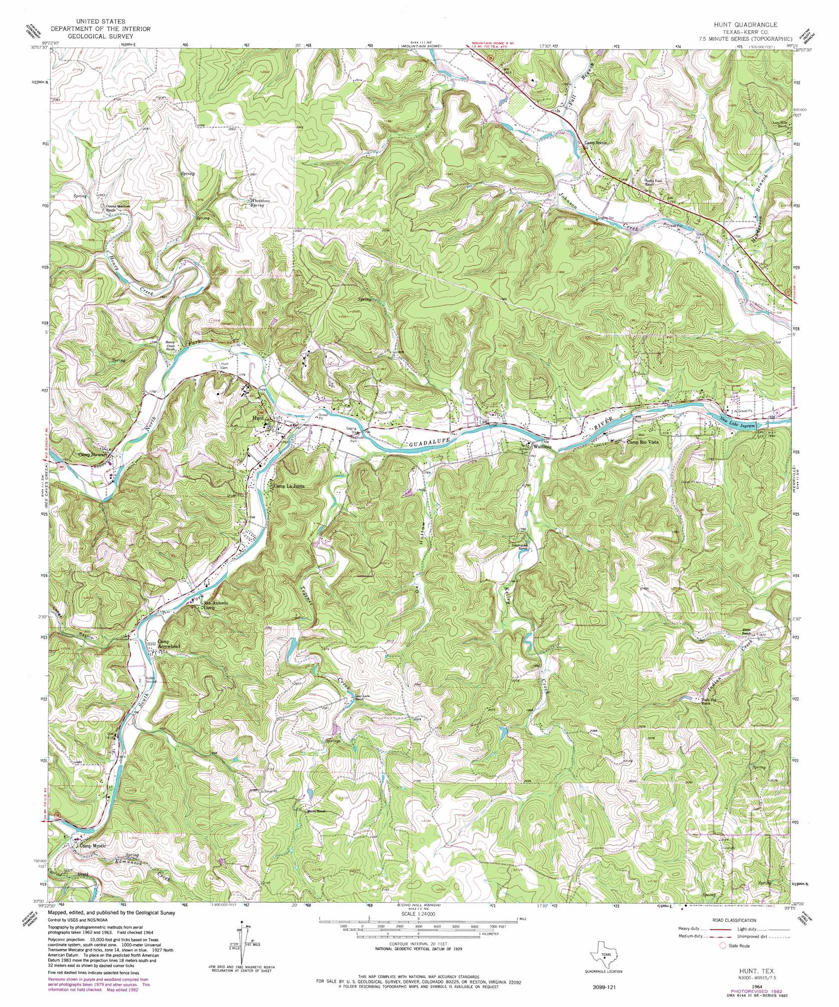
USGS Topo Quad 30099a3 - 1:24,000 scale
| Topo Map Name: | Hunt |
| USGS Topo Quad ID: | 30099a3 |
| Print Size: | ca. 21 1/4" wide x 27" high |
| Southeast Coordinates: | 30° N latitude / 99.25° W longitude |
| Map Center Coordinates: | 30.0625° N latitude / 99.3125° W longitude |
| U.S. State: | TX |
| Filename: | o30099a3.jpg |
| Download Map JPG Image: | Hunt topo map 1:24,000 scale |
| Map Type: | Topographic |
| Topo Series: | 7.5´ |
| Map Scale: | 1:24,000 |
| Source of Map Images: | United States Geological Survey (USGS) |
| Alternate Map Versions: |
Hunt TX 1964, updated 1967 Download PDF Buy paper map Hunt TX 1964, updated 1982 Download PDF Buy paper map Hunt TX 1964, updated 1982 Download PDF Buy paper map Hunt TX 2010 Download PDF Buy paper map Hunt TX 2012 Download PDF Buy paper map Hunt TX 2016 Download PDF Buy paper map |
1:24,000 Topo Quads surrounding Hunt
Mudge Draw |
Old Noxville |
Harper West |
Harper East |
Roundhead |
Live Oak Ranch |
Contrary Creek |
Mountain Home |
Nott Branch |
Morris Ranch |
Boneyard Draw |
Bee Caves Creek |
Hunt |
Kerrville |
Legion |
Well Hollow |
Diamond S Ranch |
Echo Hill Ranch |
Fall Creek |
Center Point |
Sabinal Canyon |
Love Creek |
A Bar A Ranch |
Rock Cliff Reservoir |
Bandera Pass |
> Back to 30099a1 at 1:100,000 scale
> Back to 30098a1 at 1:250,000 scale
> Back to U.S. Topo Maps home
Hunt topo map: Gazetteer
Hunt: Dams
Blackburn Dam elevation 526m 1725′Horsman Dam elevation 543m 1781′
Ingram Lake Dam elevation 512m 1679′
Willis Lake Dam elevation 547m 1794′
Hunt: Populated Places
Hunt elevation 551m 1807′Waltonia elevation 525m 1722′
Hunt: Reservoirs
Dam J Lake elevation 512m 1679′Lake New Ingram elevation 515m 1689′
Willis Lake elevation 547m 1794′
Hunt: Springs
Henderson Springs elevation 556m 1824′Indian Springs elevation 605m 1984′
Kelly Springs elevation 555m 1820′
Tegener Springs elevation 584m 1916′
Whetstone Spring elevation 608m 1994′
Hunt: Streams
Cypress Creek elevation 555m 1820′Edmunson Creek elevation 558m 1830′
Fall Branch elevation 536m 1758′
Henderson Branch elevation 518m 1699′
Honey Creek elevation 536m 1758′
Kelley Creek elevation 521m 1709′
North Fork Guadalupe River elevation 529m 1735′
South Fork Guadalupe River elevation 529m 1735′
Tegener Creek elevation 526m 1725′
Hunt: Valleys
Lange Ravine elevation 545m 1788′Ox Hollow elevation 528m 1732′
Hunt digital topo map on disk
Buy this Hunt topo map showing relief, roads, GPS coordinates and other geographical features, as a high-resolution digital map file on DVD: