Morris Ranch Topo Map Texas
To zoom in, hover over the map of Morris Ranch
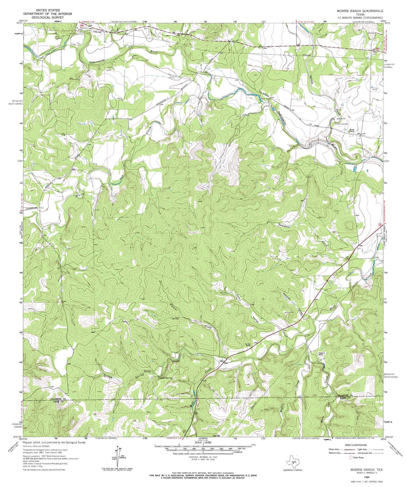
USGS Topo Quad 30099b1 - 1:24,000 scale
| Topo Map Name: | Morris Ranch |
| USGS Topo Quad ID: | 30099b1 |
| Print Size: | ca. 21 1/4" wide x 27" high |
| Southeast Coordinates: | 30.125° N latitude / 99° W longitude |
| Map Center Coordinates: | 30.1875° N latitude / 99.0625° W longitude |
| U.S. State: | TX |
| Filename: | o30099b1.jpg |
| Download Map JPG Image: | Morris Ranch topo map 1:24,000 scale |
| Map Type: | Topographic |
| Topo Series: | 7.5´ |
| Map Scale: | 1:24,000 |
| Source of Map Images: | United States Geological Survey (USGS) |
| Alternate Map Versions: |
Morris Ranch TX 1964, updated 1966 Download PDF Buy paper map Morris Ranch TX 2010 Download PDF Buy paper map Morris Ranch TX 2012 Download PDF Buy paper map Morris Ranch TX 2016 Download PDF Buy paper map |
1:24,000 Topo Quads surrounding Morris Ranch
The Falls |
Doss |
Cherry Spring |
Cherry Mountain |
Crabapple |
Harper West |
Harper East |
Roundhead |
Fredericksburg West |
Fredericksburg East |
Mountain Home |
Nott Branch |
Morris Ranch |
Oak Crest Park |
Cain City |
Hunt |
Kerrville |
Legion |
Cypress Creek |
Rafter Hollow |
Echo Hill Ranch |
Fall Creek |
Center Point |
Comfort |
Waring |
> Back to 30099a1 at 1:100,000 scale
> Back to 30098a1 at 1:250,000 scale
> Back to U.S. Topo Maps home
Morris Ranch topo map: Gazetteer
Morris Ranch: Airports
White Oak Airport elevation 568m 1863′Morris Ranch: Populated Places
Morris Ranch elevation 531m 1742′Morris Ranch: Springs
Trough Spring elevation 581m 1906′Morris Ranch: Streams
Burr Oak Creek elevation 540m 1771′Delaware Creek elevation 525m 1722′
Devils Creek elevation 543m 1781′
Middle Creek elevation 547m 1794′
Spring Creek elevation 511m 1676′
Trough Spring Creek elevation 555m 1820′
Walnut Creek elevation 555m 1820′
White Oak Creek elevation 530m 1738′
Morris Ranch: Valleys
Kott Valley elevation 547m 1794′Mitchke Valley elevation 541m 1774′
Morris Ranch digital topo map on disk
Buy this Morris Ranch topo map showing relief, roads, GPS coordinates and other geographical features, as a high-resolution digital map file on DVD: