Bradford Creek Topo Map Texas
To zoom in, hover over the map of Bradford Creek
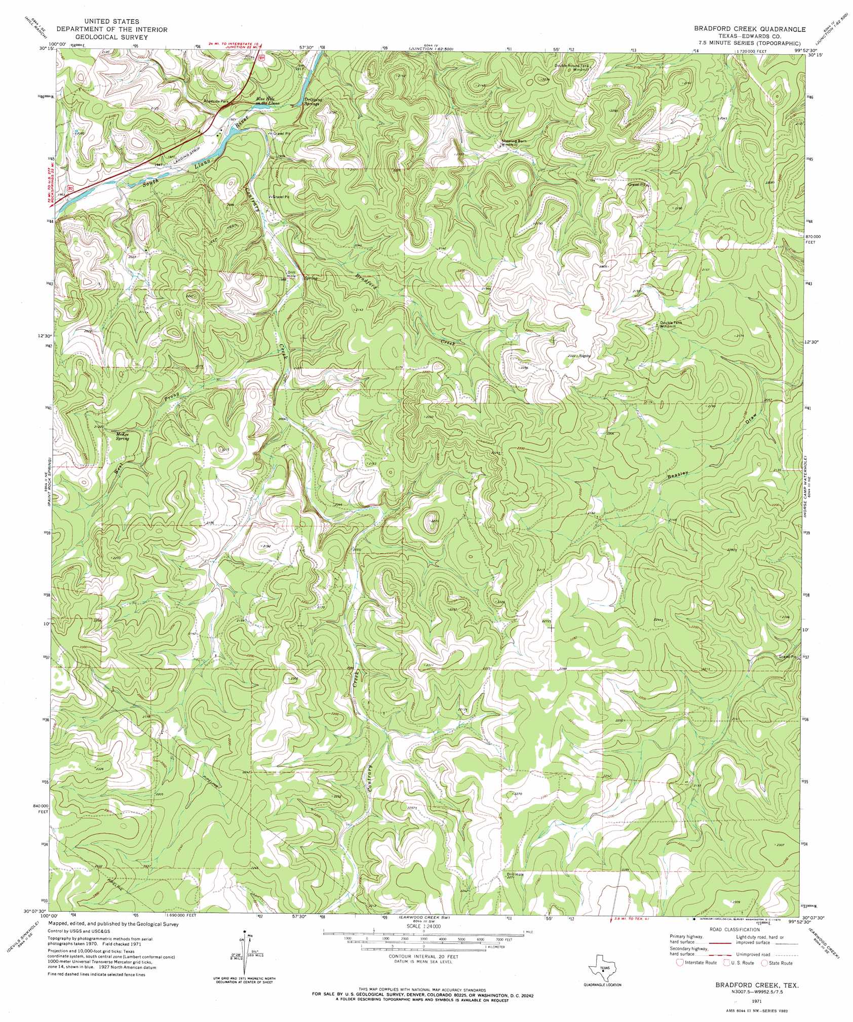
USGS Topo Quad 30099b8 - 1:24,000 scale
| Topo Map Name: | Bradford Creek |
| USGS Topo Quad ID: | 30099b8 |
| Print Size: | ca. 21 1/4" wide x 27" high |
| Southeast Coordinates: | 30.125° N latitude / 99.875° W longitude |
| Map Center Coordinates: | 30.1875° N latitude / 99.9375° W longitude |
| U.S. State: | TX |
| Filename: | o30099b8.jpg |
| Download Map JPG Image: | Bradford Creek topo map 1:24,000 scale |
| Map Type: | Topographic |
| Topo Series: | 7.5´ |
| Map Scale: | 1:24,000 |
| Source of Map Images: | United States Geological Survey (USGS) |
| Alternate Map Versions: |
Bradford Creek TX 1971, updated 1973 Download PDF Buy paper map Bradford Creek TX 2010 Download PDF Buy paper map Bradford Creek TX 2012 Download PDF Buy paper map Bradford Creek TX 2016 Download PDF Buy paper map |
1:24,000 Topo Quads surrounding Bradford Creek
Fort Terrett Ranch |
Roosevelt |
Bailey Creek |
Junction |
Segovia |
Bundy Ranch |
Hill Ranch |
Telegraph |
Junction Se |
Allen Creek |
Elbow Lake |
Paint Rock Spring |
Bradford Creek |
Horse Camp Waterhole |
Y O Ranch |
Rocksprings |
Devils Sinkhole |
Earwood Creek Sw |
Earwood Creek |
Garven Store |
Cub Lake |
Hackberry |
Joy Hollow |
Bee Cave Hollow |
Hillcrest Ranch |
> Back to 30099a1 at 1:100,000 scale
> Back to 30098a1 at 1:250,000 scale
> Back to U.S. Topo Maps home
Bradford Creek topo map: Gazetteer
Bradford Creek: Lakes
Blue Hole on the Llano elevation 584m 1916′Bradford Creek: Springs
Dripping Springs elevation 586m 1922′McKee Spring elevation 641m 2103′
Bradford Creek: Streams
Bradford Creek elevation 596m 1955′Contrary Creek elevation 585m 1919′
West Prong Contrary Creek elevation 607m 1991′
Bradford Creek: Valleys
Dry Hollow elevation 588m 1929′Bradford Creek digital topo map on disk
Buy this Bradford Creek topo map showing relief, roads, GPS coordinates and other geographical features, as a high-resolution digital map file on DVD: