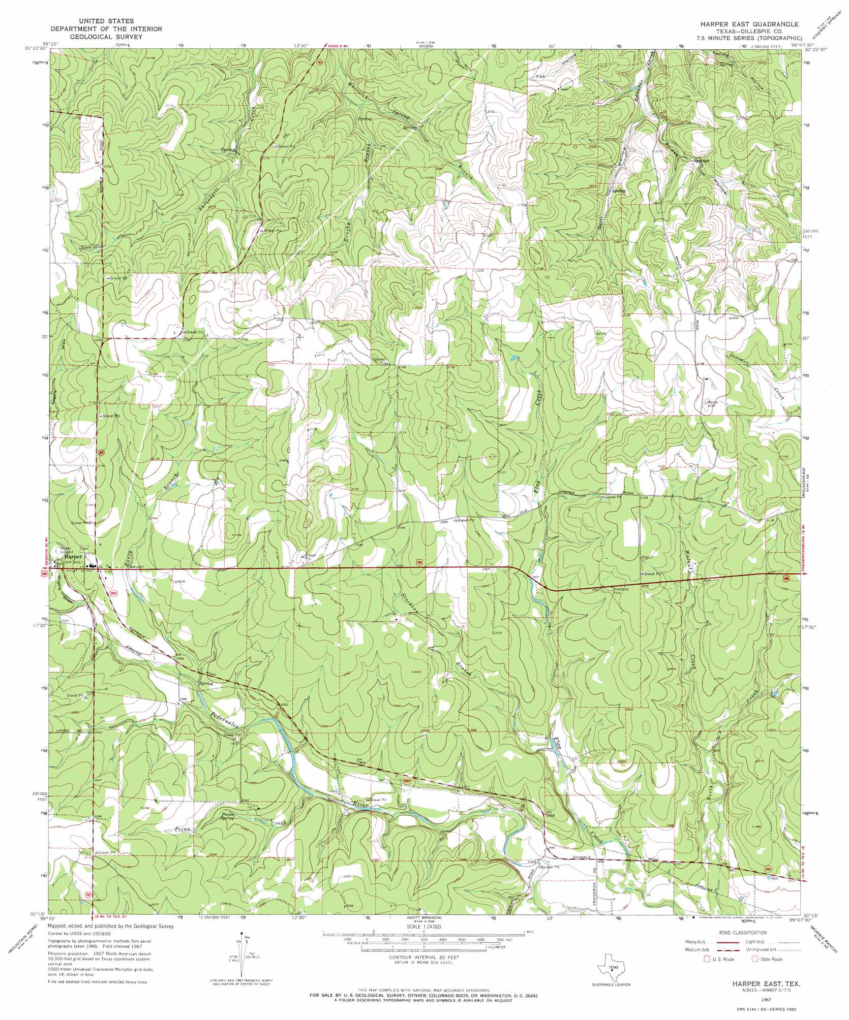
Harper East Topo Map Texas
To zoom in, hover over the map of Harper East
USGS Topo Quad 30099c2 - 1:24,000 scale
| Topo Map Name: | Harper East |
| USGS Topo Quad ID: | 30099c2 |
| Print Size: | ca. 21 1/4" wide x 27" high |
| Southeast Coordinates: | 30.25° N latitude / 99.125° W longitude |
| Map Center Coordinates: | 30.3125° N latitude / 99.1875° W longitude |
| U.S. State: | TX |
| Filename: | o30099c2.jpg |
| Download Map JPG Image: | Harper East topo map 1:24,000 scale |
| Map Type: | Topographic |
| Topo Series: | 7.5´ |
| Map Scale: | 1:24,000 |
| Source of Map Images: | United States Geological Survey (USGS) |
| Alternate Map Versions: |
Harper East TX 1967, updated 1969 Download PDF Buy paper map Harper East TX 2010 Download PDF Buy paper map Harper East TX 2012 Download PDF Buy paper map Harper East TX 2016 Download PDF Buy paper map |
1:24,000 Topo Quads surrounding Harper East
Monument Mountain |
Monument Mountain Se |
Panther Creek |
Loyal Valley |
House Mountain |
Noxville |
The Falls |
Doss |
Cherry Spring |
Cherry Mountain |
Old Noxville |
Harper West |
Harper East |
Roundhead |
Fredericksburg West |
Contrary Creek |
Mountain Home |
Nott Branch |
Morris Ranch |
Oak Crest Park |
Bee Caves Creek |
Hunt |
Kerrville |
Legion |
Cypress Creek |
> Back to 30099a1 at 1:100,000 scale
> Back to 30098a1 at 1:250,000 scale
> Back to U.S. Topo Maps home
Harper East topo map: Gazetteer
Harper East: Populated Places
Harper elevation 626m 2053′Harper East: Springs
Pecan Spring elevation 606m 1988′Harper East: Streams
Banta Branch elevation 605m 1984′Brushy Branch elevation 601m 1971′
Pecan Creek elevation 581m 1906′
Stuckens Branch elevation 579m 1899′
Walnut Creek elevation 579m 1899′
Harper East: Valleys
Drill Hollow elevation 592m 1942′Priess Hollow elevation 592m 1942′
Rogers Draw elevation 609m 1998′
Harper East digital topo map on disk
Buy this Harper East topo map showing relief, roads, GPS coordinates and other geographical features, as a high-resolution digital map file on DVD: