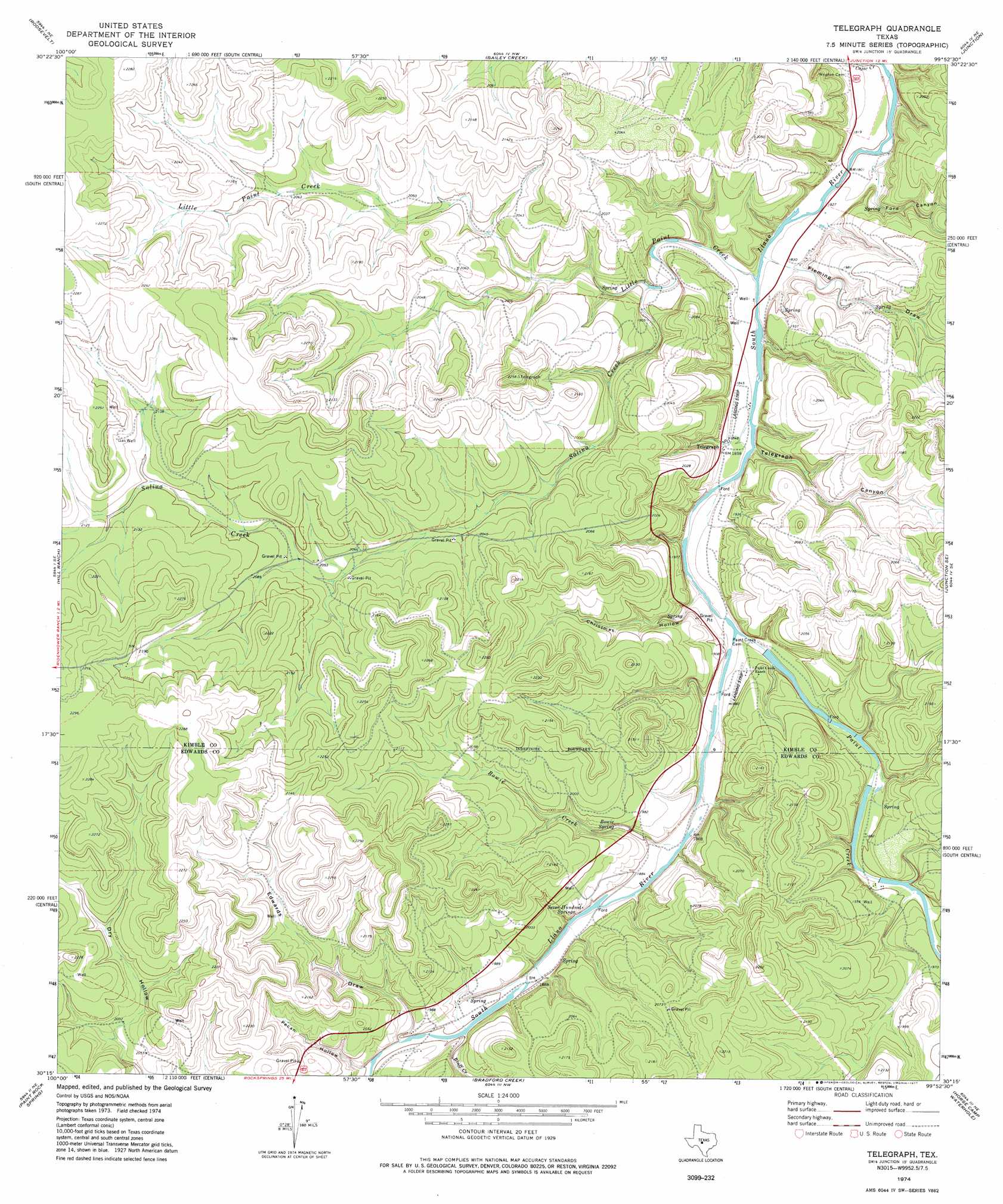
Telegraph Topo Map Texas
To zoom in, hover over the map of Telegraph
USGS Topo Quad 30099c8 - 1:24,000 scale
| Topo Map Name: | Telegraph |
| USGS Topo Quad ID: | 30099c8 |
| Print Size: | ca. 21 1/4" wide x 27" high |
| Southeast Coordinates: | 30.25° N latitude / 99.875° W longitude |
| Map Center Coordinates: | 30.3125° N latitude / 99.9375° W longitude |
| U.S. State: | TX |
| Filename: | o30099c8.jpg |
| Download Map JPG Image: | Telegraph topo map 1:24,000 scale |
| Map Type: | Topographic |
| Topo Series: | 7.5´ |
| Map Scale: | 1:24,000 |
| Source of Map Images: | United States Geological Survey (USGS) |
| Alternate Map Versions: |
Telegraph TX 1974, updated 1977 Download PDF Buy paper map Telegraph TX 2010 Download PDF Buy paper map Telegraph TX 2012 Download PDF Buy paper map Telegraph TX 2016 Download PDF Buy paper map |
1:24,000 Topo Quads surrounding Telegraph
Brokeleg Mountain |
Mckegan Draw |
Stark Creek |
Elm Slough |
Big Draw |
Fort Terrett Ranch |
Roosevelt |
Bailey Creek |
Junction |
Segovia |
Bundy Ranch |
Hill Ranch |
Telegraph |
Junction Se |
Allen Creek |
Elbow Lake |
Paint Rock Spring |
Bradford Creek |
Horse Camp Waterhole |
Y O Ranch |
Rocksprings |
Devils Sinkhole |
Earwood Creek Sw |
Earwood Creek |
Garven Store |
> Back to 30099a1 at 1:100,000 scale
> Back to 30098a1 at 1:250,000 scale
> Back to U.S. Topo Maps home
Telegraph topo map: Gazetteer
Telegraph: Airports
J R Ranch Airport elevation 581m 1906′Telegraph: Dams
Paint Creek Ranch Lake Dam elevation 568m 1863′Telegraph: Populated Places
Telegraph elevation 565m 1853′Telegraph: Reservoirs
Paint Creek Ranch Lake elevation 568m 1863′Telegraph: Springs
Big Paint Springs elevation 609m 1998′Bowie Spring elevation 576m 1889′
Christmas Canyon Spring elevation 617m 2024′
Seven Hundred Springs elevation 572m 1876′
Tanner Springs elevation 581m 1906′
Telegraph: Streams
Bluff Creek elevation 592m 1942′Bowie Creek elevation 569m 1866′
Little Paint Creek elevation 552m 1811′
Paint Creek elevation 563m 1847′
Salina Creek elevation 579m 1899′
Telegraph: Valleys
Christmas Hollow elevation 569m 1866′Edwards Draw elevation 576m 1889′
Fleming Draw elevation 551m 1807′
Ford Canyon elevation 552m 1811′
Pecan Hollow elevation 580m 1902′
Telegraph Canyon elevation 574m 1883′
Telegraph digital topo map on disk
Buy this Telegraph topo map showing relief, roads, GPS coordinates and other geographical features, as a high-resolution digital map file on DVD: