Loyal Valley Topo Map Texas
To zoom in, hover over the map of Loyal Valley
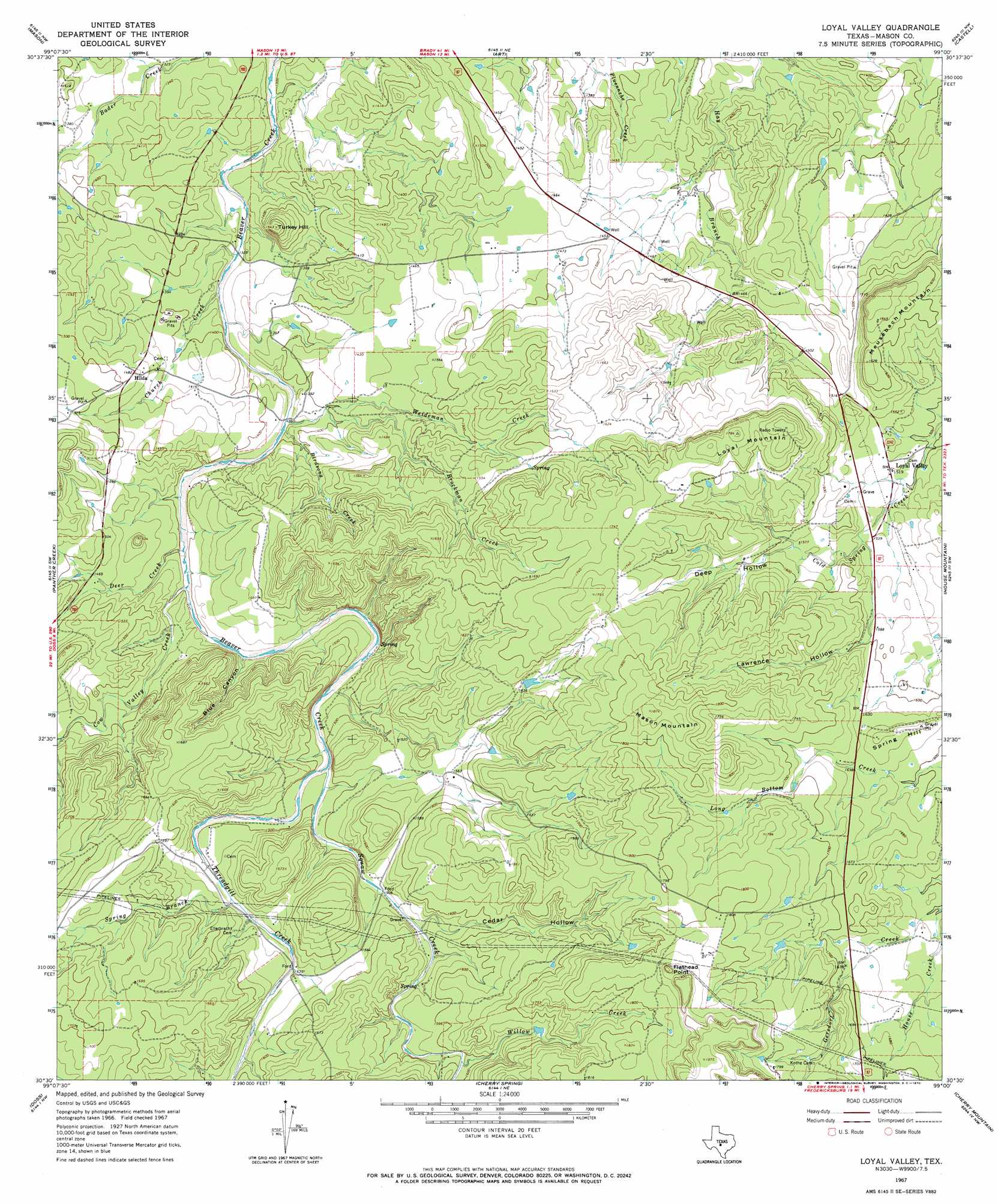
USGS Topo Quad 30099e1 - 1:24,000 scale
| Topo Map Name: | Loyal Valley |
| USGS Topo Quad ID: | 30099e1 |
| Print Size: | ca. 21 1/4" wide x 27" high |
| Southeast Coordinates: | 30.5° N latitude / 99° W longitude |
| Map Center Coordinates: | 30.5625° N latitude / 99.0625° W longitude |
| U.S. State: | TX |
| Filename: | o30099e1.jpg |
| Download Map JPG Image: | Loyal Valley topo map 1:24,000 scale |
| Map Type: | Topographic |
| Topo Series: | 7.5´ |
| Map Scale: | 1:24,000 |
| Source of Map Images: | United States Geological Survey (USGS) |
| Alternate Map Versions: |
Loyal Valley TX 1967, updated 1969 Download PDF Buy paper map Loyal Valley TX 1967, updated 1970 Download PDF Buy paper map Loyal Valley TX 2010 Download PDF Buy paper map Loyal Valley TX 2012 Download PDF Buy paper map Loyal Valley TX 2016 Download PDF Buy paper map |
1:24,000 Topo Quads surrounding Loyal Valley
Grit |
Purdy Hill |
Fly Gap |
Smoothingiron Mountain |
Valley Spring |
Turtle Creek |
Mason |
Art |
Castell |
Scotts Crossing |
Monument Mountain Se |
Panther Creek |
Loyal Valley |
House Mountain |
Enchanted Rock |
The Falls |
Doss |
Cherry Spring |
Cherry Mountain |
Crabapple |
Harper West |
Harper East |
Roundhead |
Fredericksburg West |
Fredericksburg East |
> Back to 30099e1 at 1:100,000 scale
> Back to 30098a1 at 1:250,000 scale
> Back to U.S. Topo Maps home
Loyal Valley topo map: Gazetteer
Loyal Valley: Populated Places
Hilda elevation 452m 1482′Loyal Valley elevation 464m 1522′
Loyal Valley: Springs
Cold Spring elevation 525m 1722′Loyal Valley: Streams
Birdsong Creek elevation 415m 1361′Brockman Creek elevation 423m 1387′
Church Creek elevation 407m 1335′
Cow Valley Creek elevation 423m 1387′
Deer Creek elevation 420m 1377′
House Creek elevation 488m 1601′
Spring Branch elevation 461m 1512′
Squaw Creek elevation 445m 1459′
Threadgill Creek elevation 445m 1459′
Weideman Creek elevation 411m 1348′
Willow Creek elevation 478m 1568′
Loyal Valley: Summits
Flathead Point elevation 584m 1916′Loyal Mountain elevation 544m 1784′
Mason Mountain elevation 569m 1866′
Meusebach Mountain elevation 508m 1666′
Spring Hill elevation 506m 1660′
Turkey Hill elevation 471m 1545′
Loyal Valley: Valleys
Blue Canyon elevation 433m 1420′Cedar Hollow elevation 461m 1512′
Deep Hollow elevation 481m 1578′
Lawrence Hollow elevation 468m 1535′
Loyal Valley digital topo map on disk
Buy this Loyal Valley topo map showing relief, roads, GPS coordinates and other geographical features, as a high-resolution digital map file on DVD: