Art Topo Map Texas
To zoom in, hover over the map of Art
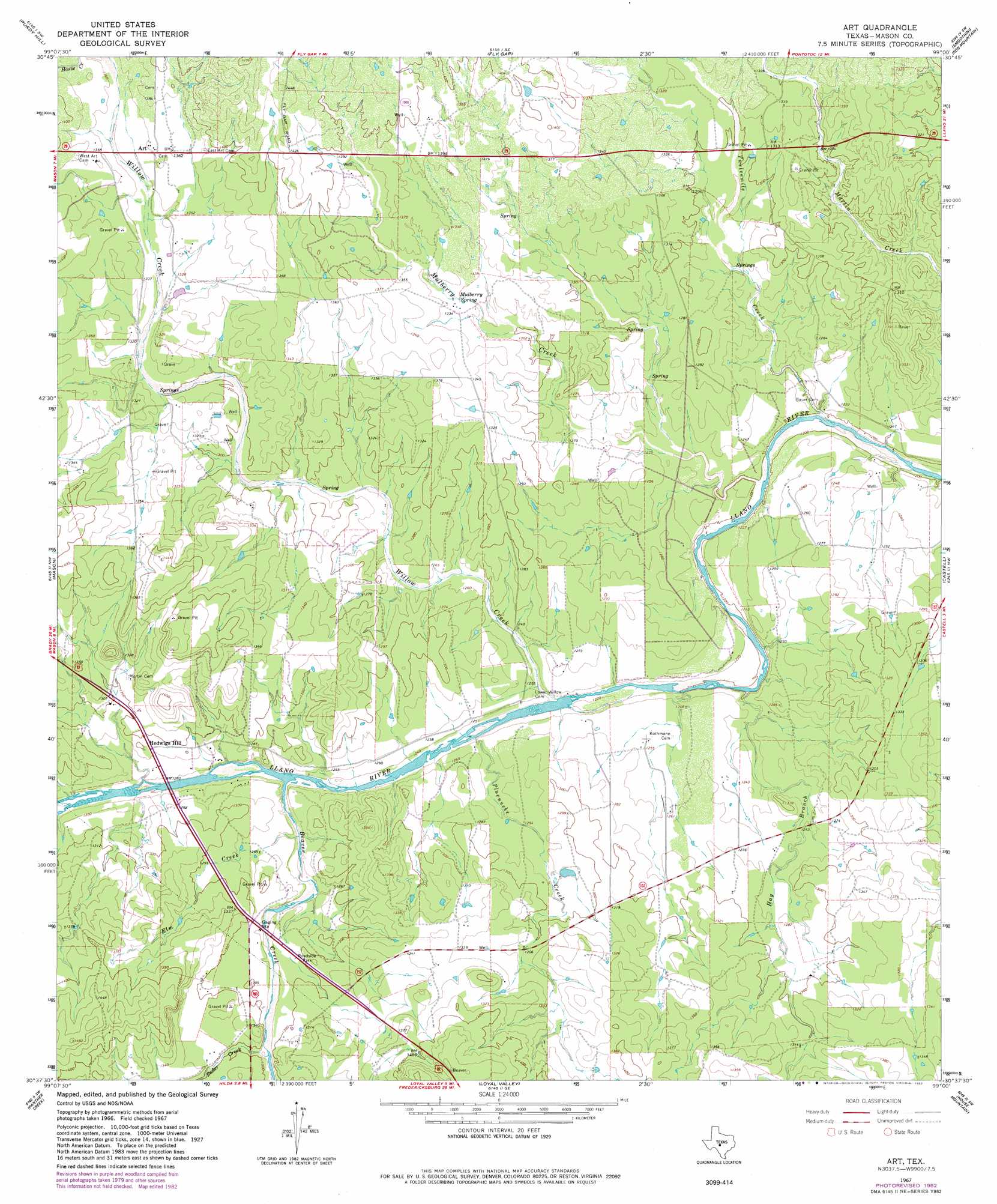
USGS Topo Quad 30099f1 - 1:24,000 scale
| Topo Map Name: | Art |
| USGS Topo Quad ID: | 30099f1 |
| Print Size: | ca. 21 1/4" wide x 27" high |
| Southeast Coordinates: | 30.625° N latitude / 99° W longitude |
| Map Center Coordinates: | 30.6875° N latitude / 99.0625° W longitude |
| U.S. State: | TX |
| Filename: | o30099f1.jpg |
| Download Map JPG Image: | Art topo map 1:24,000 scale |
| Map Type: | Topographic |
| Topo Series: | 7.5´ |
| Map Scale: | 1:24,000 |
| Source of Map Images: | United States Geological Survey (USGS) |
| Alternate Map Versions: |
Art TX 1967, updated 1969 Download PDF Buy paper map Art TX 1967, updated 1982 Download PDF Buy paper map Art TX 2010 Download PDF Buy paper map Art TX 2012 Download PDF Buy paper map Art TX 2016 Download PDF Buy paper map |
1:24,000 Topo Quads surrounding Art
Katemcy |
Spy Rock |
Fredonia |
Pontotoc |
Magill Mountain |
Grit |
Purdy Hill |
Fly Gap |
Smoothingiron Mountain |
Valley Spring |
Turtle Creek |
Mason |
Art |
Castell |
Scotts Crossing |
Monument Mountain Se |
Panther Creek |
Loyal Valley |
House Mountain |
Enchanted Rock |
The Falls |
Doss |
Cherry Spring |
Cherry Mountain |
Crabapple |
> Back to 30099e1 at 1:100,000 scale
> Back to 30098a1 at 1:250,000 scale
> Back to U.S. Topo Maps home
Art topo map: Gazetteer
Art: Bridges
State Highway 9 Bridge elevation 375m 1230′Art: Populated Places
Art elevation 415m 1361′Hedwigs Hill elevation 392m 1286′
Art: Springs
Mulberry Spring elevation 405m 1328′Art: Streams
Bader Creek elevation 387m 1269′Beaver Creek elevation 377m 1236′
Elm Creek elevation 377m 1236′
Hay Branch elevation 368m 1207′
Mulberry Creek elevation 361m 1184′
Pluenneke Creek elevation 377m 1236′
Stone Creek elevation 407m 1335′
Twelvemile Creek elevation 359m 1177′
Willow Creek elevation 371m 1217′
Art digital topo map on disk
Buy this Art topo map showing relief, roads, GPS coordinates and other geographical features, as a high-resolution digital map file on DVD: