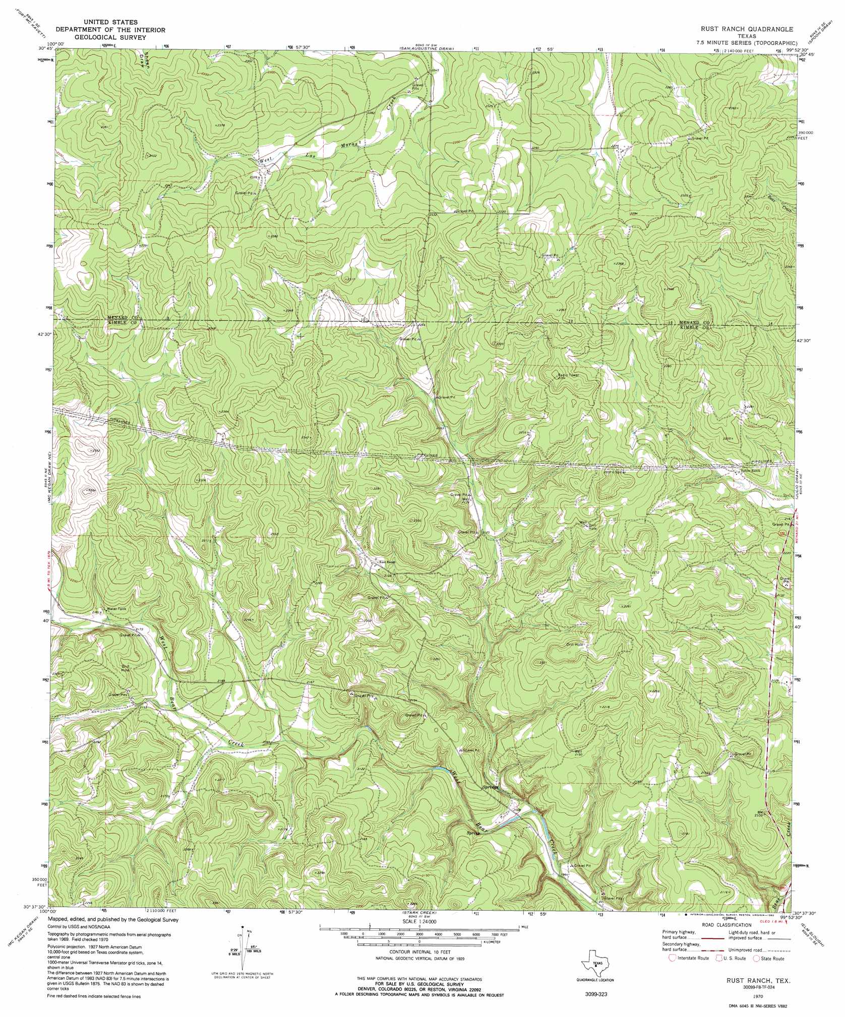
Rust Ranch Topo Map Texas
To zoom in, hover over the map of Rust Ranch
USGS Topo Quad 30099f8 - 1:24,000 scale
| Topo Map Name: | Rust Ranch |
| USGS Topo Quad ID: | 30099f8 |
| Print Size: | ca. 21 1/4" wide x 27" high |
| Southeast Coordinates: | 30.625° N latitude / 99.875° W longitude |
| Map Center Coordinates: | 30.6875° N latitude / 99.9375° W longitude |
| U.S. State: | TX |
| Filename: | o30099f8.jpg |
| Download Map JPG Image: | Rust Ranch topo map 1:24,000 scale |
| Map Type: | Topographic |
| Topo Series: | 7.5´ |
| Map Scale: | 1:24,000 |
| Source of Map Images: | United States Geological Survey (USGS) |
| Alternate Map Versions: |
Rust Ranch TX 1970, updated 1973 Download PDF Buy paper map Rust Ranch TX 1970, updated 1992 Download PDF Buy paper map Rust Ranch TX 2010 Download PDF Buy paper map Rust Ranch TX 2012 Download PDF Buy paper map Rust Ranch TX 2016 Download PDF Buy paper map |
1:24,000 Topo Quads surrounding Rust Ranch
Fort Mckavett Nw |
Fort Mckavett Ne |
Clear Creek Lake |
Menard |
Chapman Draw |
Coralina Ranch |
Fort Mckavett |
San Augustine Draw |
Spoon Draw |
East Elm Creek |
Coal Kiln Draw |
Mckegan Draw Ne |
Rust Ranch |
Julio Draw |
Brewer Hollow |
Brokeleg Mountain |
Mckegan Draw |
Stark Creek |
Elm Slough |
Big Draw |
Fort Terrett Ranch |
Roosevelt |
Bailey Creek |
Junction |
Segovia |
> Back to 30099e1 at 1:100,000 scale
> Back to 30098a1 at 1:250,000 scale
> Back to U.S. Topo Maps home
Rust Ranch digital topo map on disk
Buy this Rust Ranch topo map showing relief, roads, GPS coordinates and other geographical features, as a high-resolution digital map file on DVD: