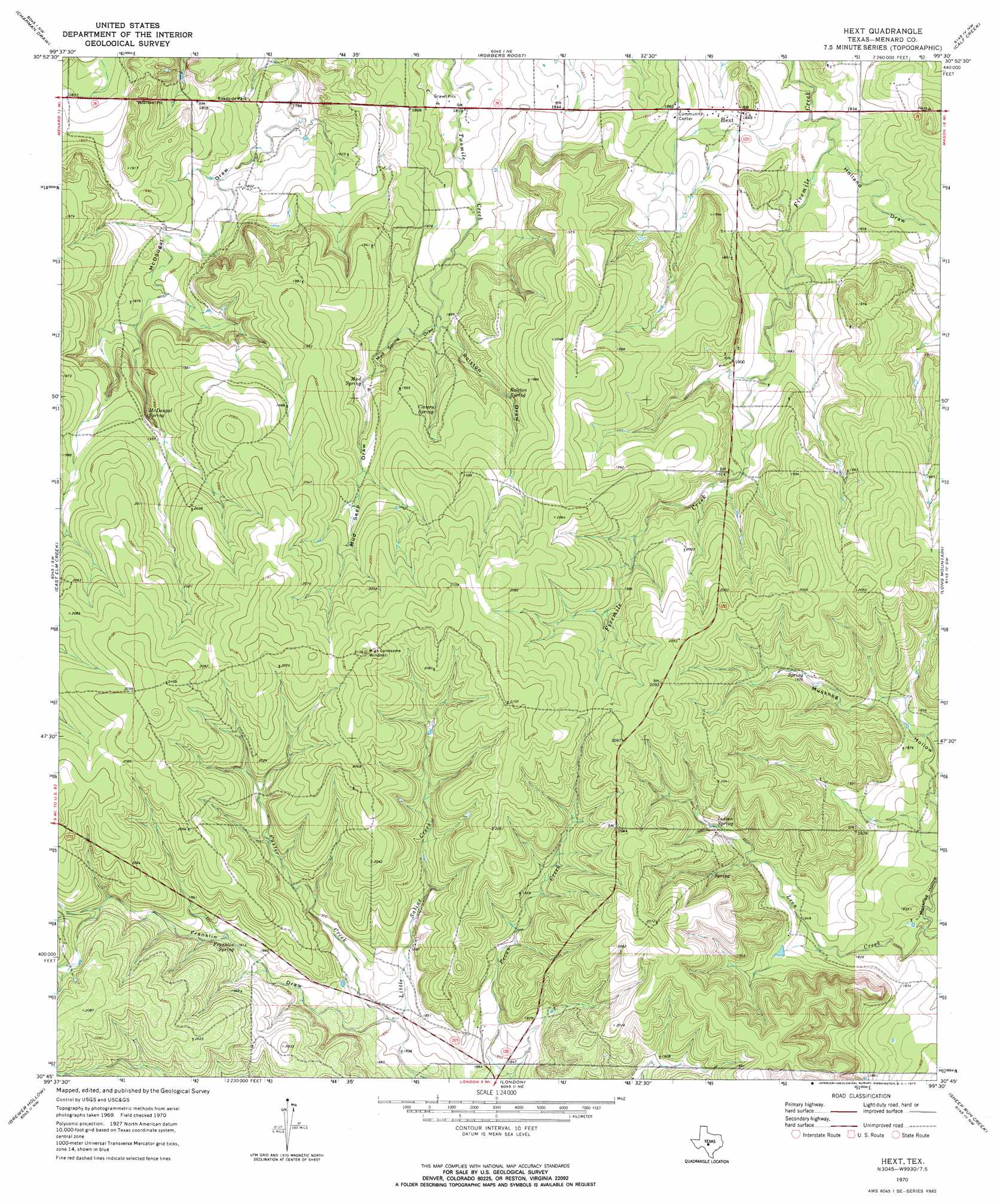
Hext Topo Map Texas
To zoom in, hover over the map of Hext
USGS Topo Quad 30099g5 - 1:24,000 scale
| Topo Map Name: | Hext |
| USGS Topo Quad ID: | 30099g5 |
| Print Size: | ca. 21 1/4" wide x 27" high |
| Southeast Coordinates: | 30.75° N latitude / 99.5° W longitude |
| Map Center Coordinates: | 30.8125° N latitude / 99.5625° W longitude |
| U.S. State: | TX |
| Filename: | o30099g5.jpg |
| Download Map JPG Image: | Hext topo map 1:24,000 scale |
| Map Type: | Topographic |
| Topo Series: | 7.5´ |
| Map Scale: | 1:24,000 |
| Source of Map Images: | United States Geological Survey (USGS) |
| Alternate Map Versions: |
Hext TX 1970, updated 1973 Download PDF Buy paper map Hext TX 2010 Download PDF Buy paper map Hext TX 2012 Download PDF Buy paper map Hext TX 2016 Download PDF Buy paper map |
1:24,000 Topo Quads surrounding Hext
Eden Se |
Callan |
Needle Creek |
Brady Sw |
Brady South |
Menard |
Chapman Draw |
Robbers Roost |
Calf Creek |
Katemcy |
Spoon Draw |
East Elm Creek |
Hext |
Long Mountain |
Grit |
Julio Draw |
Brewer Hollow |
London |
Sheep Run Creek |
Turtle Creek |
Elm Slough |
Big Draw |
Yates |
Monument Mountain |
Monument Mountain Se |
> Back to 30099e1 at 1:100,000 scale
> Back to 30098a1 at 1:250,000 scale
> Back to U.S. Topo Maps home
Hext topo map: Gazetteer
Hext: Populated Places
Hext elevation 563m 1847′Hext: Springs
Cistern Spring elevation 593m 1945′Franklin Spring elevation 583m 1912′
Indian Spring elevation 586m 1922′
McDougal Spring elevation 582m 1909′
Mud Spring elevation 586m 1922′
Rolston Spring elevation 585m 1919′
Hext: Streams
Custer Creek elevation 561m 1840′Hext: Valleys
Franklin Draw elevation 561m 1840′Holland Draw elevation 553m 1814′
Mud Seep Draw elevation 584m 1916′
Mud Spring Draw elevation 571m 1873′
Muskhog Hollow elevation 546m 1791′
Rolston Draw elevation 571m 1873′
Hext digital topo map on disk
Buy this Hext topo map showing relief, roads, GPS coordinates and other geographical features, as a high-resolution digital map file on DVD: