East Elm Creek Topo Map Texas
To zoom in, hover over the map of East Elm Creek
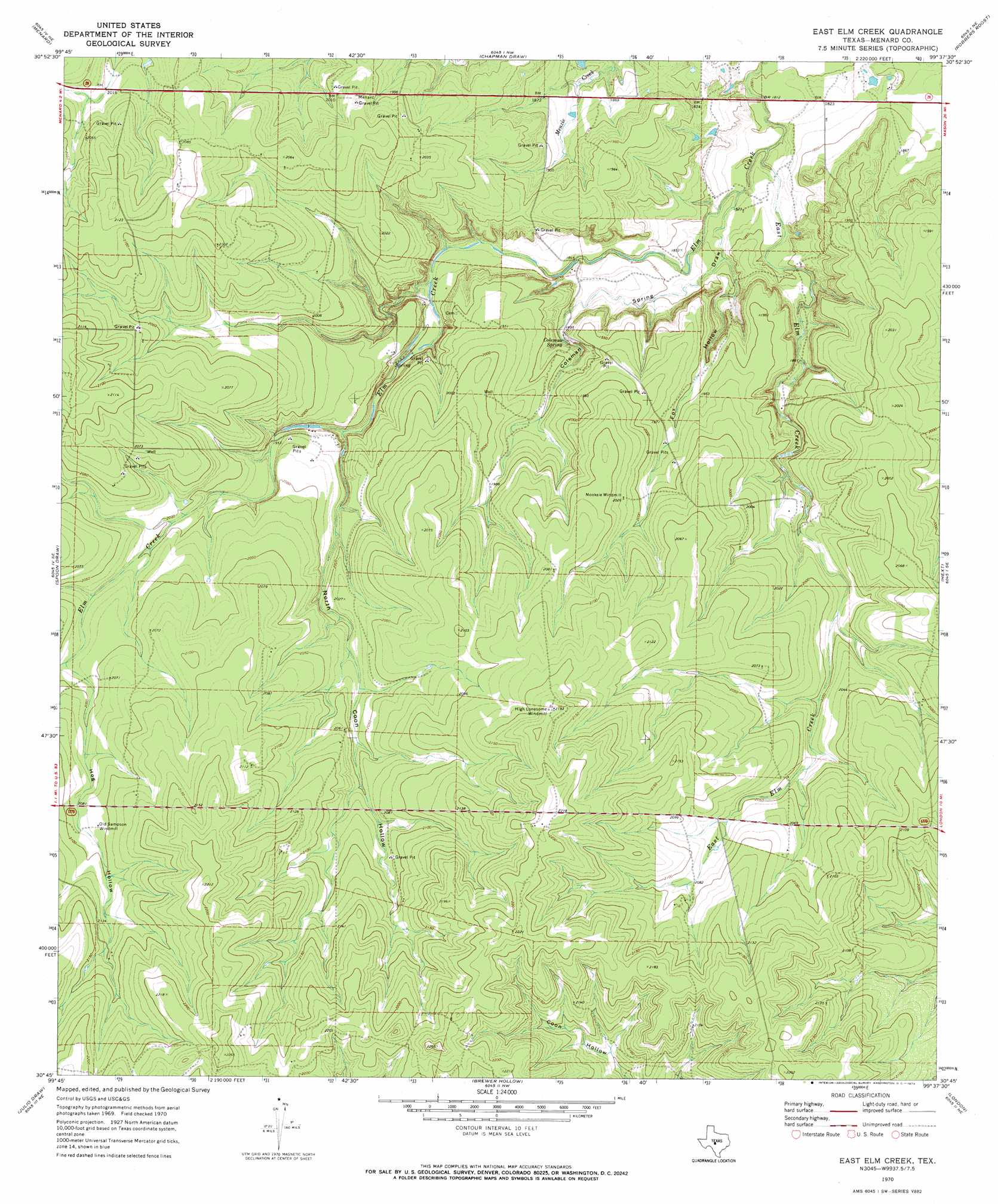
USGS Topo Quad 30099g6 - 1:24,000 scale
| Topo Map Name: | East Elm Creek |
| USGS Topo Quad ID: | 30099g6 |
| Print Size: | ca. 21 1/4" wide x 27" high |
| Southeast Coordinates: | 30.75° N latitude / 99.625° W longitude |
| Map Center Coordinates: | 30.8125° N latitude / 99.6875° W longitude |
| U.S. State: | TX |
| Filename: | o30099g6.jpg |
| Download Map JPG Image: | East Elm Creek topo map 1:24,000 scale |
| Map Type: | Topographic |
| Topo Series: | 7.5´ |
| Map Scale: | 1:24,000 |
| Source of Map Images: | United States Geological Survey (USGS) |
| Alternate Map Versions: |
East Elm Creek TX 1970, updated 1973 Download PDF Buy paper map East Elm Creek TX 2010 Download PDF Buy paper map East Elm Creek TX 2012 Download PDF Buy paper map East Elm Creek TX 2016 Download PDF Buy paper map |
1:24,000 Topo Quads surrounding East Elm Creek
Eden Sw |
Eden Se |
Callan |
Needle Creek |
Brady Sw |
Clear Creek Lake |
Menard |
Chapman Draw |
Robbers Roost |
Calf Creek |
San Augustine Draw |
Spoon Draw |
East Elm Creek |
Hext |
Long Mountain |
Rust Ranch |
Julio Draw |
Brewer Hollow |
London |
Sheep Run Creek |
Stark Creek |
Elm Slough |
Big Draw |
Yates |
Monument Mountain |
> Back to 30099e1 at 1:100,000 scale
> Back to 30098a1 at 1:250,000 scale
> Back to U.S. Topo Maps home
East Elm Creek topo map: Gazetteer
East Elm Creek: Springs
Coleman Spring elevation 581m 1906′East Elm Creek: Streams
East Elm Creek elevation 551m 1807′East Elm Creek: Valleys
Coleman Spring Draw elevation 552m 1811′Fox Hollow elevation 555m 1820′
Hog Hollow elevation 622m 2040′
North Coon Hollow elevation 585m 1919′
East Elm Creek digital topo map on disk
Buy this East Elm Creek topo map showing relief, roads, GPS coordinates and other geographical features, as a high-resolution digital map file on DVD: