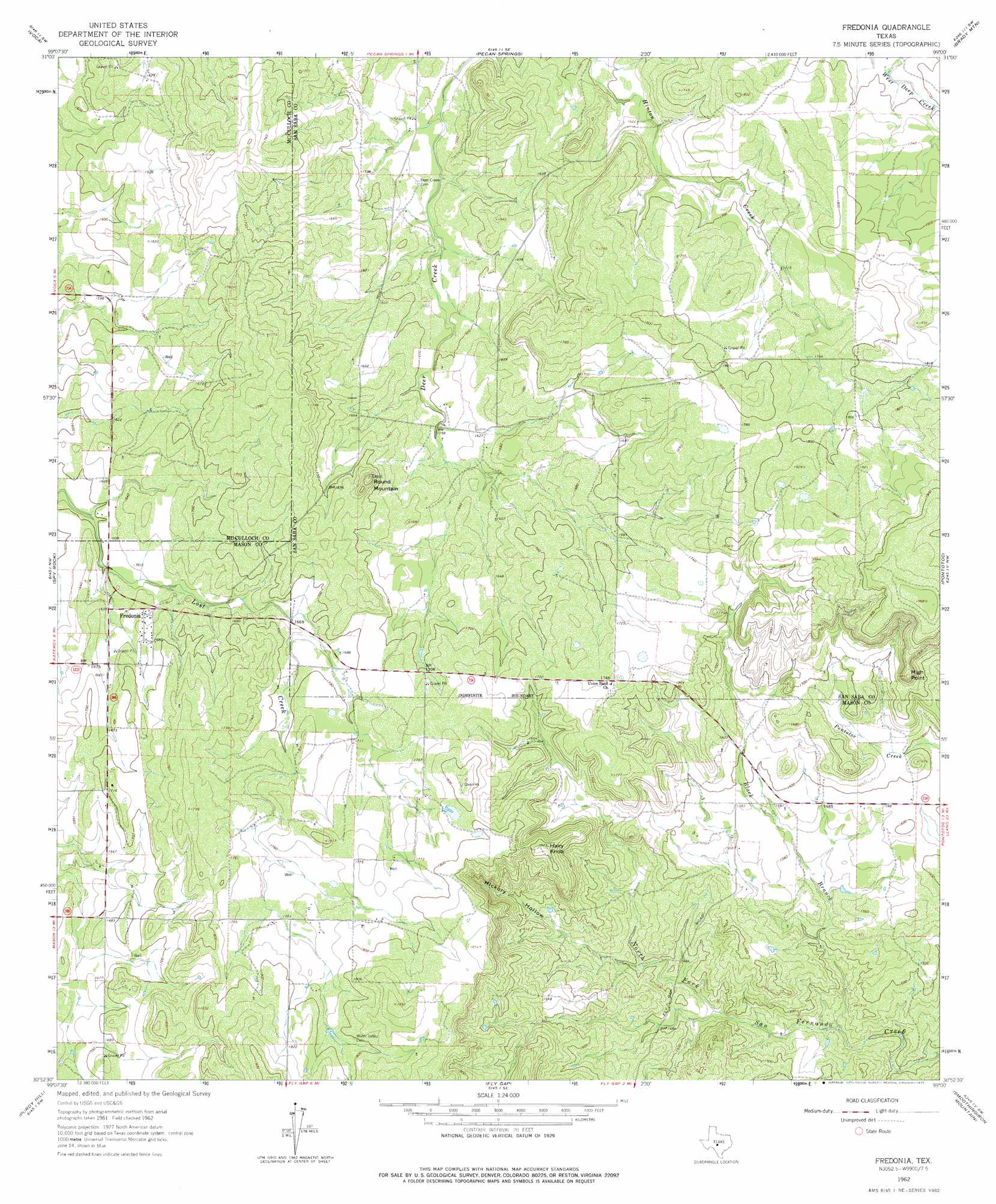
Fredonia Topo Map Texas
To zoom in, hover over the map of Fredonia
USGS Topo Quad 30099h1 - 1:24,000 scale
| Topo Map Name: | Fredonia |
| USGS Topo Quad ID: | 30099h1 |
| Print Size: | ca. 21 1/4" wide x 27" high |
| Southeast Coordinates: | 30.875° N latitude / 99° W longitude |
| Map Center Coordinates: | 30.9375° N latitude / 99.0625° W longitude |
| U.S. State: | TX |
| Filename: | o30099h1.jpg |
| Download Map JPG Image: | Fredonia topo map 1:24,000 scale |
| Map Type: | Topographic |
| Topo Series: | 7.5´ |
| Map Scale: | 1:24,000 |
| Source of Map Images: | United States Geological Survey (USGS) |
| Alternate Map Versions: |
Fredonia TX 1962, updated 1965 Download PDF Buy paper map Fredonia TX 1962, updated 1975 Download PDF Buy paper map Fredonia TX 2010 Download PDF Buy paper map Fredonia TX 2012 Download PDF Buy paper map Fredonia TX 2016 Download PDF Buy paper map |
1:24,000 Topo Quads surrounding Fredonia
Brady North |
Rochelle |
Lost Creek |
Baker Spring |
Algerita |
Brady South |
Voca |
Pecan Springs |
Brady Mountain |
Buffalo Knob |
Katemcy |
Spy Rock |
Fredonia |
Pontotoc |
Magill Mountain |
Grit |
Purdy Hill |
Fly Gap |
Smoothingiron Mountain |
Valley Spring |
Turtle Creek |
Mason |
Art |
Castell |
Scotts Crossing |
> Back to 30099e1 at 1:100,000 scale
> Back to 30098a1 at 1:250,000 scale
> Back to U.S. Topo Maps home
Fredonia topo map: Gazetteer
Fredonia: Populated Places
Fredonia elevation 504m 1653′Fredonia: Streams
Black Branch elevation 432m 1417′Fredonia: Summits
Hairy Knob elevation 551m 1807′High Point elevation 575m 1886′
Round Mountain elevation 558m 1830′
Fredonia: Valleys
Hickory Hollow elevation 456m 1496′Fredonia digital topo map on disk
Buy this Fredonia topo map showing relief, roads, GPS coordinates and other geographical features, as a high-resolution digital map file on DVD: