Robbers Roost Topo Map Texas
To zoom in, hover over the map of Robbers Roost
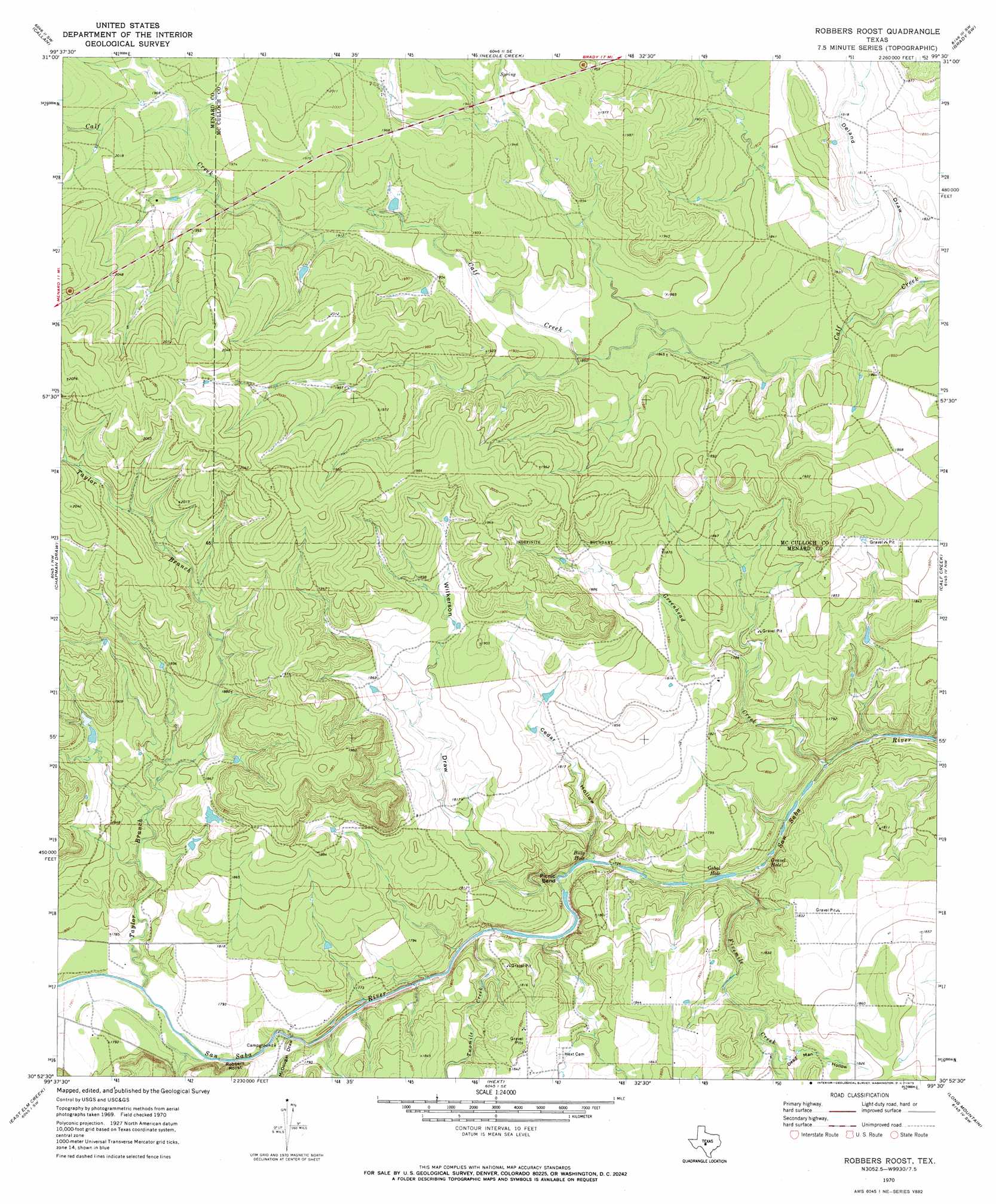
USGS Topo Quad 30099h5 - 1:24,000 scale
| Topo Map Name: | Robbers Roost |
| USGS Topo Quad ID: | 30099h5 |
| Print Size: | ca. 21 1/4" wide x 27" high |
| Southeast Coordinates: | 30.875° N latitude / 99.5° W longitude |
| Map Center Coordinates: | 30.9375° N latitude / 99.5625° W longitude |
| U.S. State: | TX |
| Filename: | o30099h5.jpg |
| Download Map JPG Image: | Robbers Roost topo map 1:24,000 scale |
| Map Type: | Topographic |
| Topo Series: | 7.5´ |
| Map Scale: | 1:24,000 |
| Source of Map Images: | United States Geological Survey (USGS) |
| Alternate Map Versions: |
Robbers Roost TX 1970, updated 1973 Download PDF Buy paper map Robbers Roost TX 2010 Download PDF Buy paper map Robbers Roost TX 2012 Download PDF Buy paper map Robbers Roost TX 2016 Download PDF Buy paper map |
1:24,000 Topo Quads surrounding Robbers Roost
Eden |
Pasche |
Melvin |
West Sweden |
Brady North |
Eden Se |
Callan |
Needle Creek |
Brady Sw |
Brady South |
Menard |
Chapman Draw |
Robbers Roost |
Calf Creek |
Katemcy |
Spoon Draw |
East Elm Creek |
Hext |
Long Mountain |
Grit |
Julio Draw |
Brewer Hollow |
London |
Sheep Run Creek |
Turtle Creek |
> Back to 30099e1 at 1:100,000 scale
> Back to 30098a1 at 1:250,000 scale
> Back to U.S. Topo Maps home
Robbers Roost topo map: Gazetteer
Robbers Roost: Bends
Picnic Bend elevation 527m 1729′Robbers Roost: Cliffs
Robbers Roost elevation 559m 1833′Robbers Roost: Lakes
Billy Hole elevation 525m 1722′Gobal Hole elevation 522m 1712′
Gravel Hole elevation 522m 1712′
Robbers Roost: Streams
Fivemile Creek elevation 525m 1722′Greenhead Creek elevation 518m 1699′
Taylor Branch elevation 535m 1755′
Twomile Creek elevation 528m 1732′
Robbers Roost: Valleys
Cedar Hollow elevation 529m 1735′Dead Man Hollow elevation 542m 1778′
Deland Draw elevation 542m 1778′
McDougal Draw elevation 532m 1745′
Wilkerson Draw elevation 525m 1722′
Robbers Roost digital topo map on disk
Buy this Robbers Roost topo map showing relief, roads, GPS coordinates and other geographical features, as a high-resolution digital map file on DVD: