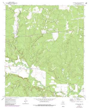
Chapman Draw Topo Map Texas
To zoom in, hover over the map of Chapman Draw
USGS Topo Quad 30099h6 - 1:24,000 scale
| Topo Map Name: | Chapman Draw |
| USGS Topo Quad ID: | 30099h6 |
| Print Size: | ca. 21 1/4" wide x 27" high |
| Southeast Coordinates: | 30.875° N latitude / 99.625° W longitude |
| Map Center Coordinates: | 30.9375° N latitude / 99.6875° W longitude |
| U.S. State: | TX |
| Filename: | o30099h6.jpg |
| Download Map JPG Image: | Chapman Draw topo map 1:24,000 scale |
| Map Type: | Topographic |
| Topo Series: | 7.5´ |
| Map Scale: | 1:24,000 |
| Source of Map Images: | United States Geological Survey (USGS) |
| Alternate Map Versions: |
Chapman Draw TX 1970, updated 1973 Download PDF Buy paper map Chapman Draw TX 1970, updated 1973 Download PDF Buy paper map Chapman Draw TX 1970, updated 1987 Download PDF Buy paper map Chapman Draw TX 2010 Download PDF Buy paper map Chapman Draw TX 2012 Download PDF Buy paper map Chapman Draw TX 2016 Download PDF Buy paper map |
1:24,000 Topo Quads surrounding Chapman Draw
> Back to 30099e1 at 1:100,000 scale
> Back to 30098a1 at 1:250,000 scale
> Back to U.S. Topo Maps home
Chapman Draw topo map: Gazetteer
Chapman Draw: Airports
M and M Land Company Airport elevation 547m 1794′Chapman Draw: Populated Places
Fivemile Crossing elevation 553m 1814′Tenmile Crossing elevation 538m 1765′
Chapman Draw: Streams
East Scalp Creek elevation 602m 1975′Elm Creek elevation 540m 1771′
Menzie Creek elevation 546m 1791′
Scalp Creek elevation 555m 1820′
West Scalp Creek elevation 601m 1971′
Chapman Draw: Summits
Hyman Hill elevation 647m 2122′Chapman Draw: Valleys
Chapman Draw elevation 556m 1824′Mann Draw elevation 597m 1958′
One Hundred Sixty Acre Draw elevation 607m 1991′
Chapman Draw digital topo map on disk
Buy this Chapman Draw topo map showing relief, roads, GPS coordinates and other geographical features, as a high-resolution digital map file on DVD:


