Sonora Se Topo Map Texas
To zoom in, hover over the map of Sonora Se
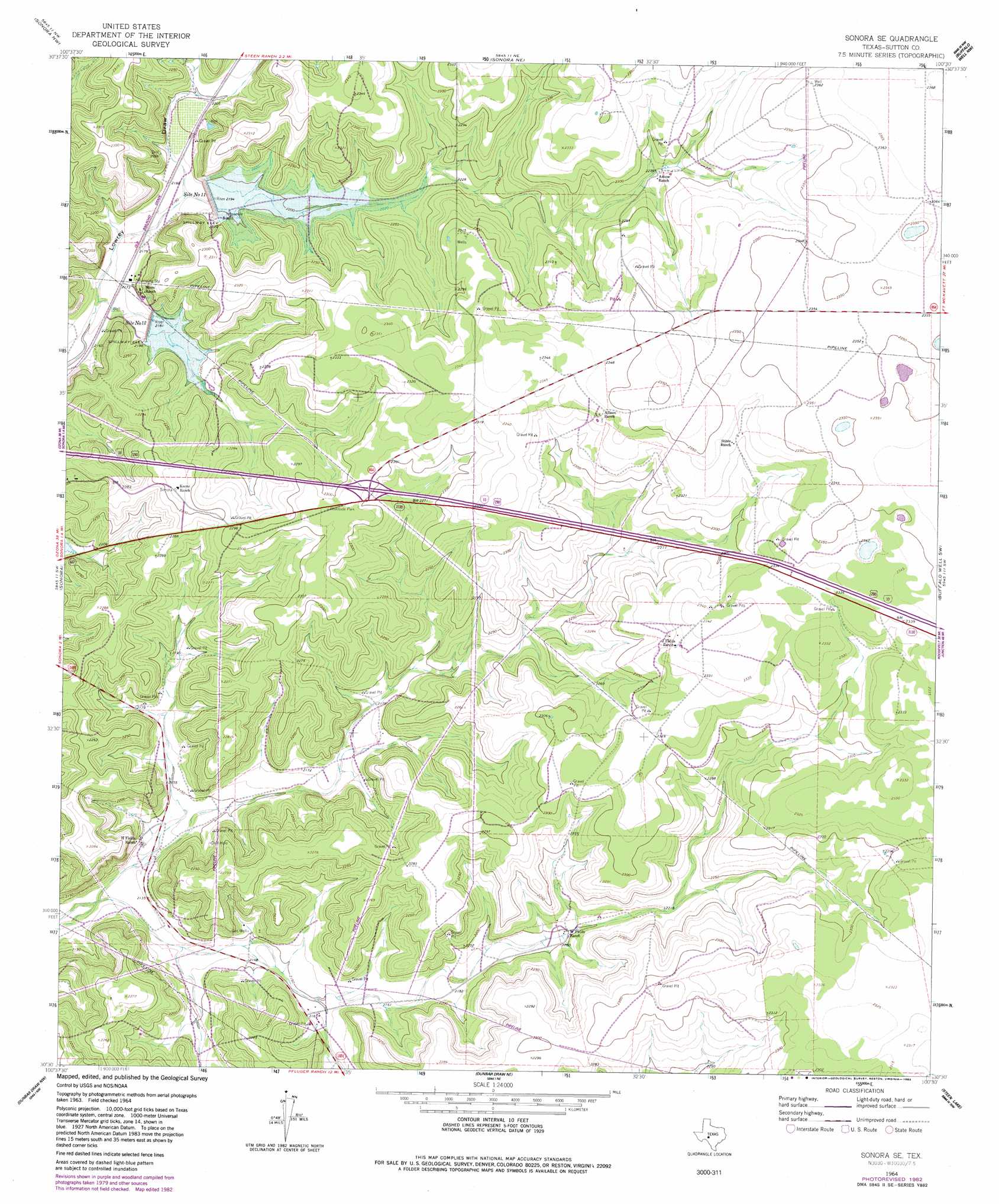
USGS Topo Quad 30100e5 - 1:24,000 scale
| Topo Map Name: | Sonora Se |
| USGS Topo Quad ID: | 30100e5 |
| Print Size: | ca. 21 1/4" wide x 27" high |
| Southeast Coordinates: | 30.5° N latitude / 100.5° W longitude |
| Map Center Coordinates: | 30.5625° N latitude / 100.5625° W longitude |
| U.S. State: | TX |
| Filename: | o30100e5.jpg |
| Download Map JPG Image: | Sonora Se topo map 1:24,000 scale |
| Map Type: | Topographic |
| Topo Series: | 7.5´ |
| Map Scale: | 1:24,000 |
| Source of Map Images: | United States Geological Survey (USGS) |
| Alternate Map Versions: |
Sonora SE TX 1964, updated 1966 Download PDF Buy paper map Sonora SE TX 1964, updated 1983 Download PDF Buy paper map Sonora SE TX 2010 Download PDF Buy paper map Sonora SE TX 2012 Download PDF Buy paper map Sonora SE TX 2016 Download PDF Buy paper map |
1:24,000 Topo Quads surrounding Sonora Se
Coupe Ranch |
Eldorado Sw |
Eldorado |
Adams Sw |
Adams Se |
Savell Ranch |
Sonora Nw |
Sonora Ne |
Buffalo Well Nw |
Buffalo Well |
Caverns Of Sonora |
Sonora |
Sonora Se |
Buffalo Well Sw |
Buffalo Well Se |
Hudspeth Draw |
Dunbar Draw Nw |
Dunbar Draw Ne |
Steen Lake |
Live Oak Draw |
Flat Rock Draw Se |
Dunbar Draw Sw |
Dunbar Draw Se |
Harrison Ranch |
Stewart Ranch |
> Back to 30100e1 at 1:100,000 scale
> Back to 30100a1 at 1:250,000 scale
> Back to U.S. Topo Maps home
Sonora Se topo map: Gazetteer
Sonora Se: Airports
John Fields Ranch Airport elevation 714m 2342′Sonora Se: Dams
Soil Conservation Service Site 11 Dam elevation 680m 2230′Soil Conservation Service Site 12 Dam elevation 664m 2178′
Sonora Se: Reservoirs
Site Number Eleven elevation 672m 2204′Site Number Twelve elevation 666m 2185′
Soil Conservation Service Site 11 Reservoir elevation 680m 2230′
Soil Conservation Service Site 12 Reservoir elevation 664m 2178′
Sonora Se: Wells
Threemile Well elevation 678m 2224′Sonora Se digital topo map on disk
Buy this Sonora Se topo map showing relief, roads, GPS coordinates and other geographical features, as a high-resolution digital map file on DVD: