Divide Well Draw Topo Map Texas
To zoom in, hover over the map of Divide Well Draw
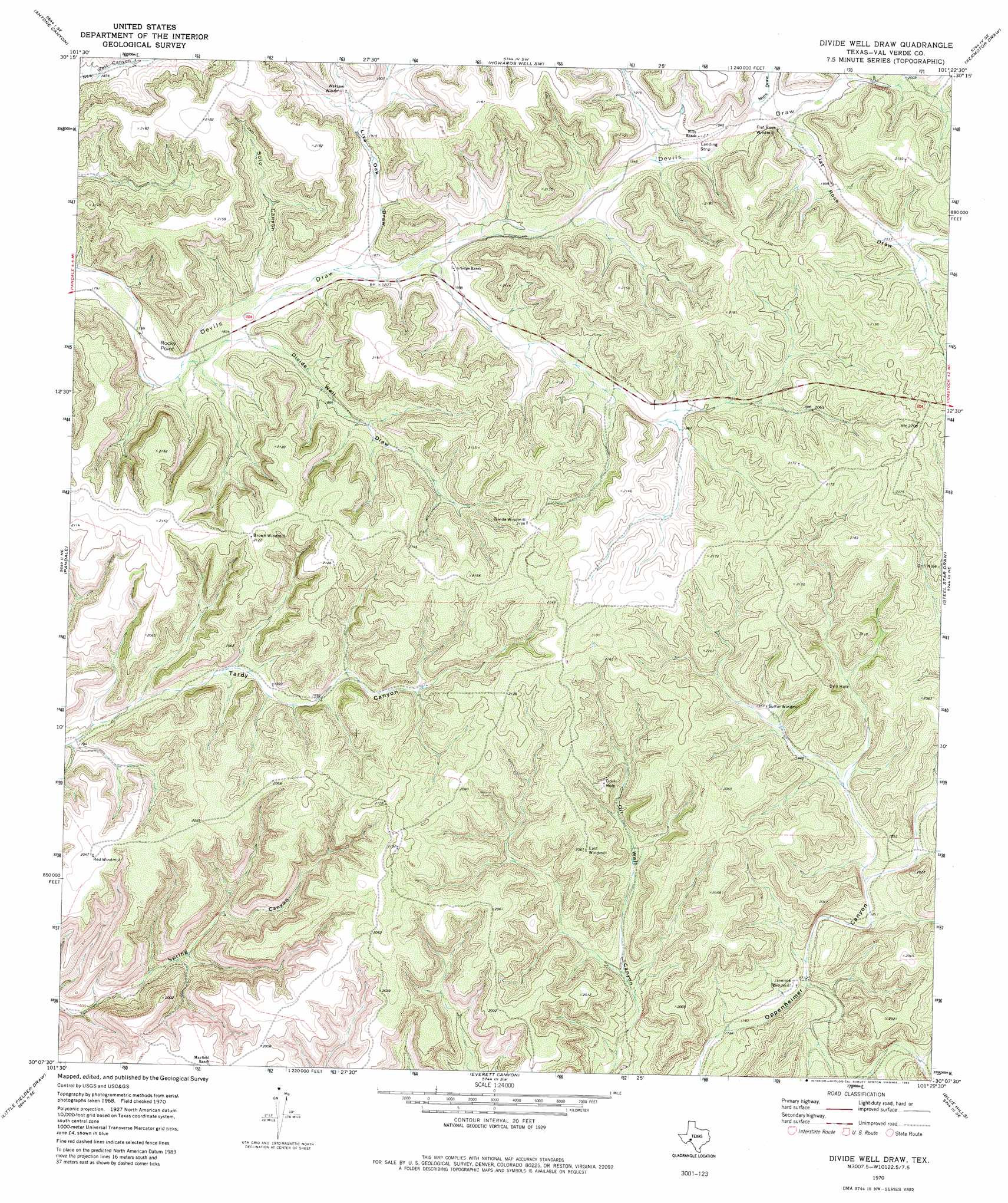
USGS Topo Quad 30101b4 - 1:24,000 scale
| Topo Map Name: | Divide Well Draw |
| USGS Topo Quad ID: | 30101b4 |
| Print Size: | ca. 21 1/4" wide x 27" high |
| Southeast Coordinates: | 30.125° N latitude / 101.375° W longitude |
| Map Center Coordinates: | 30.1875° N latitude / 101.4375° W longitude |
| U.S. State: | TX |
| Filename: | o30101b4.jpg |
| Download Map JPG Image: | Divide Well Draw topo map 1:24,000 scale |
| Map Type: | Topographic |
| Topo Series: | 7.5´ |
| Map Scale: | 1:24,000 |
| Source of Map Images: | United States Geological Survey (USGS) |
| Alternate Map Versions: |
Divide Well Draw TX 1970, updated 1973 Download PDF Buy paper map Divide Well Draw TX 1970, updated 1982 Download PDF Buy paper map Divide Well Draw TX 2010 Download PDF Buy paper map Divide Well Draw TX 2012 Download PDF Buy paper map Divide Well Draw TX 2016 Download PDF Buy paper map |
1:24,000 Topo Quads surrounding Divide Well Draw
Sixshooter Canyon |
Prince Albert Draw |
Howards Well |
Howards Well Ne |
Harrell Canyon |
Post Canyon |
Antone Canyon |
Howards Well Sw |
Aermotor Draw |
Indian Draw |
Hackberry Crossing |
Pandale |
Divide Well Draw |
Steel Star Draw |
Bee Canyon |
Roundhill Ranch |
Little Fielder Draw |
Everett Canyon |
Blue Hills |
Sycamore Canyon |
Pumpville |
Harkell Canyon |
Still Canyon |
Mayfield Canyon |
Bakers Crossing |
> Back to 30101a1 at 1:100,000 scale
> Back to 30100a1 at 1:250,000 scale
> Back to U.S. Topo Maps home
Divide Well Draw topo map: Gazetteer
Divide Well Draw: Airports
Mills Ranch Airport elevation 599m 1965′Divide Well Draw: Capes
Rocky Point elevation 582m 1909′Divide Well Draw: Valleys
Divide Well Draw elevation 560m 1837′Flat Rock Draw elevation 603m 1978′
Live Oak Draw elevation 565m 1853′
Mills Draw elevation 602m 1975′
Soto Canyon elevation 561m 1840′
Divide Well Draw digital topo map on disk
Buy this Divide Well Draw topo map showing relief, roads, GPS coordinates and other geographical features, as a high-resolution digital map file on DVD: