Fort Lancaster Topo Map Texas
To zoom in, hover over the map of Fort Lancaster
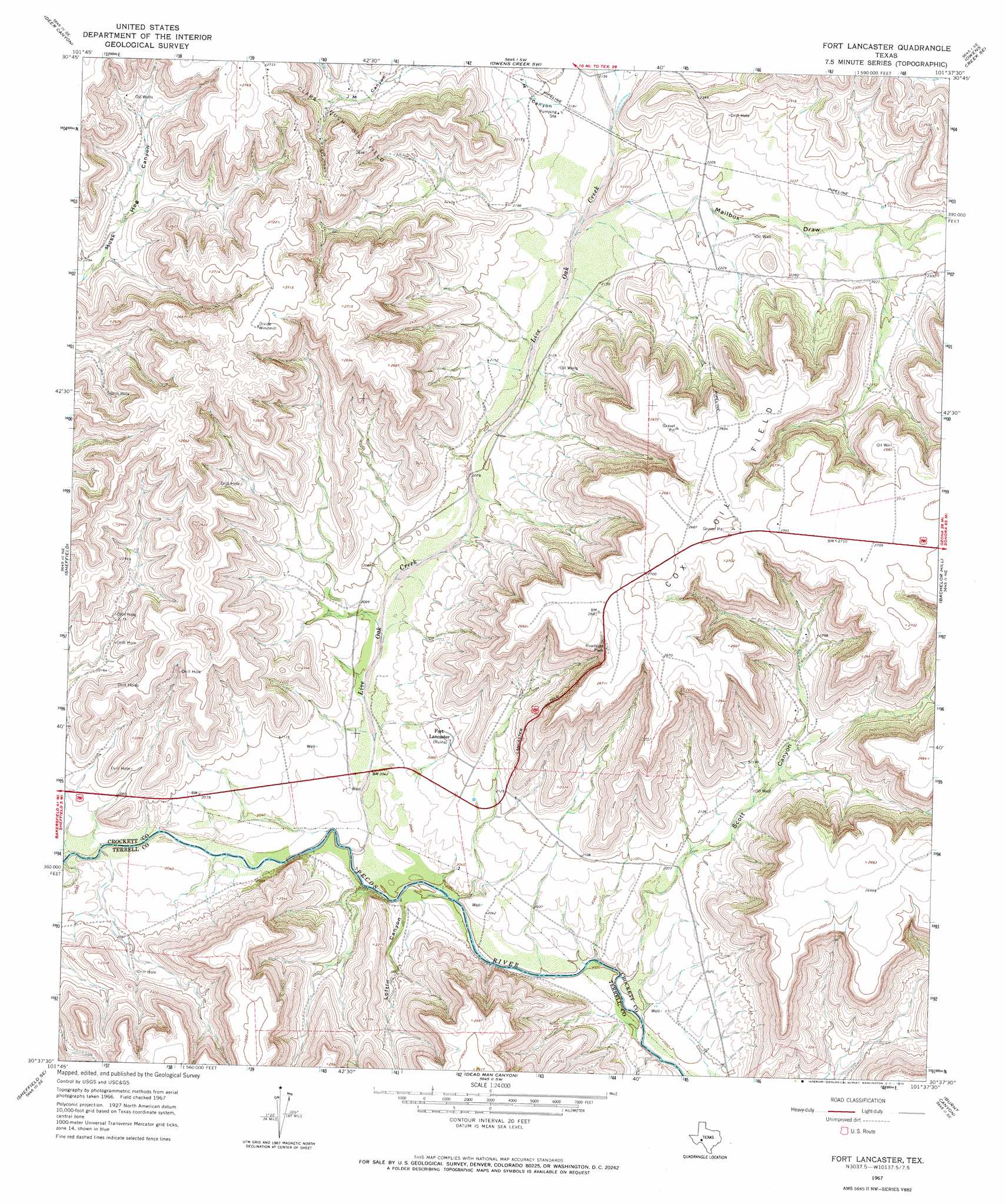
USGS Topo Quad 30101f6 - 1:24,000 scale
| Topo Map Name: | Fort Lancaster |
| USGS Topo Quad ID: | 30101f6 |
| Print Size: | ca. 21 1/4" wide x 27" high |
| Southeast Coordinates: | 30.625° N latitude / 101.625° W longitude |
| Map Center Coordinates: | 30.6875° N latitude / 101.6875° W longitude |
| U.S. State: | TX |
| Filename: | o30101f6.jpg |
| Download Map JPG Image: | Fort Lancaster topo map 1:24,000 scale |
| Map Type: | Topographic |
| Topo Series: | 7.5´ |
| Map Scale: | 1:24,000 |
| Source of Map Images: | United States Geological Survey (USGS) |
| Alternate Map Versions: |
Fort Lancaster TX 1967, updated 1970 Download PDF Buy paper map Fort Lancaster TX 2010 Download PDF Buy paper map Fort Lancaster TX 2012 Download PDF Buy paper map Fort Lancaster TX 2016 Download PDF Buy paper map |
1:24,000 Topo Quads surrounding Fort Lancaster
Iraan |
Twelvemile Camp |
Owens Creek Nw |
Owens Creek Ne |
Schneeman Draw Nw |
Divide Country |
Deer Canyon |
Owens Creek Sw |
Owens Creek Se |
Schneeman Draw Sw |
Sheffield Nw |
Sheffield |
Fort Lancaster |
Bachelor Hill |
Pikes Peak |
Horsehead Canyon |
Sheffield Se |
Dead Man Canyon |
Burnt Canyon |
Mitchell Canyon |
Geddis Canyon Nw |
Oasis Ranch |
Sixshooter Canyon |
Prince Albert Draw |
Howards Well |
> Back to 30101e1 at 1:100,000 scale
> Back to 30100a1 at 1:250,000 scale
> Back to U.S. Topo Maps home
Fort Lancaster topo map: Gazetteer
Fort Lancaster: Oilfields
Cox Oil Field elevation 810m 2657′Fort Lancaster: Parks
Fort Lancaster State Historical Park elevation 652m 2139′Fort Lancaster: Populated Places
Fort Lancaster elevation 641m 2103′Fort Lancaster: Streams
Live Oak Creek elevation 610m 2001′Fort Lancaster: Trails
Fort Lancaster State Historic Site Trail elevation 640m 2099′Fort Lancaster: Valleys
Loftin Canyon elevation 610m 2001′Mailbox Draw elevation 653m 2142′
Scott Canyon elevation 607m 1991′
Fort Lancaster digital topo map on disk
Buy this Fort Lancaster topo map showing relief, roads, GPS coordinates and other geographical features, as a high-resolution digital map file on DVD: