Divide Country Topo Map Texas
To zoom in, hover over the map of Divide Country
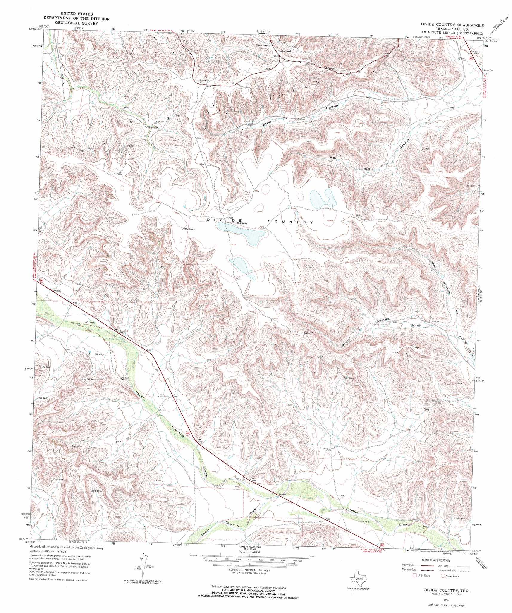
USGS Topo Quad 30101g8 - 1:24,000 scale
| Topo Map Name: | Divide Country |
| USGS Topo Quad ID: | 30101g8 |
| Print Size: | ca. 21 1/4" wide x 27" high |
| Southeast Coordinates: | 30.75° N latitude / 101.875° W longitude |
| Map Center Coordinates: | 30.8125° N latitude / 101.9375° W longitude |
| U.S. State: | TX |
| Filename: | o30101g8.jpg |
| Download Map JPG Image: | Divide Country topo map 1:24,000 scale |
| Map Type: | Topographic |
| Topo Series: | 7.5´ |
| Map Scale: | 1:24,000 |
| Source of Map Images: | United States Geological Survey (USGS) |
| Alternate Map Versions: |
Divide Country TX 1967, updated 1970 Download PDF Buy paper map Divide Country TX 1967, updated 1970 Download PDF Buy paper map Divide Country TX 2010 Download PDF Buy paper map Divide Country TX 2012 Download PDF Buy paper map Divide Country TX 2016 Download PDF Buy paper map |
1:24,000 Topo Quads surrounding Divide Country
Mccamey South |
Table Top Mountain |
Cedar Canyon |
Rankin Se |
Lone Mountain |
Indian Mesa |
Indian Mesa Ne |
Iraan |
Twelvemile Camp |
Owens Creek Nw |
Sherbino Ranch |
Indian Mesa Se |
Divide Country |
Deer Canyon |
Owens Creek Sw |
Hat-A Ranch |
Smokey Mountain Ranch |
Sheffield Nw |
Sheffield |
Fort Lancaster |
Seventeen Ranch |
Mitchell Draw |
Horsehead Canyon |
Sheffield Se |
Dead Man Canyon |
> Back to 30101e1 at 1:100,000 scale
> Back to 30100a1 at 1:250,000 scale
> Back to U.S. Topo Maps home
Divide Country topo map: Gazetteer
Divide Country: Flats
Divide Country elevation 892m 2926′Divide Country: Valleys
Little Riffle Canyon elevation 710m 2329′Lower Fourmile Draw elevation 695m 2280′
North Sixmile Draw elevation 705m 2312′
South Sixmile Draw elevation 705m 2312′
Divide Country digital topo map on disk
Buy this Divide Country topo map showing relief, roads, GPS coordinates and other geographical features, as a high-resolution digital map file on DVD: