Big Canyon Ranch Nw Topo Map Texas
To zoom in, hover over the map of Big Canyon Ranch Nw
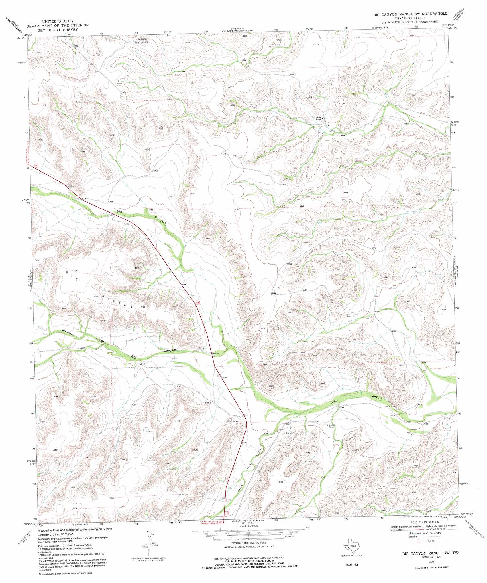
USGS Topo Quad 30102d4 - 1:24,000 scale
| Topo Map Name: | Big Canyon Ranch Nw |
| USGS Topo Quad ID: | 30102d4 |
| Print Size: | ca. 21 1/4" wide x 27" high |
| Southeast Coordinates: | 30.375° N latitude / 102.375° W longitude |
| Map Center Coordinates: | 30.4375° N latitude / 102.4375° W longitude |
| U.S. State: | TX |
| Filename: | o30102d4.jpg |
| Download Map JPG Image: | Big Canyon Ranch Nw topo map 1:24,000 scale |
| Map Type: | Topographic |
| Topo Series: | 7.5´ |
| Map Scale: | 1:24,000 |
| Source of Map Images: | United States Geological Survey (USGS) |
| Alternate Map Versions: |
Big Canyon Ranch NW TX 1969, updated 1972 Download PDF Buy paper map Big Canyon Ranch NW TX 1969, updated 1992 Download PDF Buy paper map Big Canyon Ranch NW TX 2010 Download PDF Buy paper map Big Canyon Ranch NW TX 2012 Download PDF Buy paper map Big Canyon Ranch NW TX 2016 Download PDF Buy paper map |
1:24,000 Topo Quads surrounding Big Canyon Ranch Nw
Rock House Draw Nw |
Rock House Draw Ne |
Hackberry Draw Nw |
Hackberry Draw Ne |
Hat-A Ranch |
Panther Tank |
Rock House Draw |
Hackberry Draw Sw |
Hackberry Draw Se |
Seventeen Ranch |
Ebers Camp |
Busher Canyon |
Big Canyon Ranch Nw |
Big Canyon Ranch Ne |
Circle Dot Ranch |
F C Ranch |
Toms Canyon |
Big Canyon Ranch Sw |
Big Canyon Ranch |
Allen Ranch |
Longfellow |
Ninemile Ranch |
Sanderson |
Sanderson Ne |
Dryden Nw |
> Back to 30102a1 at 1:100,000 scale
> Back to 30102a1 at 1:250,000 scale
> Back to U.S. Topo Maps home
Big Canyon Ranch Nw topo map: Gazetteer
Big Canyon Ranch Nw: Valleys
Clark Place Draw elevation 931m 3054′Cliett Draw elevation 945m 3100′
Big Canyon Ranch Nw digital topo map on disk
Buy this Big Canyon Ranch Nw topo map showing relief, roads, GPS coordinates and other geographical features, as a high-resolution digital map file on DVD: