Sierra Madera Ne Topo Map Texas
To zoom in, hover over the map of Sierra Madera Ne
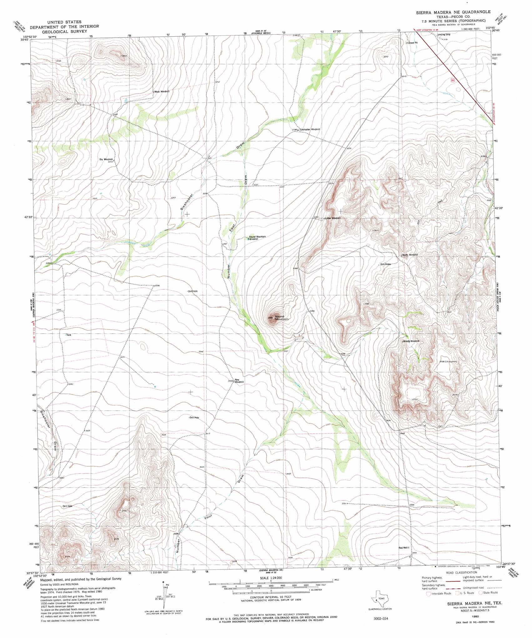
USGS Topo Quad 30102f7 - 1:24,000 scale
| Topo Map Name: | Sierra Madera Ne |
| USGS Topo Quad ID: | 30102f7 |
| Print Size: | ca. 21 1/4" wide x 27" high |
| Southeast Coordinates: | 30.625° N latitude / 102.75° W longitude |
| Map Center Coordinates: | 30.6875° N latitude / 102.8125° W longitude |
| U.S. State: | TX |
| Filename: | o30102f7.jpg |
| Download Map JPG Image: | Sierra Madera Ne topo map 1:24,000 scale |
| Map Type: | Topographic |
| Topo Series: | 7.5´ |
| Map Scale: | 1:24,000 |
| Source of Map Images: | United States Geological Survey (USGS) |
| Alternate Map Versions: |
Sierra Madera NE TX 1980, updated 1980 Download PDF Buy paper map Sierra Madera NE TX 2010 Download PDF Buy paper map Sierra Madera NE TX 2012 Download PDF Buy paper map Sierra Madera NE TX 2016 Download PDF Buy paper map |
1:24,000 Topo Quads surrounding Sierra Madera Ne
Belding Ne |
Fort Stockton West |
Fort Stockton East |
East Mesa |
Saddle Butte |
Belding |
Twelvemile Mesa |
Fivemile Mesa |
East Mesa Sw |
Panther Bluff |
Cave Mesa Ne |
Sierra Madera Nw |
Sierra Madera Ne |
Rock House Draw Nw |
Rock House Draw Ne |
Cave Mesa Se |
Sierra Madera |
Sierra Madera Se |
Panther Tank |
Rock House Draw |
Glass Mountain Ranch |
Marathon Gap |
Reininger Draw |
Ebers Camp |
Busher Canyon |
> Back to 30102e1 at 1:100,000 scale
> Back to 30102a1 at 1:250,000 scale
> Back to U.S. Topo Maps home
Sierra Madera Ne topo map: Gazetteer
Sierra Madera Ne: Summits
Round Mountain elevation 1091m 3579′Sierra Madera Ne: Valleys
Number Four Draw elevation 978m 3208′Sierra Madera Ne: Wells
Red Well elevation 1056m 3464′Sierra Madera Ne digital topo map on disk
Buy this Sierra Madera Ne topo map showing relief, roads, GPS coordinates and other geographical features, as a high-resolution digital map file on DVD: