Twelvemile Mesa Topo Map Texas
To zoom in, hover over the map of Twelvemile Mesa
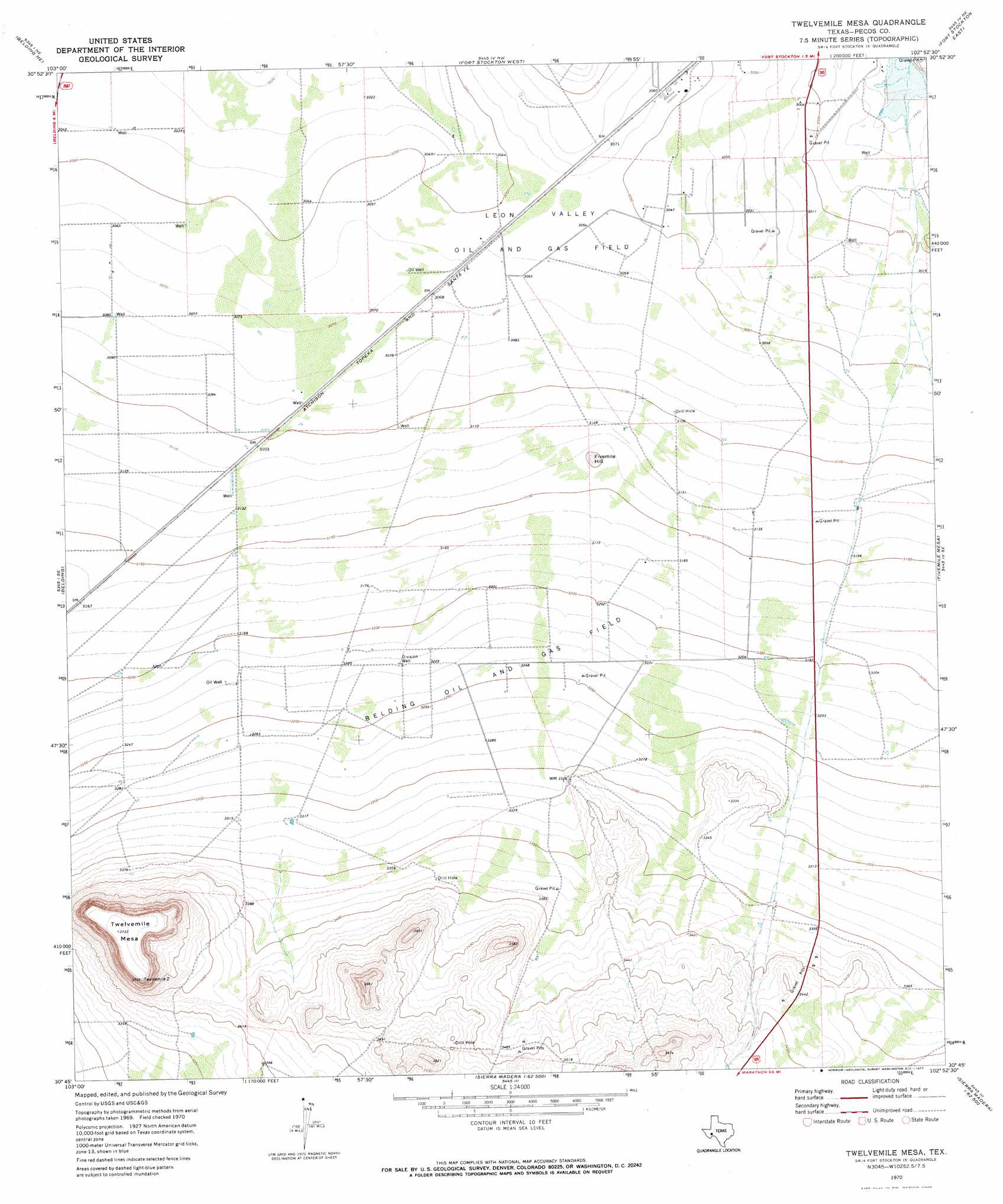
USGS Topo Quad 30102g8 - 1:24,000 scale
| Topo Map Name: | Twelvemile Mesa |
| USGS Topo Quad ID: | 30102g8 |
| Print Size: | ca. 21 1/4" wide x 27" high |
| Southeast Coordinates: | 30.75° N latitude / 102.875° W longitude |
| Map Center Coordinates: | 30.8125° N latitude / 102.9375° W longitude |
| U.S. State: | TX |
| Filename: | o30102g8.jpg |
| Download Map JPG Image: | Twelvemile Mesa topo map 1:24,000 scale |
| Map Type: | Topographic |
| Topo Series: | 7.5´ |
| Map Scale: | 1:24,000 |
| Source of Map Images: | United States Geological Survey (USGS) |
| Alternate Map Versions: |
Twelvemile Mesa TX 1970, updated 1973 Download PDF Buy paper map Twelvemile Mesa TX 2010 Download PDF Buy paper map Twelvemile Mesa TX 2012 Download PDF Buy paper map Twelvemile Mesa TX 2016 Download PDF Buy paper map |
1:24,000 Topo Quads surrounding Twelvemile Mesa
Coyanosa Sw |
Coyanosa Se |
Diamond Y Spring |
Diamond Y Spring Se |
Buena Vista Sw |
Belding Nw |
Belding Ne |
Fort Stockton West |
Fort Stockton East |
East Mesa |
Belding Sw |
Belding |
Twelvemile Mesa |
Fivemile Mesa |
East Mesa Sw |
Chancellor |
Cave Mesa Ne |
Sierra Madera Nw |
Sierra Madera Ne |
Rock House Draw Nw |
Cave Mesa |
Cave Mesa Se |
Sierra Madera |
Sierra Madera Se |
Panther Tank |
> Back to 30102e1 at 1:100,000 scale
> Back to 30102a1 at 1:250,000 scale
> Back to U.S. Topo Maps home
Twelvemile Mesa topo map: Gazetteer
Twelvemile Mesa: Dams
Comanche Creek Dam elevation 902m 2959′Twelvemile Mesa: Oilfields
Belding Oil and Gas Field elevation 990m 3248′Leon Valley Oil and Gas Field elevation 932m 3057′
Twelvemile Mesa: Populated Places
Alamo Ranchettes Colonia elevation 924m 3031′Twelvemile Mesa: Reservoirs
Comanche Creek Reservoir elevation 902m 2959′Twelvemile Mesa: Summits
Fivemile Hill elevation 972m 3188′Twelvemile Mesa elevation 1139m 3736′
Twelvemile Mesa: Wells
Division Well elevation 983m 3225′Twelvemile Mesa digital topo map on disk
Buy this Twelvemile Mesa topo map showing relief, roads, GPS coordinates and other geographical features, as a high-resolution digital map file on DVD: