Bird Mountain Topo Map Texas
To zoom in, hover over the map of Bird Mountain
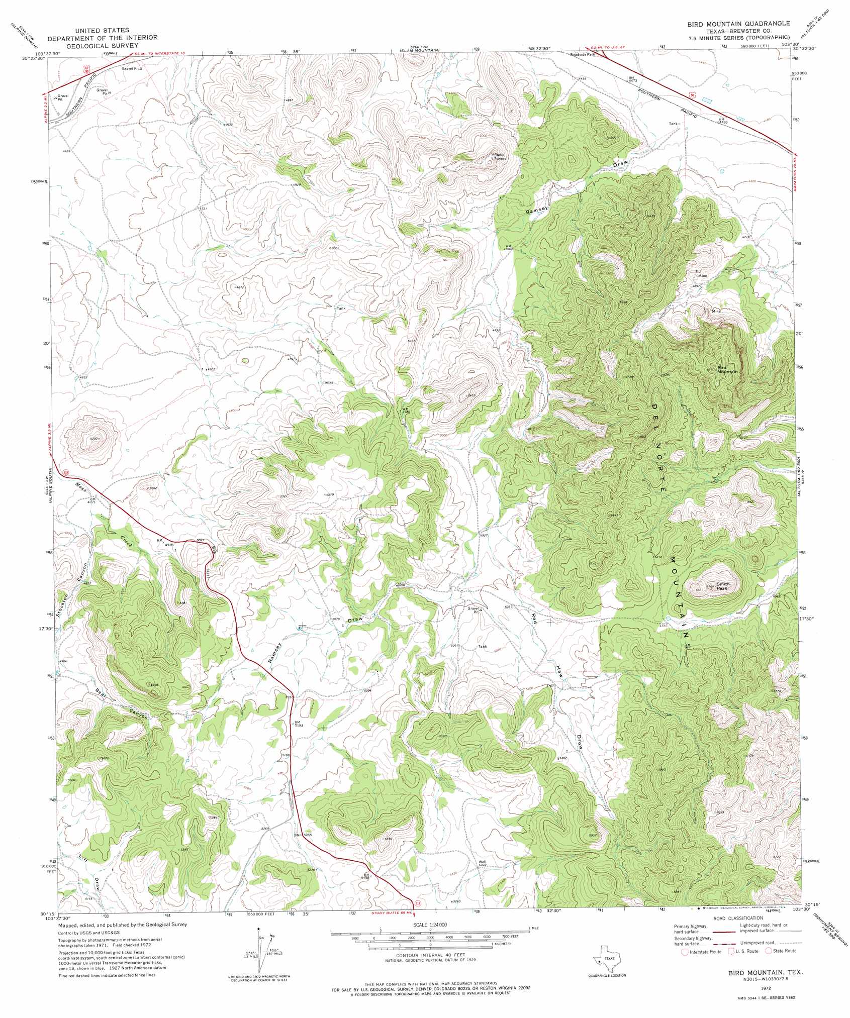
USGS Topo Quad 30103c5 - 1:24,000 scale
| Topo Map Name: | Bird Mountain |
| USGS Topo Quad ID: | 30103c5 |
| Print Size: | ca. 21 1/4" wide x 27" high |
| Southeast Coordinates: | 30.25° N latitude / 103.5° W longitude |
| Map Center Coordinates: | 30.3125° N latitude / 103.5625° W longitude |
| U.S. State: | TX |
| Filename: | o30103c5.jpg |
| Download Map JPG Image: | Bird Mountain topo map 1:24,000 scale |
| Map Type: | Topographic |
| Topo Series: | 7.5´ |
| Map Scale: | 1:24,000 |
| Source of Map Images: | United States Geological Survey (USGS) |
| Alternate Map Versions: |
Bird Mountain TX 1972, updated 1974 Download PDF Buy paper map Bird Mountain TX 2010 Download PDF Buy paper map Bird Mountain TX 2012 Download PDF Buy paper map Bird Mountain TX 2016 Download PDF Buy paper map |
1:24,000 Topo Quads surrounding Bird Mountain
Fort Davis Se |
Henderson Mesa |
Last Chance Mesa |
Hovey Sw |
Hovey |
Mitre Peak |
Alpine North |
Elam Mountain |
Bissett Mountain |
Old Blue Mountain |
Paisano |
Alpine South |
Bird Mountain |
Altuda |
Gilliland Peak |
Tinaja Ne |
Cathedral Mountain |
Mount Ord |
Dugout Mountain |
Beckwith Hills |
Cactus Flat |
Goat Mountain |
Elephant Mountain |
Rock House Gap |
Simpson Springs Mountain |
> Back to 30103a1 at 1:100,000 scale
> Back to 30102a1 at 1:250,000 scale
> Back to U.S. Topo Maps home
Bird Mountain topo map: Gazetteer
Bird Mountain: Mines
Bird Mine elevation 1492m 4895′Bird Mountain: Summits
Big Hill elevation 1575m 5167′Bird Mountain elevation 1849m 6066′
Smith Peak elevation 1745m 5725′
Bird Mountain: Valleys
Red Haw Draw elevation 1511m 4957′Stockton Canyon elevation 1462m 4796′
Bird Mountain digital topo map on disk
Buy this Bird Mountain topo map showing relief, roads, GPS coordinates and other geographical features, as a high-resolution digital map file on DVD: