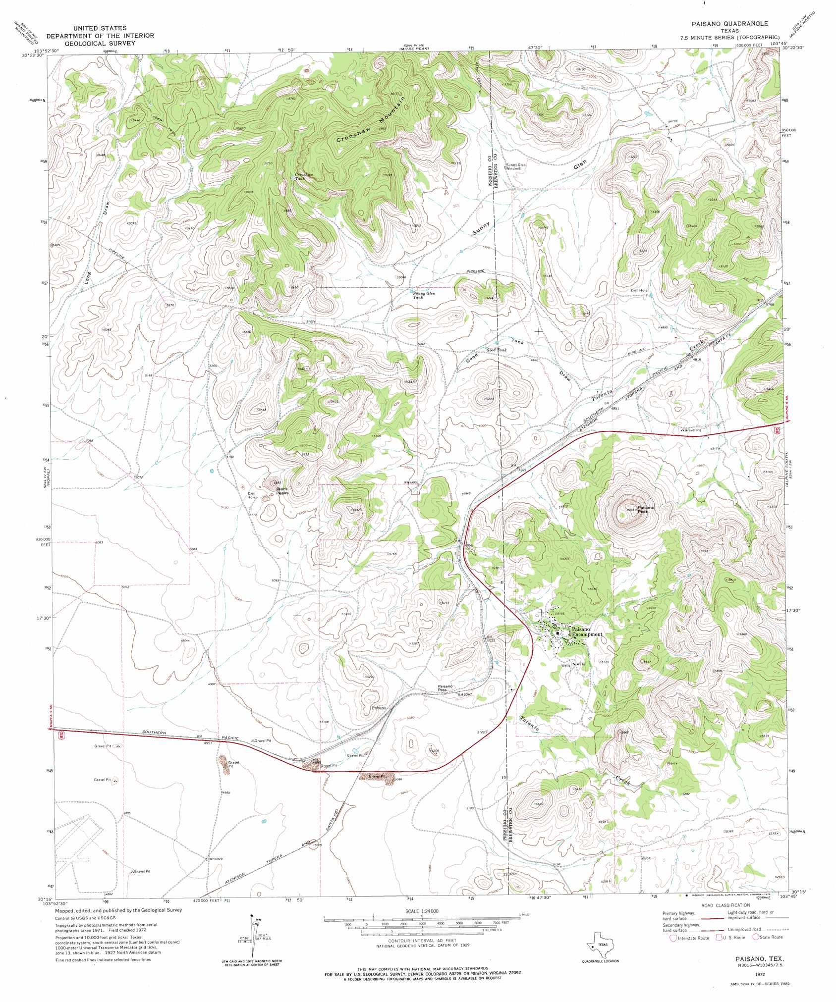
Paisano Topo Map Texas
To zoom in, hover over the map of Paisano
USGS Topo Quad 30103c7 - 1:24,000 scale
| Topo Map Name: | Paisano |
| USGS Topo Quad ID: | 30103c7 |
| Print Size: | ca. 21 1/4" wide x 27" high |
| Southeast Coordinates: | 30.25° N latitude / 103.75° W longitude |
| Map Center Coordinates: | 30.3125° N latitude / 103.8125° W longitude |
| U.S. State: | TX |
| Filename: | o30103c7.jpg |
| Download Map JPG Image: | Paisano topo map 1:24,000 scale |
| Map Type: | Topographic |
| Topo Series: | 7.5´ |
| Map Scale: | 1:24,000 |
| Source of Map Images: | United States Geological Survey (USGS) |
| Alternate Map Versions: |
Paisano TX 1972, updated 1975 Download PDF Buy paper map Paisano TX 2010 Download PDF Buy paper map Paisano TX 2012 Download PDF Buy paper map Paisano TX 2016 Download PDF Buy paper map |
1:24,000 Topo Quads surrounding Paisano
Blue Mountain |
Fort Davis |
Fort Davis Se |
Henderson Mesa |
Last Chance Mesa |
Smith Hills |
Mano Prieto Mountain |
Mitre Peak |
Alpine North |
Elam Mountain |
Marfa |
Nopal |
Paisano |
Alpine South |
Bird Mountain |
San Estaban Lake |
Tinaja |
Tinaja Ne |
Cathedral Mountain |
Mount Ord |
Frenchman Hills |
Devils Den |
Cactus Flat |
Goat Mountain |
Elephant Mountain |
> Back to 30103a1 at 1:100,000 scale
> Back to 30102a1 at 1:250,000 scale
> Back to U.S. Topo Maps home
Paisano topo map: Gazetteer
Paisano: Gaps
Paisano Pass elevation 1550m 5085′Paisano: Populated Places
Toronto elevation 1455m 4773′Paisano: Reservoirs
Crenshaw Tank elevation 1604m 5262′Good Tank elevation 1512m 4960′
Sunny Glen Tank elevation 1520m 4986′
Paisano: Summits
Black Peaks elevation 1650m 5413′Crenshaw Mountain elevation 1789m 5869′
Paisano Peak elevation 1824m 5984′
Paisano: Valleys
Good Tank Draw elevation 1482m 4862′Paisano digital topo map on disk
Buy this Paisano topo map showing relief, roads, GPS coordinates and other geographical features, as a high-resolution digital map file on DVD: