Alpine North Topo Map Texas
To zoom in, hover over the map of Alpine North
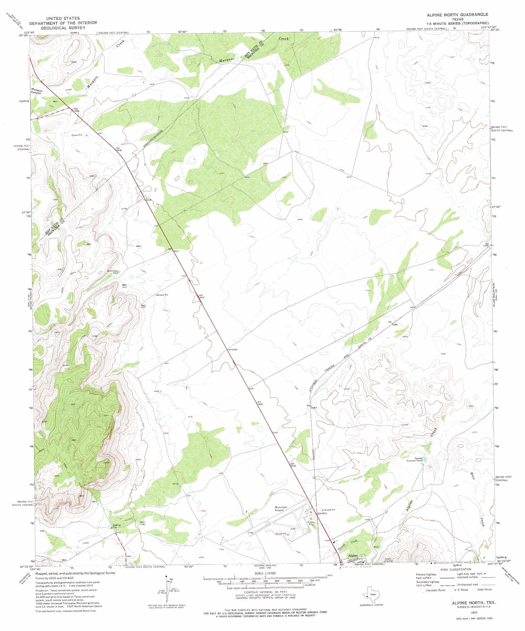
USGS Topo Quad 30103d6 - 1:24,000 scale
| Topo Map Name: | Alpine North |
| USGS Topo Quad ID: | 30103d6 |
| Print Size: | ca. 21 1/4" wide x 27" high |
| Southeast Coordinates: | 30.375° N latitude / 103.625° W longitude |
| Map Center Coordinates: | 30.4375° N latitude / 103.6875° W longitude |
| U.S. State: | TX |
| Filename: | o30103d6.jpg |
| Download Map JPG Image: | Alpine North topo map 1:24,000 scale |
| Map Type: | Topographic |
| Topo Series: | 7.5´ |
| Map Scale: | 1:24,000 |
| Source of Map Images: | United States Geological Survey (USGS) |
| Alternate Map Versions: |
Alpine North TX 1972, updated 1975 Download PDF Buy paper map Alpine North TX 2010 Download PDF Buy paper map Alpine North TX 2012 Download PDF Buy paper map Alpine North TX 2016 Download PDF Buy paper map |
1:24,000 Topo Quads surrounding Alpine North
Casket Mountain |
Swayback Mountain |
Major Peak |
Little Star Mountain |
Leoncita Ranch |
Fort Davis |
Fort Davis Se |
Henderson Mesa |
Last Chance Mesa |
Hovey Sw |
Mano Prieto Mountain |
Mitre Peak |
Alpine North |
Elam Mountain |
Bissett Mountain |
Nopal |
Paisano |
Alpine South |
Bird Mountain |
Altuda |
Tinaja |
Tinaja Ne |
Cathedral Mountain |
Mount Ord |
Dugout Mountain |
> Back to 30103a1 at 1:100,000 scale
> Back to 30102a1 at 1:250,000 scale
> Back to U.S. Topo Maps home
Alpine North topo map: Gazetteer
Alpine North: Airports
Alpine-Casparis Municipal Airport elevation 1363m 4471′Alpine North: Springs
Leoncita Springs elevation 1312m 4304′Alpine North: Streams
Moss Creek elevation 1309m 4294′Paisano Creek elevation 1345m 4412′
Alpine North digital topo map on disk
Buy this Alpine North topo map showing relief, roads, GPS coordinates and other geographical features, as a high-resolution digital map file on DVD: