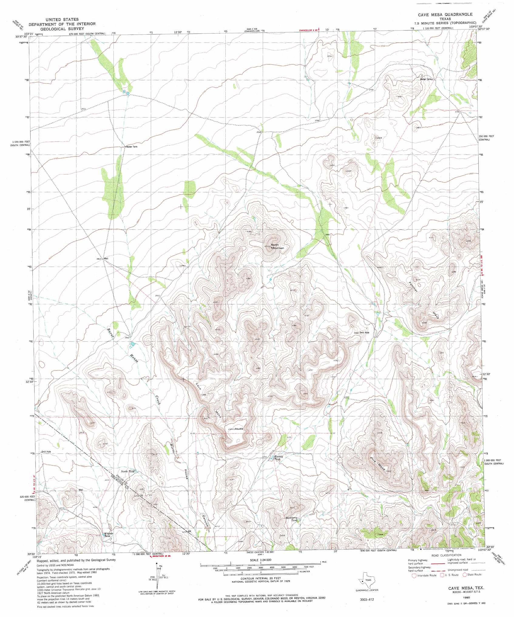
Cave Mesa Topo Map Texas
To zoom in, hover over the map of Cave Mesa
USGS Topo Quad 30103e2 - 1:24,000 scale
| Topo Map Name: | Cave Mesa |
| USGS Topo Quad ID: | 30103e2 |
| Print Size: | ca. 21 1/4" wide x 27" high |
| Southeast Coordinates: | 30.5° N latitude / 103.125° W longitude |
| Map Center Coordinates: | 30.5625° N latitude / 103.1875° W longitude |
| U.S. State: | TX |
| Filename: | o30103e2.jpg |
| Download Map JPG Image: | Cave Mesa topo map 1:24,000 scale |
| Map Type: | Topographic |
| Topo Series: | 7.5´ |
| Map Scale: | 1:24,000 |
| Source of Map Images: | United States Geological Survey (USGS) |
| Alternate Map Versions: |
Cave Mesa TX 1980, updated 1980 Download PDF Buy paper map Cave Mesa TX 2010 Download PDF Buy paper map Cave Mesa TX 2012 Download PDF Buy paper map Cave Mesa TX 2016 Download PDF Buy paper map |
1:24,000 Topo Quads surrounding Cave Mesa
Deep Well Ranch |
Deep Well Ranch Se |
Belding Sw |
Belding |
Twelvemile Mesa |
Leoncita Ranch |
Hovey Ne |
Chancellor |
Cave Mesa Ne |
Sierra Madera Nw |
Hovey Sw |
Hovey |
Cave Mesa |
Cave Mesa Se |
Sierra Madera |
Bissett Mountain |
Old Blue Mountain |
Hess Canyon |
Glass Mountain Ranch |
Marathon Gap |
Altuda |
Gilliland Peak |
Leonard Mountain |
Wolf Camp Hills |
Dimple Hills |
> Back to 30103e1 at 1:100,000 scale
> Back to 30102a1 at 1:250,000 scale
> Back to U.S. Topo Maps home
Cave Mesa topo map: Gazetteer
Cave Mesa: Reservoirs
Hackberry Tank elevation 1323m 4340′North Tank elevation 1251m 4104′
Rooney Tank elevation 1279m 4196′
Witcher Tank elevation 1252m 4107′
Cave Mesa: Summits
Cave Mesa elevation 1336m 4383′North Mountain elevation 1295m 4248′
Panther Mesa elevation 1280m 4199′
Pine Mesa elevation 1411m 4629′
Cave Mesa: Valleys
Burnt House Canyon elevation 1202m 3943′Cave Mesa digital topo map on disk
Buy this Cave Mesa topo map showing relief, roads, GPS coordinates and other geographical features, as a high-resolution digital map file on DVD: