Deep Well Ranch Se Topo Map Texas
To zoom in, hover over the map of Deep Well Ranch Se
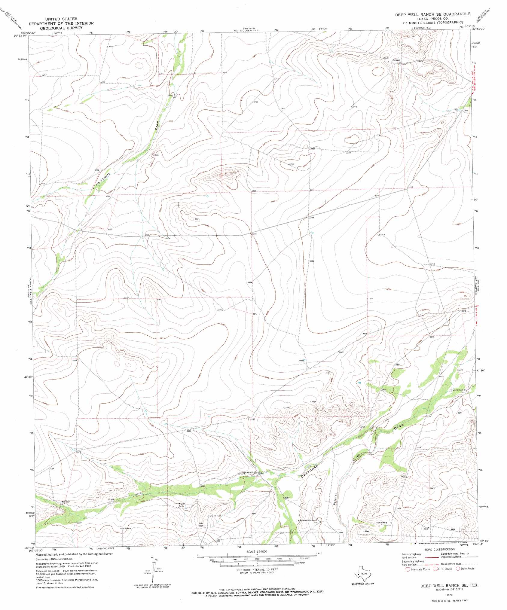
USGS Topo Quad 30103g3 - 1:24,000 scale
| Topo Map Name: | Deep Well Ranch Se |
| USGS Topo Quad ID: | 30103g3 |
| Print Size: | ca. 21 1/4" wide x 27" high |
| Southeast Coordinates: | 30.75° N latitude / 103.25° W longitude |
| Map Center Coordinates: | 30.8125° N latitude / 103.3125° W longitude |
| U.S. State: | TX |
| Filename: | o30103g3.jpg |
| Download Map JPG Image: | Deep Well Ranch Se topo map 1:24,000 scale |
| Map Type: | Topographic |
| Topo Series: | 7.5´ |
| Map Scale: | 1:24,000 |
| Source of Map Images: | United States Geological Survey (USGS) |
| Alternate Map Versions: |
Deep Well Ranch SE TX 1970, updated 1973 Download PDF Buy paper map Deep Well Ranch SE TX 2010 Download PDF Buy paper map Deep Well Ranch SE TX 2012 Download PDF Buy paper map Deep Well Ranch SE TX 2016 Download PDF Buy paper map |
1:24,000 Topo Quads surrounding Deep Well Ranch Se
Verhalen South |
Barstow 3 Sw |
Barstow 3 Se |
Coyanosa Sw |
Coyanosa Se |
Cox Draw |
Deep Well Ranch Nw |
Tucker Hill |
Belding Nw |
Belding Ne |
Barrilla Mountains East |
Deep Well Ranch |
Deep Well Ranch Se |
Belding Sw |
Belding |
Little Star Mountain |
Leoncita Ranch |
Hovey Ne |
Chancellor |
Cave Mesa Ne |
Last Chance Mesa |
Hovey Sw |
Hovey |
Cave Mesa |
Cave Mesa Se |
> Back to 30103e1 at 1:100,000 scale
> Back to 30102a1 at 1:250,000 scale
> Back to U.S. Topo Maps home
Deep Well Ranch Se topo map: Gazetteer
Deep Well Ranch Se: Streams
Paisano Creek elevation 988m 3241′Deep Well Ranch Se digital topo map on disk
Buy this Deep Well Ranch Se topo map showing relief, roads, GPS coordinates and other geographical features, as a high-resolution digital map file on DVD: