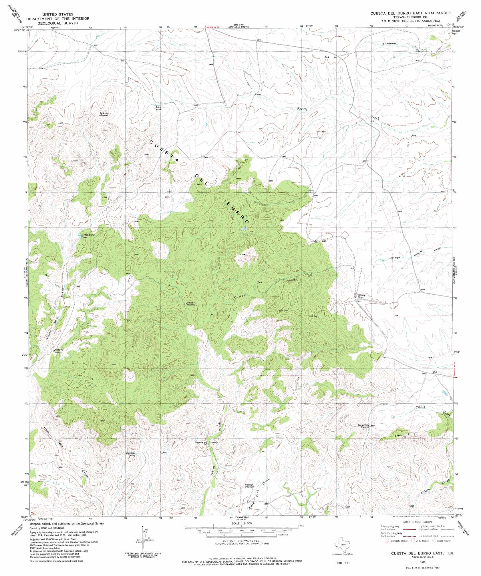
Cuesta Del Burro East Topo Map Texas
To zoom in, hover over the map of Cuesta Del Burro East
USGS Topo Quad 30104a3 - 1:24,000 scale
| Topo Map Name: | Cuesta Del Burro East |
| USGS Topo Quad ID: | 30104a3 |
| Print Size: | ca. 21 1/4" wide x 27" high |
| Southeast Coordinates: | 30° N latitude / 104.25° W longitude |
| Map Center Coordinates: | 30.0625° N latitude / 104.3125° W longitude |
| U.S. State: | TX |
| Filename: | o30104a3.jpg |
| Download Map JPG Image: | Cuesta Del Burro East topo map 1:24,000 scale |
| Map Type: | Topographic |
| Topo Series: | 7.5´ |
| Map Scale: | 1:24,000 |
| Source of Map Images: | United States Geological Survey (USGS) |
| Alternate Map Versions: |
Cuesta Del Burro East TX 1983, updated 1983 Download PDF Buy paper map Cuesta Del Burro East TX 2010 Download PDF Buy paper map Cuesta Del Burro East TX 2012 Download PDF Buy paper map Cuesta Del Burro East TX 2016 Download PDF Buy paper map |
1:24,000 Topo Quads surrounding Cuesta Del Burro East
Capote Peak |
Ryan Sw |
Oak Hills North |
Aragon |
Marfa |
Capote Falls |
Cuesta Del Burro Nw |
Oak Hills South |
Oak Creek |
San Estaban Lake |
Ruidosa Hot Springs |
Cuesta Del Burro West |
Cuesta Del Burro East |
San Estaban Lake Sw |
Frenchman Hills |
Sierra Parda |
Chinati Peak |
Cieneguita |
Cerros Priestos |
Plata Ne |
Adobes |
Cerro Orona |
Shafter |
Cienaga Mountains |
Plata |
> Back to 30104a1 at 1:100,000 scale
> Back to 30104a1 at 1:250,000 scale
> Back to U.S. Topo Maps home
No gazetteer data is available for the Cuesta Del Burro East topo map sheet.
Cuesta Del Burro East digital topo map on disk
Buy this Cuesta Del Burro East topo map showing relief, roads, GPS coordinates and other geographical features, as a high-resolution digital map file on DVD: