Candelaria Topo Map Texas
To zoom in, hover over the map of Candelaria
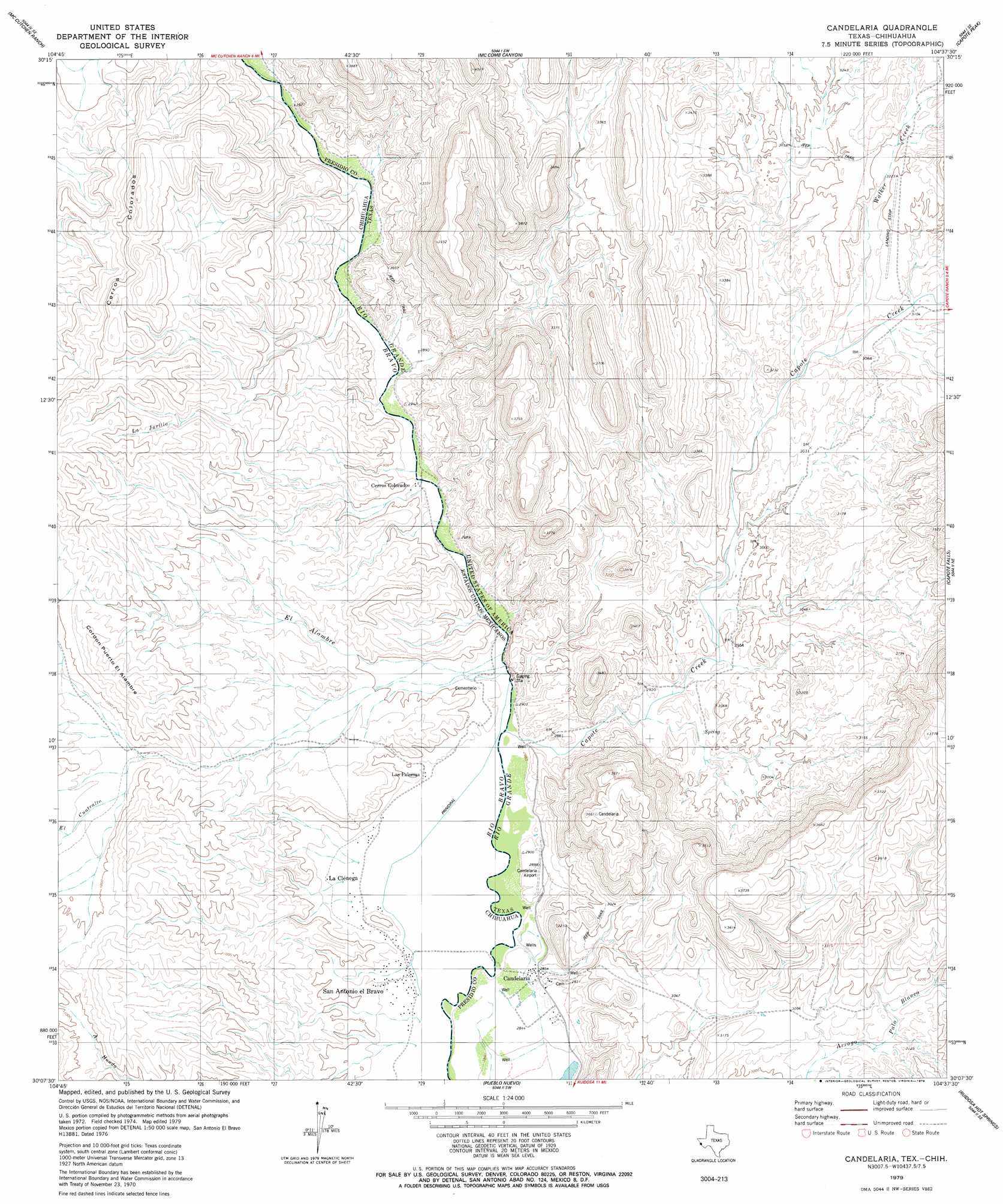
USGS Topo Quad 30104b6 - 1:24,000 scale
| Topo Map Name: | Candelaria |
| USGS Topo Quad ID: | 30104b6 |
| Print Size: | ca. 21 1/4" wide x 27" high |
| Southeast Coordinates: | 30.125° N latitude / 104.625° W longitude |
| Map Center Coordinates: | 30.1875° N latitude / 104.6875° W longitude |
| U.S. State: | TX |
| Filename: | o30104b6.jpg |
| Download Map JPG Image: | Candelaria topo map 1:24,000 scale |
| Map Type: | Topographic |
| Topo Series: | 7.5´ |
| Map Scale: | 1:24,000 |
| Source of Map Images: | United States Geological Survey (USGS) |
| Alternate Map Versions: |
Candelaria TX 1979, updated 1979 Download PDF Buy paper map Candelaria TX 2010 Download PDF Buy paper map Candelaria TX 2012 Download PDF Buy paper map Candelaria TX 2016 Download PDF Buy paper map |
1:24,000 Topo Quads surrounding Candelaria
Gettysburg Peak |
Nancy Anne Ranch |
Deer Peak |
||
Mccutchen Ranch |
Mccomb Canyon |
Capote Peak |
Ryan Sw |
|
Candelaria |
Capote Falls |
Cuesta Del Burro Nw |
||
Pueblo Nuevo |
Ruidosa Hot Springs |
Cuesta Del Burro West |
||
Las Conchas |
Sierra Parda |
Chinati Peak |
> Back to 30104a1 at 1:100,000 scale
> Back to 30104a1 at 1:250,000 scale
> Back to U.S. Topo Maps home
Candelaria topo map: Gazetteer
Candelaria: Populated Places
Cadelaria elevation 872m 2860′Candelaria elevation 871m 2857′
Candelaria: Streams
Capote Creek elevation 873m 2864′Walker Creek elevation 934m 3064′
Candelaria digital topo map on disk
Buy this Candelaria topo map showing relief, roads, GPS coordinates and other geographical features, as a high-resolution digital map file on DVD: