Marfa Topo Map Texas
To zoom in, hover over the map of Marfa
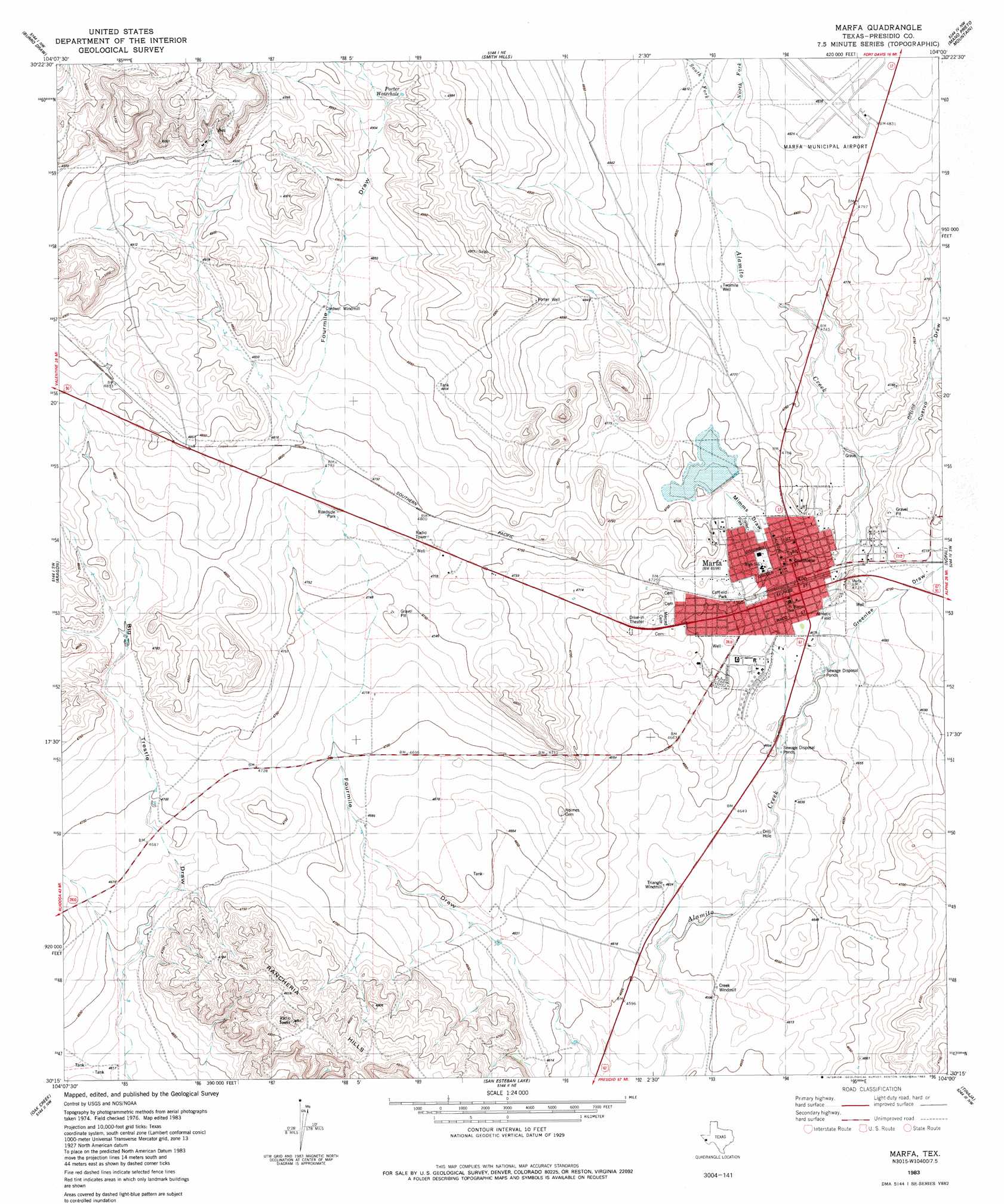
USGS Topo Quad 30104c1 - 1:24,000 scale
| Topo Map Name: | Marfa |
| USGS Topo Quad ID: | 30104c1 |
| Print Size: | ca. 21 1/4" wide x 27" high |
| Southeast Coordinates: | 30.25° N latitude / 104° W longitude |
| Map Center Coordinates: | 30.3125° N latitude / 104.0625° W longitude |
| U.S. State: | TX |
| Filename: | o30104c1.jpg |
| Download Map JPG Image: | Marfa topo map 1:24,000 scale |
| Map Type: | Topographic |
| Topo Series: | 7.5´ |
| Map Scale: | 1:24,000 |
| Source of Map Images: | United States Geological Survey (USGS) |
| Alternate Map Versions: |
Marfa TX 1983, updated 1983 Download PDF Buy paper map Marfa TX 2010 Download PDF Buy paper map Marfa TX 2012 Download PDF Buy paper map Marfa TX 2016 Download PDF Buy paper map |
1:24,000 Topo Quads surrounding Marfa
San Antonio Pass |
Paradise Mountain |
Blue Mountain |
Fort Davis |
Fort Davis Se |
Ryan |
Burro Draw |
Smith Hills |
Mano Prieto Mountain |
Mitre Peak |
Oak Hills North |
Aragon |
Marfa |
Nopal |
Paisano |
Oak Hills South |
Oak Creek |
San Estaban Lake |
Tinaja |
Tinaja Ne |
Cuesta Del Burro East |
San Estaban Lake Sw |
Frenchman Hills |
Devils Den |
Cactus Flat |
> Back to 30104a1 at 1:100,000 scale
> Back to 30104a1 at 1:250,000 scale
> Back to U.S. Topo Maps home
Marfa topo map: Gazetteer
Marfa: Airports
Marfa Municipal Airport elevation 1475m 4839′Marfa: Dams
Soil Conservation Service Site 1 Dam elevation 1424m 4671′Marfa: Parks
Coffield Park elevation 1438m 4717′Marfa: Populated Places
Marfa elevation 1428m 4685′Marfa: Reservoirs
Soil Conservation Service Site 1 Reservoir elevation 1424m 4671′Marfa: Streams
North Fork Alamito Creek elevation 1466m 4809′South Fork Alamito Creek elevation 1466m 4809′
Marfa: Valleys
Cuervo Draw elevation 1438m 4717′Greenlee Draw elevation 1427m 4681′
Marfa digital topo map on disk
Buy this Marfa topo map showing relief, roads, GPS coordinates and other geographical features, as a high-resolution digital map file on DVD: