Valentine West Topo Map Texas
To zoom in, hover over the map of Valentine West
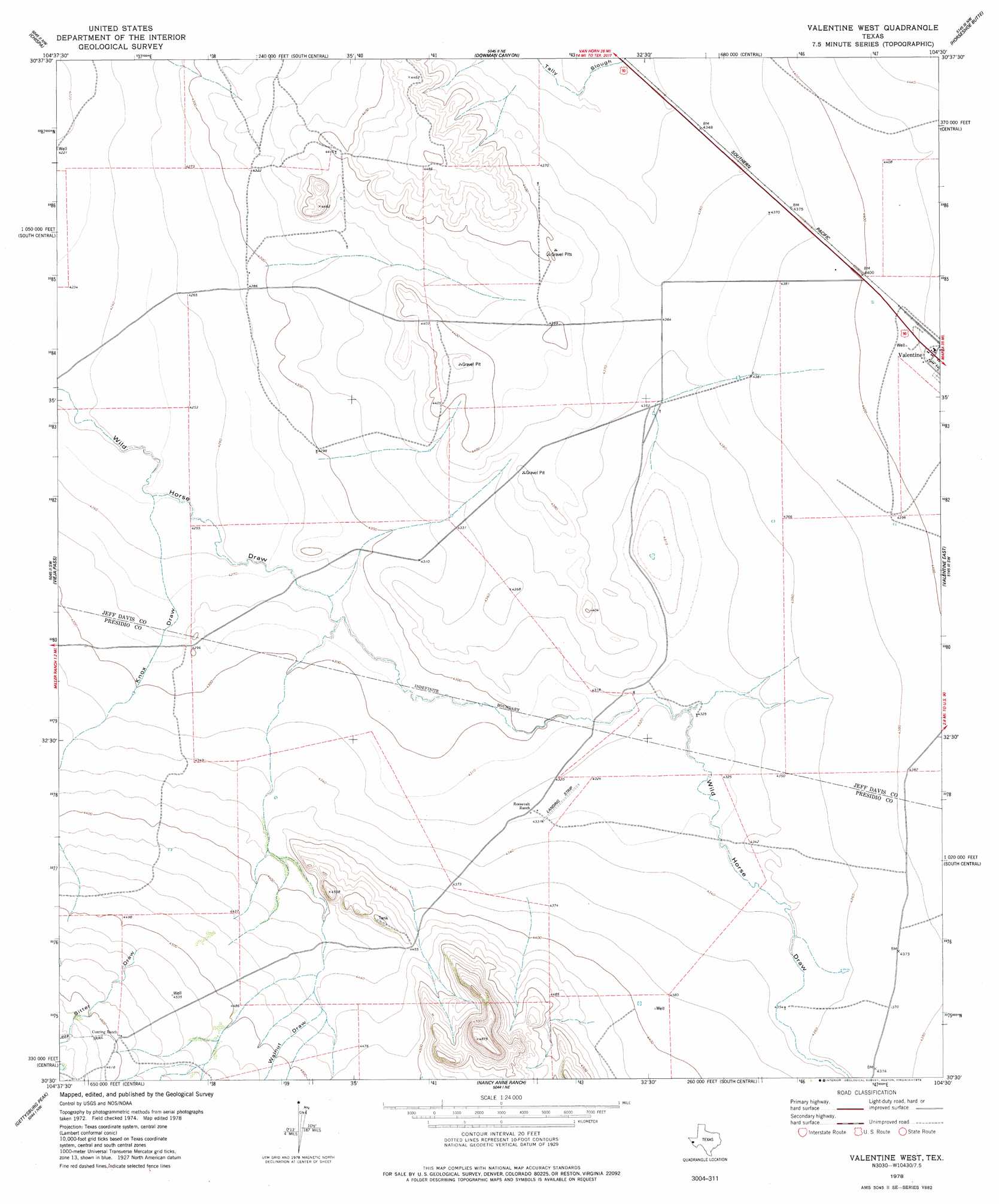
USGS Topo Quad 30104e5 - 1:24,000 scale
| Topo Map Name: | Valentine West |
| USGS Topo Quad ID: | 30104e5 |
| Print Size: | ca. 21 1/4" wide x 27" high |
| Southeast Coordinates: | 30.5° N latitude / 104.5° W longitude |
| Map Center Coordinates: | 30.5625° N latitude / 104.5625° W longitude |
| U.S. State: | TX |
| Filename: | o30104e5.jpg |
| Download Map JPG Image: | Valentine West topo map 1:24,000 scale |
| Map Type: | Topographic |
| Topo Series: | 7.5´ |
| Map Scale: | 1:24,000 |
| Source of Map Images: | United States Geological Survey (USGS) |
| Alternate Map Versions: |
Valentine West TX 1978, updated 1978 Download PDF Buy paper map Valentine West TX 2010 Download PDF Buy paper map Valentine West TX 2012 Download PDF Buy paper map Valentine West TX 2016 Download PDF Buy paper map |
1:24,000 Topo Quads surrounding Valentine West
Lobo |
Chispa Mountain |
Mayfield Hills |
Boggy Draw |
Bare Mountain |
Ninetysix Ranch |
Chispa |
Dowman Canyon |
Horseshoe Butte |
El Muerto Peak |
Soldier Spring |
Vieja Pass |
Valentine West |
Valentine East |
San Antonio Pass |
Gettysburg Peak |
Nancy Anne Ranch |
Deer Peak |
Ryan |
|
Mccutchen Ranch |
Mccomb Canyon |
Capote Peak |
Ryan Sw |
Oak Hills North |
> Back to 30104e1 at 1:100,000 scale
> Back to 30104a1 at 1:250,000 scale
> Back to U.S. Topo Maps home
Valentine West topo map: Gazetteer
Valentine West: Valleys
Knox Draw elevation 1296m 4251′Sitter Canyon elevation 1378m 4520′
Walnut Draw elevation 1354m 4442′
Valentine West digital topo map on disk
Buy this Valentine West topo map showing relief, roads, GPS coordinates and other geographical features, as a high-resolution digital map file on DVD: