Chispa Topo Map Texas
To zoom in, hover over the map of Chispa
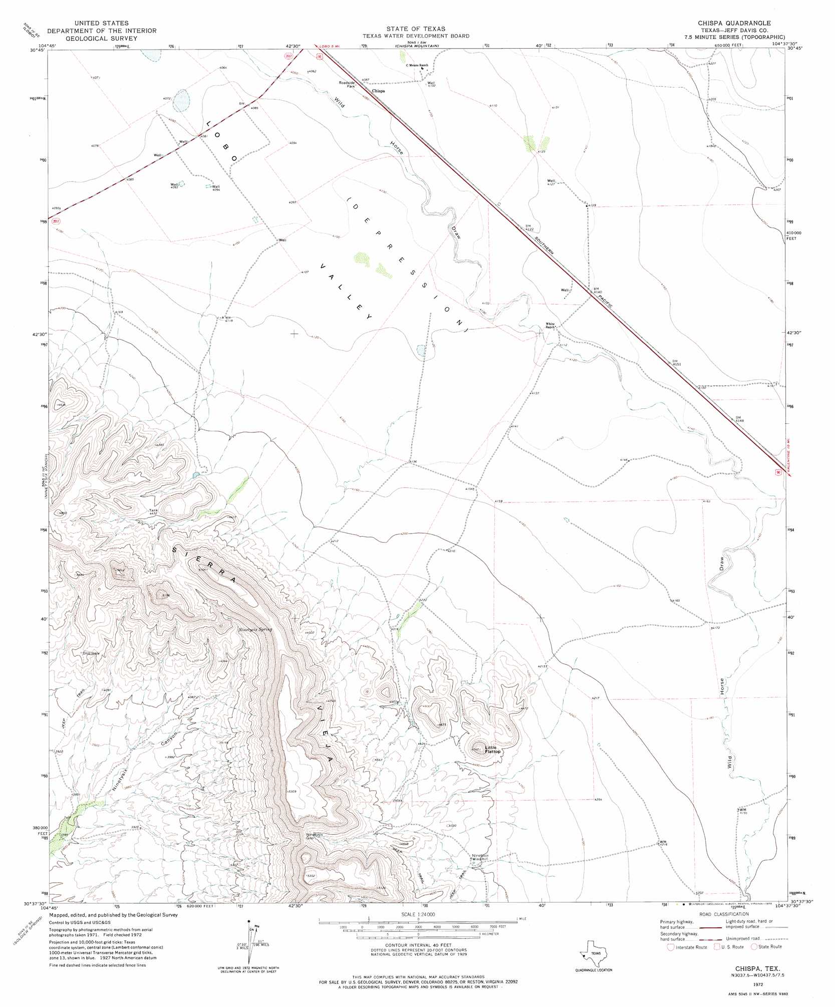
USGS Topo Quad 30104f6 - 1:24,000 scale
| Topo Map Name: | Chispa |
| USGS Topo Quad ID: | 30104f6 |
| Print Size: | ca. 21 1/4" wide x 27" high |
| Southeast Coordinates: | 30.625° N latitude / 104.625° W longitude |
| Map Center Coordinates: | 30.6875° N latitude / 104.6875° W longitude |
| U.S. State: | TX |
| Filename: | o30104f6.jpg |
| Download Map JPG Image: | Chispa topo map 1:24,000 scale |
| Map Type: | Topographic |
| Topo Series: | 7.5´ |
| Map Scale: | 1:24,000 |
| Source of Map Images: | United States Geological Survey (USGS) |
| Alternate Map Versions: |
Chispa TX 1972, updated 1975 Download PDF Buy paper map Chispa TX 2010 Download PDF Buy paper map Chispa TX 2012 Download PDF Buy paper map Chispa TX 2016 Download PDF Buy paper map |
1:24,000 Topo Quads surrounding Chispa
Bass Canyon |
Van Horn Wells |
Chispa Mountain Nw |
Chispa Mountain Ne |
Boracho Peak |
Lobo Sw |
Lobo |
Chispa Mountain |
Mayfield Hills |
Boggy Draw |
Mesquite Spring |
Ninetysix Ranch |
Chispa |
Dowman Canyon |
Horseshoe Butte |
Bennett Ranch |
Soldier Spring |
Vieja Pass |
Valentine West |
Valentine East |
Gettysburg Peak |
Nancy Anne Ranch |
Deer Peak |
> Back to 30104e1 at 1:100,000 scale
> Back to 30104a1 at 1:250,000 scale
> Back to U.S. Topo Maps home
Chispa topo map: Gazetteer
Chispa: Gaps
Ninetysix Gap elevation 1491m 4891′Chispa: Populated Places
Chispa elevation 1245m 4084′Chispa: Springs
Ninetysix Spring elevation 1300m 4265′Chispa: Streams
Tally Slough elevation 1268m 4160′Chispa: Summits
Little Flattop elevation 1442m 4730′Chispa digital topo map on disk
Buy this Chispa topo map showing relief, roads, GPS coordinates and other geographical features, as a high-resolution digital map file on DVD: