Van Horn Wells Topo Map Texas
To zoom in, hover over the map of Van Horn Wells
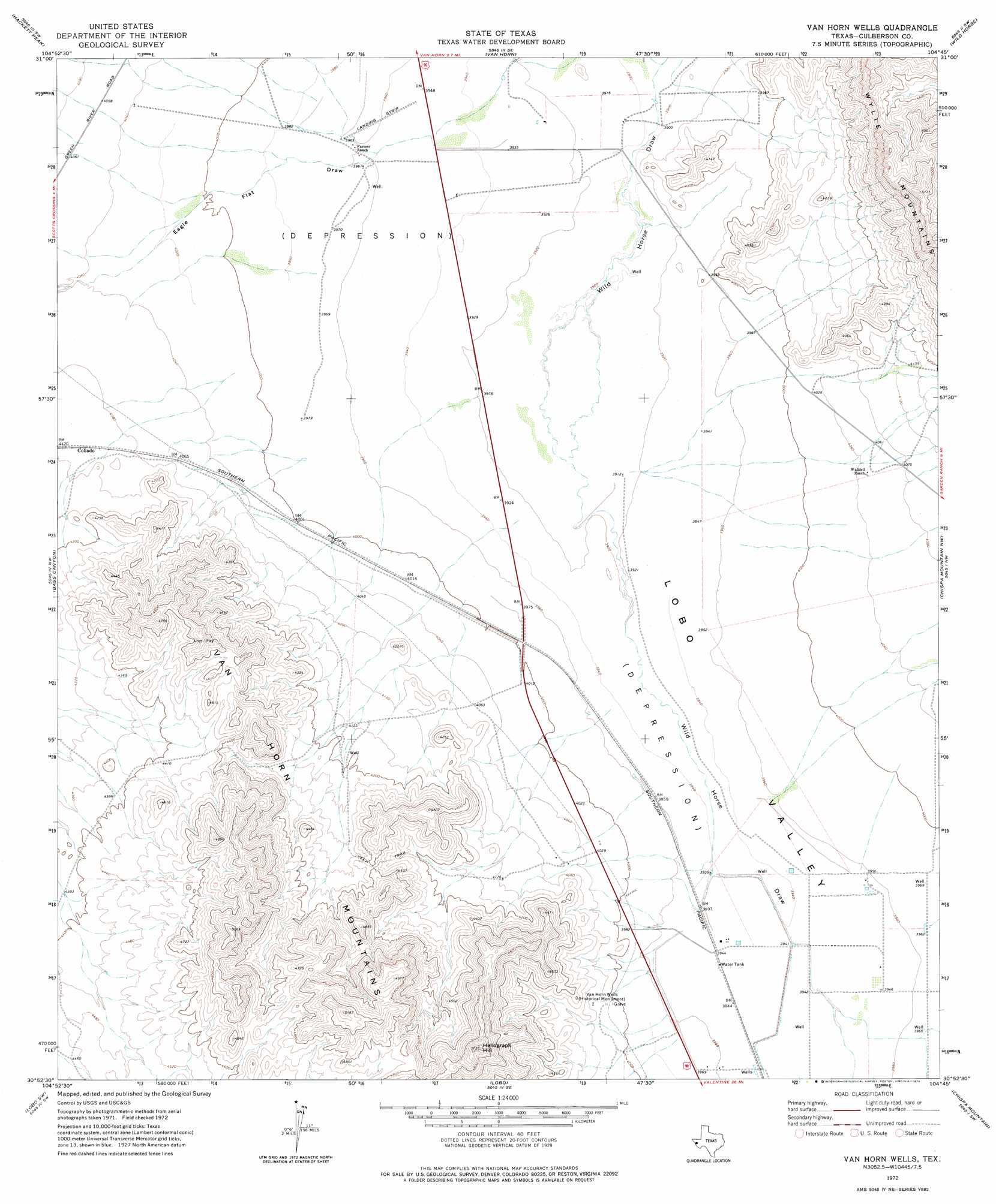
USGS Topo Quad 30104h7 - 1:24,000 scale
| Topo Map Name: | Van Horn Wells |
| USGS Topo Quad ID: | 30104h7 |
| Print Size: | ca. 21 1/4" wide x 27" high |
| Southeast Coordinates: | 30.875° N latitude / 104.75° W longitude |
| Map Center Coordinates: | 30.9375° N latitude / 104.8125° W longitude |
| U.S. State: | TX |
| Filename: | o30104h7.jpg |
| Download Map JPG Image: | Van Horn Wells topo map 1:24,000 scale |
| Map Type: | Topographic |
| Topo Series: | 7.5´ |
| Map Scale: | 1:24,000 |
| Source of Map Images: | United States Geological Survey (USGS) |
| Alternate Map Versions: |
Van Horn Wells TX 1972, updated 1974 Download PDF Buy paper map Van Horn Wells TX 2010 Download PDF Buy paper map Van Horn Wells TX 2012 Download PDF Buy paper map Van Horn Wells TX 2016 Download PDF Buy paper map |
1:24,000 Topo Quads surrounding Van Horn Wells
Bean Hills |
Sheep Peak |
Nutt Ranch |
Watson Ranch |
Goat Canyon |
Allamoore |
Hackett Peak |
Van Horn |
Wild Horse |
Plateau |
Eagle Mountains Ne |
Bass Canyon |
Van Horn Wells |
Chispa Mountain Nw |
Chispa Mountain Ne |
Eagle Mountains Se |
Lobo Sw |
Lobo |
Chispa Mountain |
Mayfield Hills |
Bramlett Ranch |
Mesquite Spring |
Ninetysix Ranch |
Chispa |
Dowman Canyon |
> Back to 30104e1 at 1:100,000 scale
> Back to 30104a1 at 1:250,000 scale
> Back to U.S. Topo Maps home
Van Horn Wells topo map: Gazetteer
Van Horn Wells: Summits
Heliograph Hill elevation 1530m 5019′Van Horn Wells: Valleys
Eagle Flat Draw elevation 1201m 3940′Lobo Valley elevation 1195m 3920′
Van Horn Wells: Wells
Van Horn Wells elevation 1225m 4019′Van Horn Wells digital topo map on disk
Buy this Van Horn Wells topo map showing relief, roads, GPS coordinates and other geographical features, as a high-resolution digital map file on DVD: