Eagle Mountains Se Topo Map Texas
To zoom in, hover over the map of Eagle Mountains Se
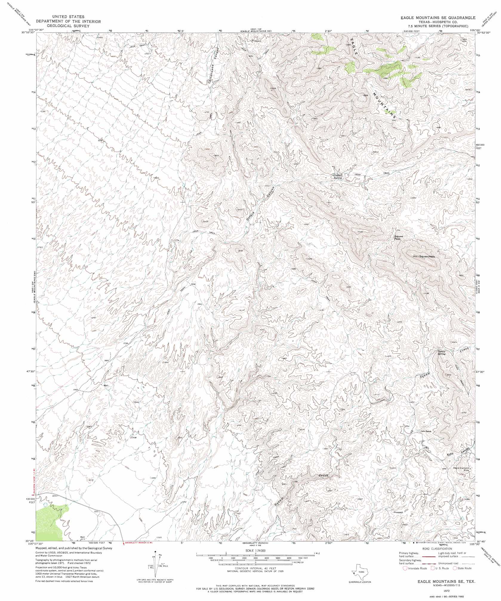
USGS Topo Quad 30105g1 - 1:24,000 scale
| Topo Map Name: | Eagle Mountains Se |
| USGS Topo Quad ID: | 30105g1 |
| Print Size: | ca. 21 1/4" wide x 27" high |
| Southeast Coordinates: | 30.75° N latitude / 105° W longitude |
| Map Center Coordinates: | 30.8125° N latitude / 105.0625° W longitude |
| U.S. State: | TX |
| Filename: | o30105g1.jpg |
| Download Map JPG Image: | Eagle Mountains Se topo map 1:24,000 scale |
| Map Type: | Topographic |
| Topo Series: | 7.5´ |
| Map Scale: | 1:24,000 |
| Source of Map Images: | United States Geological Survey (USGS) |
| Alternate Map Versions: |
Eagle Mountains SE TX 1972, updated 1975 Download PDF Buy paper map Eagle Mountains SE TX 2010 Download PDF Buy paper map Eagle Mountains SE TX 2012 Download PDF Buy paper map Eagle Mountains SE TX 2016 Download PDF Buy paper map |
1:24,000 Topo Quads surrounding Eagle Mountains Se
Devil Ridge |
Grayton Lake |
Allamoore |
Hackett Peak |
Van Horn |
Cedar Arroyo |
Eagle Mountains Nw |
Eagle Mountains Ne |
Bass Canyon |
Van Horn Wells |
Indian Hot Springs |
Eagle Mountains Sw |
Eagle Mountains Se |
Lobo Sw |
Lobo |
Bramlett Ranch |
Mesquite Spring |
Ninetysix Ranch |
||
Bennett Ranch |
Soldier Spring |
> Back to 30105e1 at 1:100,000 scale
> Back to 30104a1 at 1:250,000 scale
> Back to U.S. Topo Maps home
Eagle Mountains Se topo map: Gazetteer
Eagle Mountains Se: Gaps
Squaw Pass elevation 1393m 4570′Eagle Mountains Se: Mines
Black Diamond Mine elevation 1290m 4232′Eagle Mountains Se: Springs
Oxford Spring elevation 1341m 4399′Squaw Spring elevation 1274m 4179′
Eagle Mountains Se: Summits
Squaw Peak elevation 1649m 5410′Eagle Mountains Se: Valleys
Cottonwood Canyon elevation 1166m 3825′Echo Canyon elevation 1234m 4048′
Oxford Canyon elevation 1120m 3674′
Eagle Mountains Se digital topo map on disk
Buy this Eagle Mountains Se topo map showing relief, roads, GPS coordinates and other geographical features, as a high-resolution digital map file on DVD: