Tarboro Topo Map Georgia
To zoom in, hover over the map of Tarboro
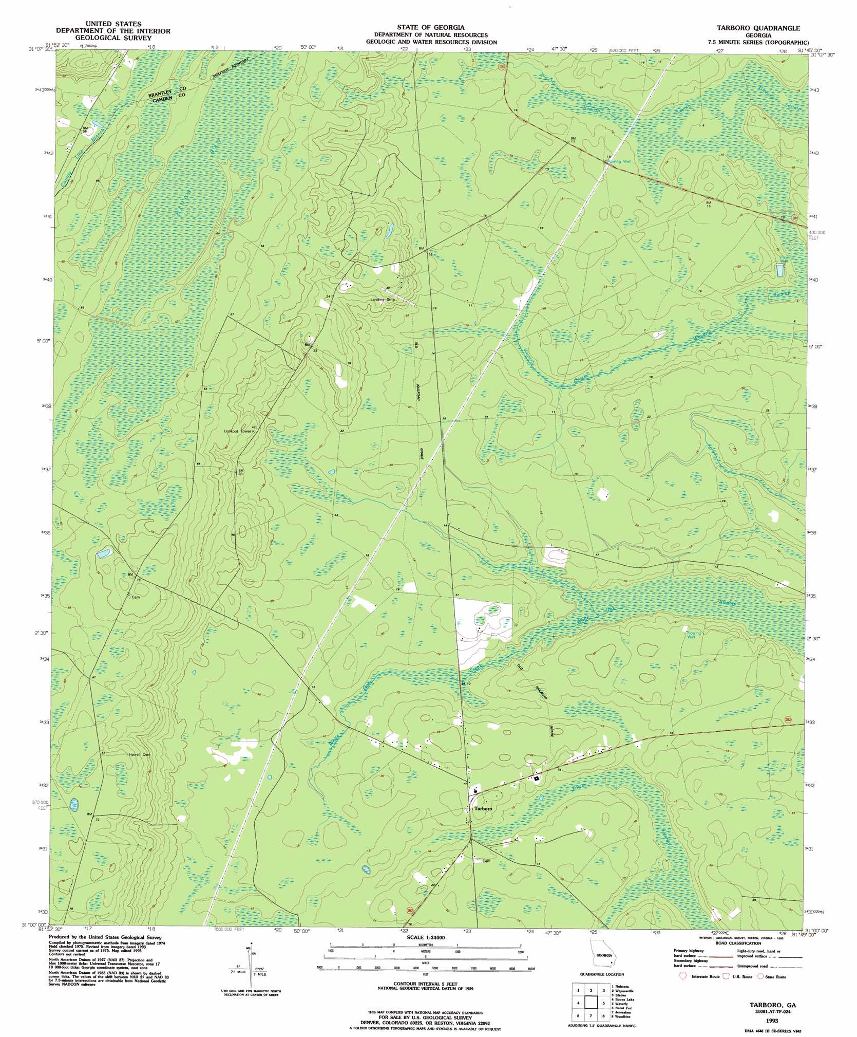
USGS Topo Quad 31081a7 - 1:24,000 scale
| Topo Map Name: | Tarboro |
| USGS Topo Quad ID: | 31081a7 |
| Print Size: | ca. 21 1/4" wide x 27" high |
| Southeast Coordinates: | 31° N latitude / 81.75° W longitude |
| Map Center Coordinates: | 31.0625° N latitude / 81.8125° W longitude |
| U.S. State: | GA |
| Filename: | o31081a7.jpg |
| Download Map JPG Image: | Tarboro topo map 1:24,000 scale |
| Map Type: | Topographic |
| Topo Series: | 7.5´ |
| Map Scale: | 1:24,000 |
| Source of Map Images: | United States Geological Survey (USGS) |
| Alternate Map Versions: |
Tarboro GA 1975, updated 1987 Download PDF Buy paper map Tarboro GA 1978, updated 1978 Download PDF Buy paper map Tarboro GA 1993, updated 1995 Download PDF Buy paper map Tarboro GA 2011 Download PDF Buy paper map Tarboro GA 2014 Download PDF Buy paper map |
1:24,000 Topo Quads surrounding Tarboro
Patterson Se |
Hortense |
Browntown |
Thalmann |
Sterling |
Hoboken East |
Nahunta |
Waynesville |
Bladen |
Brunswick West |
Winokur |
Boons Lake |
Tarboro |
Waverly |
Dover Bluff |
Newell |
Burnt Fort |
Jerusalem |
Woodbine |
Kingsland Ne |
Folkston |
Boulogne |
Kings Ferry |
Kingsland |
Harrietts Bluff |
> Back to 31081a1 at 1:100,000 scale
> Back to 31080a1 at 1:250,000 scale
> Back to U.S. Topo Maps home
Tarboro topo map: Gazetteer
Tarboro: Populated Places
Goldsborough (historical) elevation 20m 65′Tarboro elevation 5m 16′
Tarboro: Swamps
Kings Bay elevation 18m 59′Redcap Swamp elevation 2m 6′
Waverly Swamp elevation 2m 6′
White Oak Swamp elevation 0m 0′
Tarboro digital topo map on disk
Buy this Tarboro topo map showing relief, roads, GPS coordinates and other geographical features, as a high-resolution digital map file on DVD: