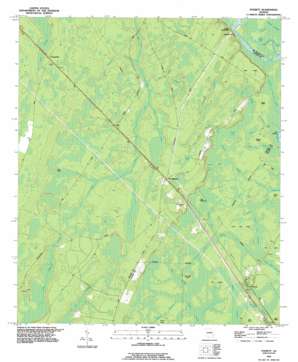
Everett Topo Map Georgia
To zoom in, hover over the map of Everett
USGS Topo Quad 31081d6 - 1:24,000 scale
| Topo Map Name: | Everett |
| USGS Topo Quad ID: | 31081d6 |
| Print Size: | ca. 21 1/4" wide x 27" high |
| Southeast Coordinates: | 31.375° N latitude / 81.625° W longitude |
| Map Center Coordinates: | 31.4375° N latitude / 81.6875° W longitude |
| U.S. State: | GA |
| Filename: | o31081d6.jpg |
| Download Map JPG Image: | Everett topo map 1:24,000 scale |
| Map Type: | Topographic |
| Topo Series: | 7.5´ |
| Map Scale: | 1:24,000 |
| Source of Map Images: | United States Geological Survey (USGS) |
| Alternate Map Versions: |
Everett GA 1978, updated 1978 Download PDF Buy paper map Everett GA 1993, updated 1995 Download PDF Buy paper map Everett GA 2011 Download PDF Buy paper map Everett GA 2014 Download PDF Buy paper map |
1:24,000 Topo Quads surrounding Everett
> Back to 31081a1 at 1:100,000 scale
> Back to 31080a1 at 1:250,000 scale
> Back to U.S. Topo Maps home
Everett topo map: Gazetteer
Everett: Cliffs
Sansavilla Bluff elevation 2m 6′Everett: Flats
Lyles Old Field elevation 4m 13′Everett: Islands
Aleck Island elevation 13m 42′Bear Island elevation 5m 16′
Briar Island elevation 4m 13′
Buck Island elevation 15m 49′
Red Oak Island elevation 4m 13′
Sallons Island elevation 4m 13′
Smith Island elevation 5m 16′
Tob Hammock elevation 4m 13′
Everett: Lakes
Barker Lake elevation 3m 9′Buck Pond (historical) elevation 4m 13′
Campbell Lake elevation 3m 9′
Creels Lake elevation 3m 9′
Smith Lake elevation 3m 9′
Everett: Populated Places
Akin elevation 15m 49′Everett elevation 4m 13′
Lower Sansavilla elevation 15m 49′
Mount Pleasant elevation 17m 55′
Everett: Ridges
Blue Ridge elevation 4m 13′Everett: Streams
Aleck Island Branch elevation 7m 22′Bridge Branch elevation 4m 13′
Bull Branch elevation 9m 29′
Buzzards Roost Branch elevation 3m 9′
Mason Cowpen Branch elevation 8m 26′
Pigeonroost Creek elevation 10m 32′
Rozier Branch elevation 6m 19′
Smith Branch elevation 2m 6′
Everett: Swamps
Bear Island Swamp elevation 3m 9′Canal Branch elevation 4m 13′
County Line Swamp elevation 4m 13′
Deep Branch elevation 4m 13′
Johns Bay elevation 4m 13′
Layway Swamp elevation 3m 9′
Martin Strand elevation 3m 9′
Mays Bay elevation 4m 13′
Pigeon Branch elevation 3m 9′
Piney Bay elevation 16m 52′
Saltons Branch elevation 3m 9′
Sandhill Bay elevation 4m 13′
Everett digital topo map on disk
Buy this Everett topo map showing relief, roads, GPS coordinates and other geographical features, as a high-resolution digital map file on DVD:


