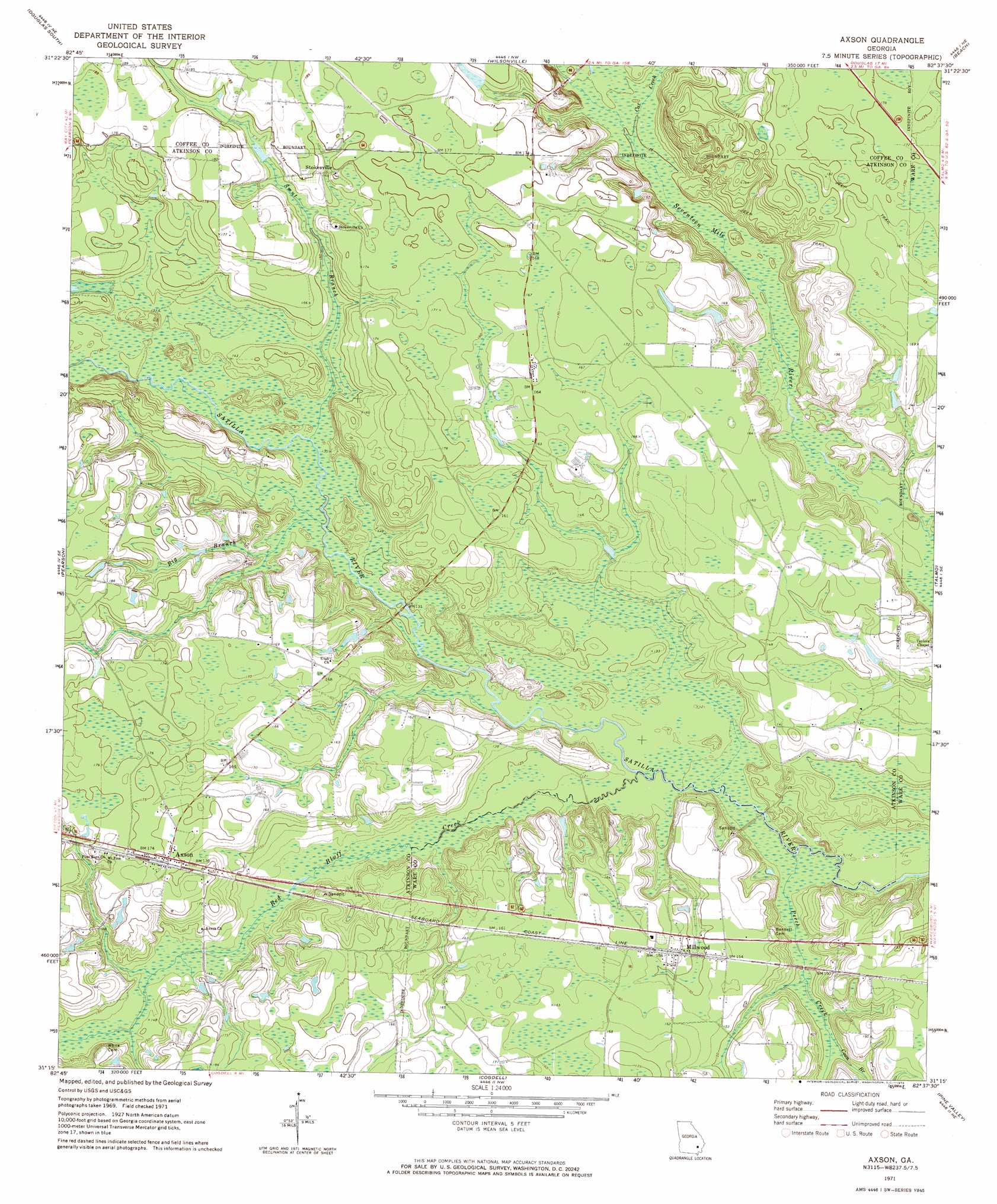
Axson Topo Map Georgia
To zoom in, hover over the map of Axson
USGS Topo Quad 31082c6 - 1:24,000 scale
| Topo Map Name: | Axson |
| USGS Topo Quad ID: | 31082c6 |
| Print Size: | ca. 21 1/4" wide x 27" high |
| Southeast Coordinates: | 31.25° N latitude / 82.625° W longitude |
| Map Center Coordinates: | 31.3125° N latitude / 82.6875° W longitude |
| U.S. State: | GA |
| Filename: | o31082c6.jpg |
| Download Map JPG Image: | Axson topo map 1:24,000 scale |
| Map Type: | Topographic |
| Topo Series: | 7.5´ |
| Map Scale: | 1:24,000 |
| Source of Map Images: | United States Geological Survey (USGS) |
| Alternate Map Versions: |
Axson GA 1971, updated 1974 Download PDF Buy paper map Axson GA 2011 Download PDF Buy paper map Axson GA 2014 Download PDF Buy paper map |
1:24,000 Topo Quads surrounding Axson
Broxton South |
Douglas North |
Nicholls |
Sessoms |
Alma |
Mora |
Douglas South |
Wilsonville |
Beach |
Crawley |
Kirkland |
Pearson |
Axson |
Talmo |
Dixie Union |
Henderson Still |
Sandy Bottom |
Cogdell |
Pine Valley |
Waycross West |
Sirmans |
Homerville West |
Homerville East |
Manor |
Waycross Sw |
> Back to 31082a1 at 1:100,000 scale
> Back to 31082a1 at 1:250,000 scale
> Back to U.S. Topo Maps home
Axson topo map: Gazetteer
Axson: Populated Places
Axson elevation 54m 177′Millwood elevation 47m 154′
Stokesville elevation 50m 164′
Axson: Post Offices
Axson Post Office elevation 54m 177′Axson: Streams
Big Branch elevation 38m 124′Cat Creek elevation 38m 124′
Coon Branch elevation 37m 121′
Little Red Bluff Creek elevation 43m 141′
Perch Creek elevation 33m 108′
Red Bluff Creek elevation 35m 114′
Smut Branch elevation 38m 124′
Axson digital topo map on disk
Buy this Axson topo map showing relief, roads, GPS coordinates and other geographical features, as a high-resolution digital map file on DVD: