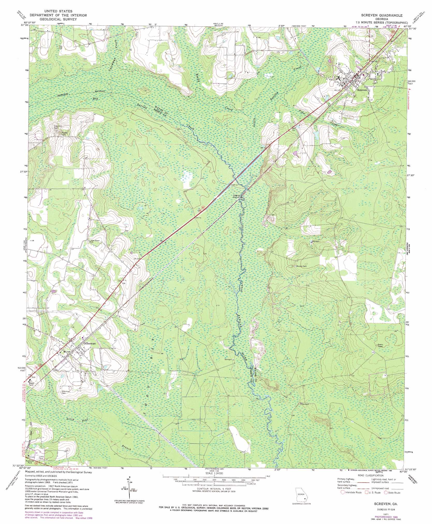
Screven Topo Map Georgia
To zoom in, hover over the map of Screven
USGS Topo Quad 31082d1 - 1:24,000 scale
| Topo Map Name: | Screven |
| USGS Topo Quad ID: | 31082d1 |
| Print Size: | ca. 21 1/4" wide x 27" high |
| Southeast Coordinates: | 31.375° N latitude / 82° W longitude |
| Map Center Coordinates: | 31.4375° N latitude / 82.0625° W longitude |
| U.S. State: | GA |
| Filename: | o31082d1.jpg |
| Download Map JPG Image: | Screven topo map 1:24,000 scale |
| Map Type: | Topographic |
| Topo Series: | 7.5´ |
| Map Scale: | 1:24,000 |
| Source of Map Images: | United States Geological Survey (USGS) |
| Alternate Map Versions: |
Screven GA 1971, updated 1974 Download PDF Buy paper map Screven GA 1971, updated 1988 Download PDF Buy paper map Screven GA 2011 Download PDF Buy paper map Screven GA 2014 Download PDF Buy paper map |
1:24,000 Topo Quads surrounding Screven
Alma Ne |
Surrency |
Odum |
Jesup Nw |
Doctortown |
Coffee |
K'Ville |
Ritch |
Jesup West |
Jesup East |
Mershon |
Patterson |
Screven |
Mckinnon |
Manningtown |
Blackshear West |
Blackshear East |
Patterson Se |
Hortense |
Browntown |
Waycross East |
Hoboken West |
Hoboken East |
Nahunta |
Waynesville |
> Back to 31082a1 at 1:100,000 scale
> Back to 31082a1 at 1:250,000 scale
> Back to U.S. Topo Maps home
Screven topo map: Gazetteer
Screven: Bridges
Doctor McKee Hargrett Bridge elevation 19m 62′Screven: Parks
Lions Park elevation 31m 101′Screven: Populated Places
Offerman elevation 32m 104′Screven elevation 37m 121′
Screven: Post Offices
Screven Post Office elevation 37m 121′Screven: Streams
Big Creek elevation 22m 72′Big Satilla Creek elevation 19m 62′
Colemans Creek elevation 21m 68′
Little Satilla Creek elevation 21m 68′
Reedy Creek elevation 21m 68′
Tiger Creek elevation 21m 68′
Screven: Swamps
Zero Bay elevation 19m 62′Screven digital topo map on disk
Buy this Screven topo map showing relief, roads, GPS coordinates and other geographical features, as a high-resolution digital map file on DVD: