Mershon Topo Map Georgia
To zoom in, hover over the map of Mershon
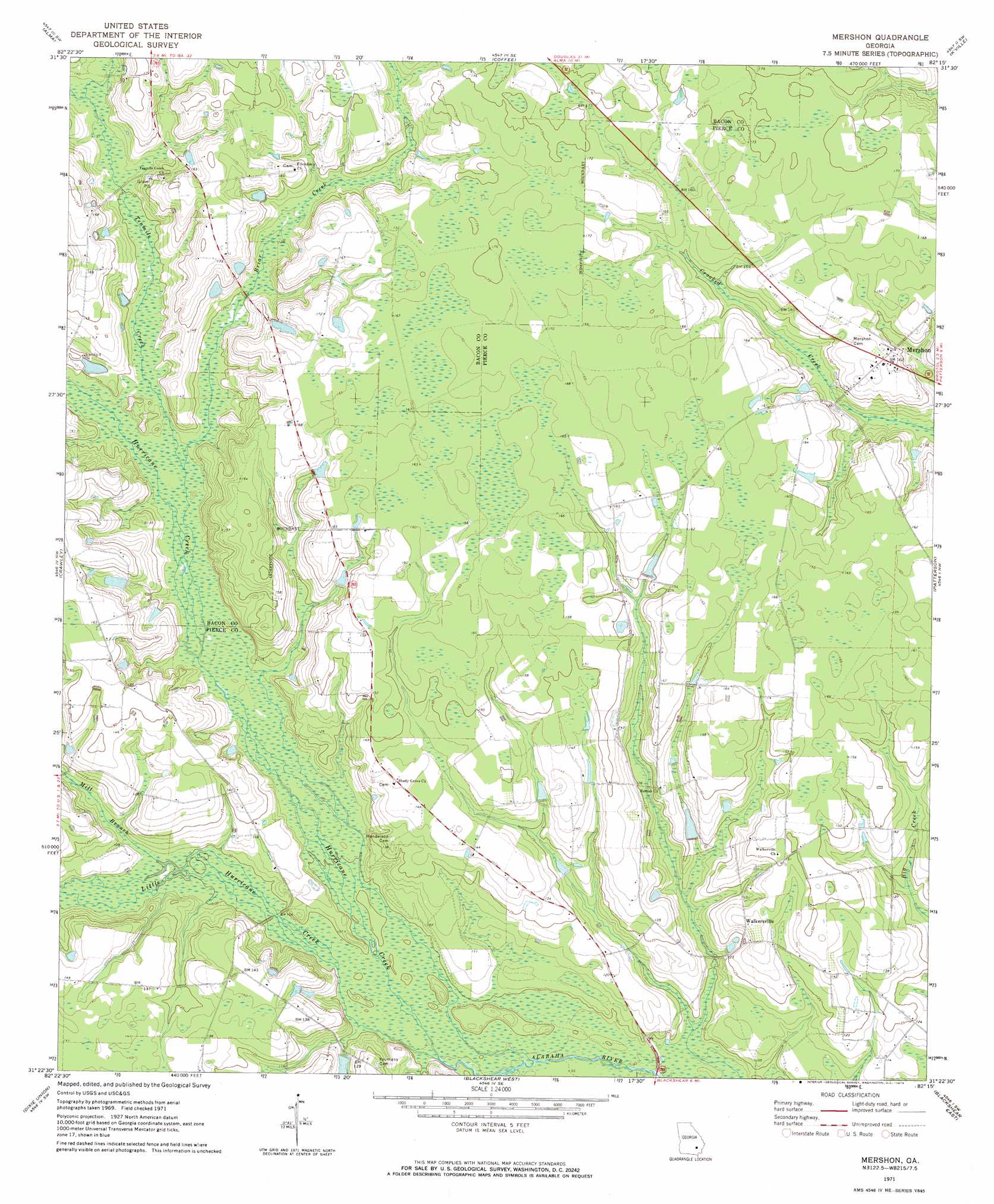
USGS Topo Quad 31082d3 - 1:24,000 scale
| Topo Map Name: | Mershon |
| USGS Topo Quad ID: | 31082d3 |
| Print Size: | ca. 21 1/4" wide x 27" high |
| Southeast Coordinates: | 31.375° N latitude / 82.25° W longitude |
| Map Center Coordinates: | 31.4375° N latitude / 82.3125° W longitude |
| U.S. State: | GA |
| Filename: | o31082d3.jpg |
| Download Map JPG Image: | Mershon topo map 1:24,000 scale |
| Map Type: | Topographic |
| Topo Series: | 7.5´ |
| Map Scale: | 1:24,000 |
| Source of Map Images: | United States Geological Survey (USGS) |
| Alternate Map Versions: |
Mershon GA 1971, updated 1974 Download PDF Buy paper map Mershon GA 2011 Download PDF Buy paper map Mershon GA 2014 Download PDF Buy paper map |
1:24,000 Topo Quads surrounding Mershon
Nicholls Ne |
Alma Nw |
Alma Ne |
Surrency |
Odum |
Sessoms |
Alma |
Coffee |
K'Ville |
Ritch |
Beach |
Crawley |
Mershon |
Patterson |
Screven |
Talmo |
Dixie Union |
Blackshear West |
Blackshear East |
Patterson Se |
Pine Valley |
Waycross West |
Waycross East |
Hoboken West |
Hoboken East |
> Back to 31082a1 at 1:100,000 scale
> Back to 31082a1 at 1:250,000 scale
> Back to U.S. Topo Maps home
Mershon topo map: Gazetteer
Mershon: Bridges
Sweat Bridge elevation 28m 91′Mershon: Crossings
Sumner Ford elevation 33m 108′Sweat Ford elevation 30m 98′
Mershon: Populated Places
Mershon elevation 49m 160′Walkersville elevation 42m 137′
Mershon: Streams
Briar Creek elevation 33m 108′Hurricane Creek elevation 29m 95′
Little Hurricane Creek elevation 29m 95′
Mill Branch elevation 30m 98′
Tenmile Creek elevation 34m 111′
Mershon digital topo map on disk
Buy this Mershon topo map showing relief, roads, GPS coordinates and other geographical features, as a high-resolution digital map file on DVD: