Beach Topo Map Georgia
To zoom in, hover over the map of Beach
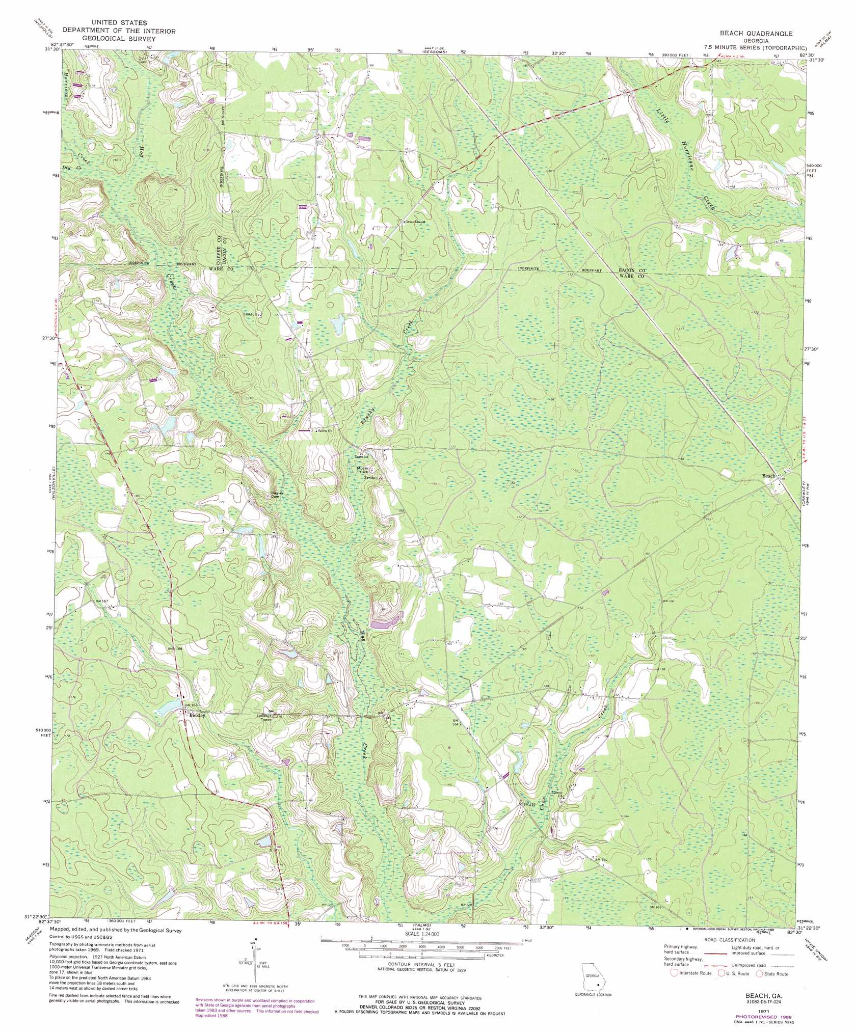
USGS Topo Quad 31082d5 - 1:24,000 scale
| Topo Map Name: | Beach |
| USGS Topo Quad ID: | 31082d5 |
| Print Size: | ca. 21 1/4" wide x 27" high |
| Southeast Coordinates: | 31.375° N latitude / 82.5° W longitude |
| Map Center Coordinates: | 31.4375° N latitude / 82.5625° W longitude |
| U.S. State: | GA |
| Filename: | o31082d5.jpg |
| Download Map JPG Image: | Beach topo map 1:24,000 scale |
| Map Type: | Topographic |
| Topo Series: | 7.5´ |
| Map Scale: | 1:24,000 |
| Source of Map Images: | United States Geological Survey (USGS) |
| Alternate Map Versions: |
Beach GA 1971, updated 1974 Download PDF Buy paper map Beach GA 1971, updated 1988 Download PDF Buy paper map Beach GA 2011 Download PDF Buy paper map Beach GA 2014 Download PDF Buy paper map |
1:24,000 Topo Quads surrounding Beach
Broxton Ne |
Denton |
Nicholls Ne |
Alma Nw |
Alma Ne |
Douglas North |
Nicholls |
Sessoms |
Alma |
Coffee |
Douglas South |
Wilsonville |
Beach |
Crawley |
Mershon |
Pearson |
Axson |
Talmo |
Dixie Union |
Blackshear West |
Sandy Bottom |
Cogdell |
Pine Valley |
Waycross West |
Waycross East |
> Back to 31082a1 at 1:100,000 scale
> Back to 31082a1 at 1:250,000 scale
> Back to U.S. Topo Maps home
Beach topo map: Gazetteer
Beach: Populated Places
Beach elevation 50m 164′Bickley elevation 50m 164′
Beach: Streams
Brushy Creek elevation 38m 124′Dry Creek elevation 43m 141′
Hurricane Creek elevation 43m 141′
Beach digital topo map on disk
Buy this Beach topo map showing relief, roads, GPS coordinates and other geographical features, as a high-resolution digital map file on DVD: