Wilsonville Topo Map Georgia
To zoom in, hover over the map of Wilsonville
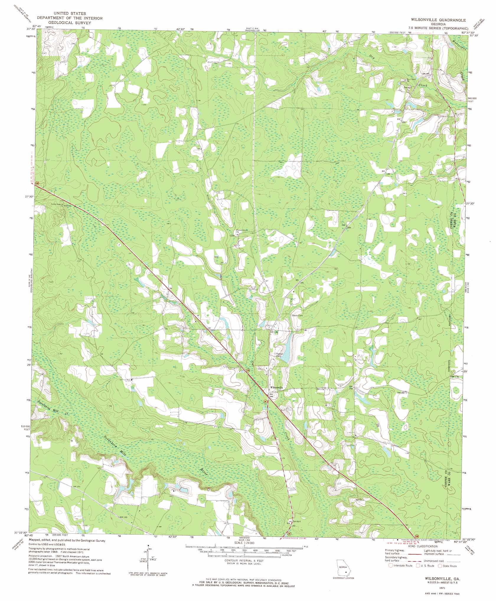
USGS Topo Quad 31082d6 - 1:24,000 scale
| Topo Map Name: | Wilsonville |
| USGS Topo Quad ID: | 31082d6 |
| Print Size: | ca. 21 1/4" wide x 27" high |
| Southeast Coordinates: | 31.375° N latitude / 82.625° W longitude |
| Map Center Coordinates: | 31.4375° N latitude / 82.6875° W longitude |
| U.S. State: | GA |
| Filename: | o31082d6.jpg |
| Download Map JPG Image: | Wilsonville topo map 1:24,000 scale |
| Map Type: | Topographic |
| Topo Series: | 7.5´ |
| Map Scale: | 1:24,000 |
| Source of Map Images: | United States Geological Survey (USGS) |
| Alternate Map Versions: |
Wilsonville GA 1971, updated 1974 Download PDF Buy paper map Wilsonville GA 2011 Download PDF Buy paper map Wilsonville GA 2014 Download PDF Buy paper map |
1:24,000 Topo Quads surrounding Wilsonville
Broxton North |
Broxton Ne |
Denton |
Nicholls Ne |
Alma Nw |
Broxton South |
Douglas North |
Nicholls |
Sessoms |
Alma |
Mora |
Douglas South |
Wilsonville |
Beach |
Crawley |
Kirkland |
Pearson |
Axson |
Talmo |
Dixie Union |
Henderson Still |
Sandy Bottom |
Cogdell |
Pine Valley |
Waycross West |
> Back to 31082a1 at 1:100,000 scale
> Back to 31082a1 at 1:250,000 scale
> Back to U.S. Topo Maps home
Wilsonville topo map: Gazetteer
Wilsonville: Populated Places
Wilsonville elevation 47m 154′Wilsonville: Streams
Twentynine Mile Creek elevation 42m 137′Wilsonville digital topo map on disk
Buy this Wilsonville topo map showing relief, roads, GPS coordinates and other geographical features, as a high-resolution digital map file on DVD: