Broxton South Topo Map Georgia
To zoom in, hover over the map of Broxton South
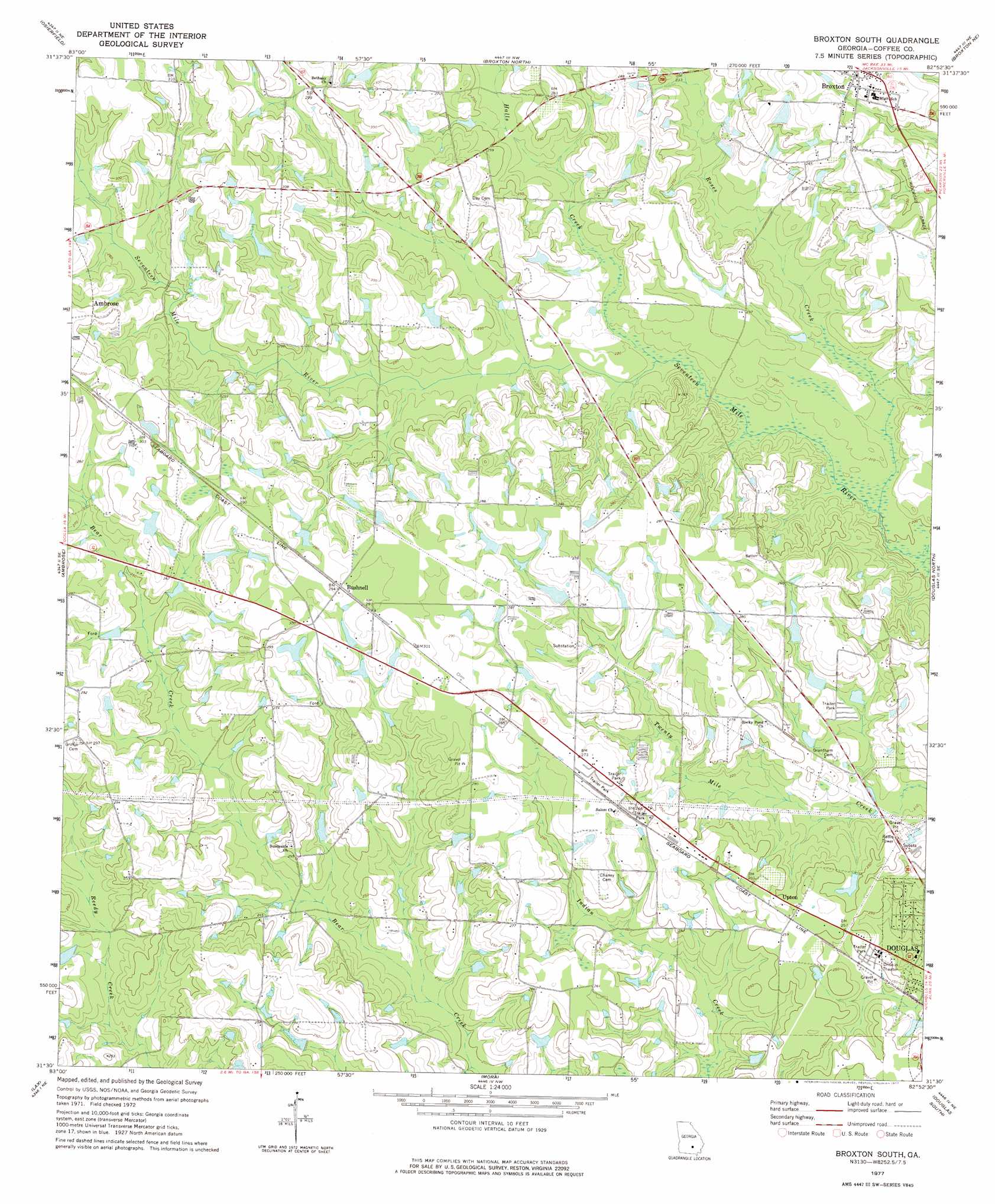
USGS Topo Quad 31082e8 - 1:24,000 scale
| Topo Map Name: | Broxton South |
| USGS Topo Quad ID: | 31082e8 |
| Print Size: | ca. 21 1/4" wide x 27" high |
| Southeast Coordinates: | 31.5° N latitude / 82.875° W longitude |
| Map Center Coordinates: | 31.5625° N latitude / 82.9375° W longitude |
| U.S. State: | GA |
| Filename: | o31082e8.jpg |
| Download Map JPG Image: | Broxton South topo map 1:24,000 scale |
| Map Type: | Topographic |
| Topo Series: | 7.5´ |
| Map Scale: | 1:24,000 |
| Source of Map Images: | United States Geological Survey (USGS) |
| Alternate Map Versions: |
Broxton South GA 1977, updated 1977 Download PDF Buy paper map Broxton South GA 2011 Download PDF Buy paper map Broxton South GA 2014 Download PDF Buy paper map |
1:24,000 Topo Quads surrounding Broxton South
Queensland |
China Hill |
Jacksonville |
Snipesville |
Roper |
Fitzgerald East |
Osierfield |
Broxton North |
Broxton Ne |
Denton |
Ocilla East |
Ambrose |
Broxton South |
Douglas North |
Nicholls |
Alapaha |
Lax |
Mora |
Douglas South |
Wilsonville |
Tenmile Bay |
Willacoochee |
Kirkland |
Pearson |
Axson |
> Back to 31082e1 at 1:100,000 scale
> Back to 31082a1 at 1:250,000 scale
> Back to U.S. Topo Maps home
Broxton South topo map: Gazetteer
Broxton South: Dams
Harper Lake Dam elevation 87m 285′Broxton South: Populated Places
Bushnell elevation 88m 288′Upton elevation 78m 255′
Broxton South: Reservoirs
Harper Lake elevation 87m 285′Broxton South: Streams
Halls Creek elevation 64m 209′Roses Creek elevation 61m 200′
Broxton South digital topo map on disk
Buy this Broxton South topo map showing relief, roads, GPS coordinates and other geographical features, as a high-resolution digital map file on DVD: