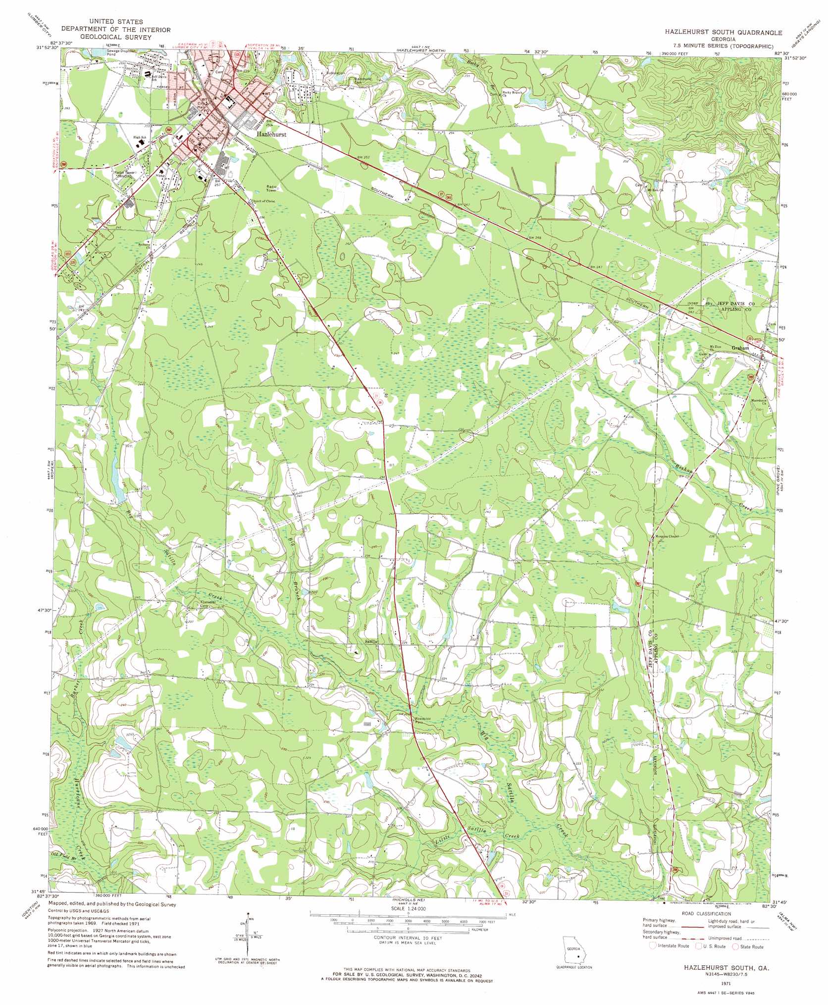
Hazlehurst South Topo Map Georgia
To zoom in, hover over the map of Hazlehurst South
USGS Topo Quad 31082g5 - 1:24,000 scale
| Topo Map Name: | Hazlehurst South |
| USGS Topo Quad ID: | 31082g5 |
| Print Size: | ca. 21 1/4" wide x 27" high |
| Southeast Coordinates: | 31.75° N latitude / 82.5° W longitude |
| Map Center Coordinates: | 31.8125° N latitude / 82.5625° W longitude |
| U.S. State: | GA |
| Filename: | o31082g5.jpg |
| Download Map JPG Image: | Hazlehurst South topo map 1:24,000 scale |
| Map Type: | Topographic |
| Topo Series: | 7.5´ |
| Map Scale: | 1:24,000 |
| Source of Map Images: | United States Geological Survey (USGS) |
| Alternate Map Versions: |
Hazlehurst South GA 1971, updated 1974 Download PDF Buy paper map Hazlehurst South GA 1971, updated 1988 Download PDF Buy paper map Hazlehurst South GA 2011 Download PDF Buy paper map Hazlehurst South GA 2014 Download PDF Buy paper map |
1:24,000 Topo Quads surrounding Hazlehurst South
Scotland |
Jordan |
Uvalda |
Alston |
Johnson Corner |
Jacksonville Ne |
Lumber City |
Hazlehurst North |
Grays Landing |
Baxley Ne |
Snipesville |
Roper |
Hazlehurst South |
Pine Grove |
Baxley |
Broxton Ne |
Denton |
Nicholls Ne |
Alma Nw |
Alma Ne |
Douglas North |
Nicholls |
Sessoms |
Alma |
Coffee |
> Back to 31082e1 at 1:100,000 scale
> Back to 31082a1 at 1:250,000 scale
> Back to U.S. Topo Maps home
Hazlehurst South topo map: Gazetteer
Hazlehurst South: Populated Places
Graham elevation 73m 239′Hazlehurst elevation 77m 252′
Johnsonville (historical) elevation 73m 239′
Maysie (historical) elevation 76m 249′
Quinn (historical) elevation 70m 229′
Satilla elevation 70m 229′
Hazlehurst South: Post Offices
Hazlehurst Post Office elevation 76m 249′Hazlehurst South: Streams
Big Branch elevation 62m 203′Burket Creek elevation 59m 193′
Little Satilla Creek elevation 56m 183′
Old Field Branch elevation 59m 193′
Hazlehurst South digital topo map on disk
Buy this Hazlehurst South topo map showing relief, roads, GPS coordinates and other geographical features, as a high-resolution digital map file on DVD: