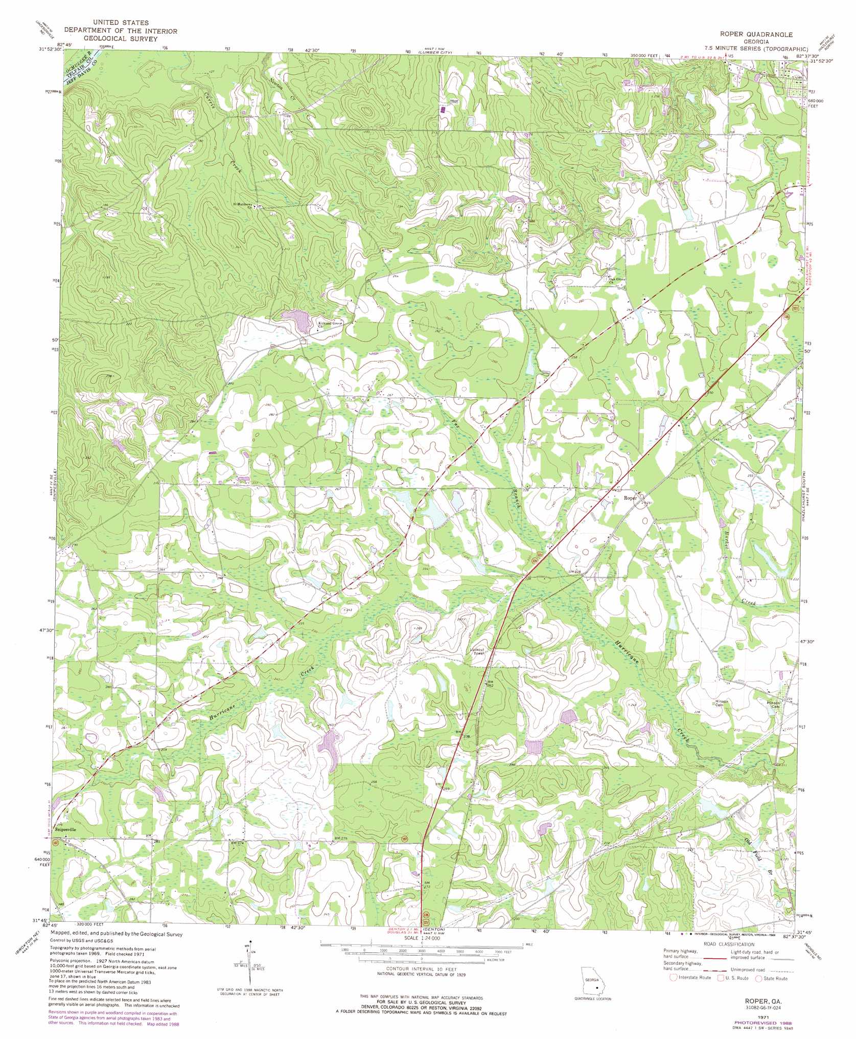
Roper Topo Map Georgia
To zoom in, hover over the map of Roper
USGS Topo Quad 31082g6 - 1:24,000 scale
| Topo Map Name: | Roper |
| USGS Topo Quad ID: | 31082g6 |
| Print Size: | ca. 21 1/4" wide x 27" high |
| Southeast Coordinates: | 31.75° N latitude / 82.625° W longitude |
| Map Center Coordinates: | 31.8125° N latitude / 82.6875° W longitude |
| U.S. State: | GA |
| Filename: | o31082g6.jpg |
| Download Map JPG Image: | Roper topo map 1:24,000 scale |
| Map Type: | Topographic |
| Topo Series: | 7.5´ |
| Map Scale: | 1:24,000 |
| Source of Map Images: | United States Geological Survey (USGS) |
| Alternate Map Versions: |
Roper GA 1971, updated 1974 Download PDF Buy paper map Roper GA 1971, updated 1988 Download PDF Buy paper map Roper GA 2011 Download PDF Buy paper map Roper GA 2014 Download PDF Buy paper map |
1:24,000 Topo Quads surrounding Roper
Mcrae |
Scotland |
Jordan |
Uvalda |
Alston |
Workmore |
Jacksonville Ne |
Lumber City |
Hazlehurst North |
Grays Landing |
Jacksonville |
Snipesville |
Roper |
Hazlehurst South |
Pine Grove |
Broxton North |
Broxton Ne |
Denton |
Nicholls Ne |
Alma Nw |
Broxton South |
Douglas North |
Nicholls |
Sessoms |
Alma |
> Back to 31082e1 at 1:100,000 scale
> Back to 31082a1 at 1:250,000 scale
> Back to U.S. Topo Maps home
Roper topo map: Gazetteer
Roper: Dams
Okuinn Lake Dam elevation 72m 236′Okuinn Lake Dam elevation 71m 232′
Sears Lake Dam elevation 54m 177′
Roper: Populated Places
Goldsmith (historical) elevation 80m 262′Roper elevation 76m 249′
Roper: Reservoirs
Okuinn Lake elevation 72m 236′Okuinn Lake elevation 71m 232′
Sears Lake elevation 54m 177′
Roper: Streams
Fox Branch elevation 64m 209′Roper digital topo map on disk
Buy this Roper topo map showing relief, roads, GPS coordinates and other geographical features, as a high-resolution digital map file on DVD: